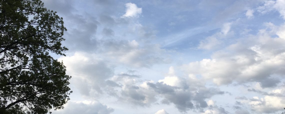
Sunshine returns today with seasonably cold temperatures! Dry and a little colder on Sunday! Dry weather to continue Monday through Wednesday night with slightly below normal temperatures! Coastal storm will likely give us rain and snow Thursday and Friday! Dry and cold weather likely for the Christmas weekend!


Good morning everyone!

Skies are partly cloudy early on this Saturday morning and early temperatures range from 36 in Clifton down to 30 at High Point. Winds are a little gusty out of the west.

CLIFTON’S ALMANAC FOR DECEMBER 17TH:

AVERAGE HIGH: 43 AVERAGE LOW: 26

RECORD HIGH: 61 – 2000 RECORD LOW: 9 – 1989

YESTERDAY’S HIGH: 42 LOW: 36 PRECIPITATION: .59″

The storm responsible for the rain the last two days is now moving off the Maine coast as high pressure builds from the west. We should have mostly sunny skies today with highs near normal in the low 40s.

Partly to mostly sunny skies on Sunday with highs a couple of degrees lower than today.

Dry weather to persist Monday through Wednesday with slightly below normal temperatures.

A coastal storm is expected to develop and move through our area Thursday and Friday, latest models show that the storm will track more inland so the precipitation in our area may be mostly in the form of rain with mainly snow further inland. The potential storm is still 5 days away so this forecast will likely change so keep tuned for further updates.

Cold Arctic air will be with us for the Christmas weekend but we should stay dry.

THE FORECAST:

TODAY – DEC 17 – Mostly sunny, high in the low 40s.

TONIGHT – Partly cloudy, low in the upper 20s.

SUNDAY – DEC 18 – Mostly sunny, high in the upper 30s.

MONDAY – DEC 19 – Mostly sunny, high in the low 40s.

TUESDAY – DEC 20 – Sunny, high in the low 40s.

WEDNESDAY – DEC 21 – Mostly sunny, high in the low 40s.

THURSDAY – DEC 22 – Cloudy with rain and snow likely, high in the low 40s.

FRIDAY – DEC 23 – Cloudy with a chance of rain and snow, high in the mid 40s.

MARINE FORECAST: A small craft advisory is in effect until 6 p.m. this evening for westerly winds gusting to 30 knots, seas 4-7 feet.

OUTLOOK: No advisories expected during the day on Sunday; advisories possible Sunday night through the day on Monday; no advisories expected Monday night through Wednesday.

Have a nice weekend and please stay safe!

Cloudy and windy with periods of rain ending this evening! Sunshine returns on Saturday but it will be breezy and seasonably cold. Still dry on Sunday with continued cold conditions but with lighter winds. Mainly dry and cold weather continuing Monday through Wednesday! Potential growing for coastal storm Thursday night into Friday with possible accumulating snow!


Good morning everyone!

Skies are cloudy early on this Friday morning and rain is falling over much of the area, early temperatures range from 41 in Clifton down to 31 at High Point. Winds are gusty out of the east-northeast.

CLIFTON’S ALMANAC FOR DECEMBER 16TH:

AVERAGE HIGH: 44 AVERAGE LOW: 26

RECORD HIGH: 62 – 2021 RECORD LOW: 12 – 2016

YESTERDAY’S HIGH: 40 LOW: 28 PRECIPITATION: .57″ SNOW: TRACE

The coastal low pressure is now located east of Atlantic City and will move up along the coast today. Periods of mainly light rain or drizzle will continued through this evening. Additional rainfall will be around 1/2″. Winds will remain strong with gusts to 35 mph slowly diminishing tonight.

As the storm moves away high pressure will build into our area for the weekend. Saturday will be sunny but breezy and cool. Sunshine again on Sunday, highs will be a couple of degrees lower than on Saturday but we should have less wind.

Fair and seasonably cold weather to continue Monday through Wednesday.

A strong coastal storm looks more likely Thursday afternoon into Friday with some significant snow accumulations possible followed by dry but quite cold weather for the Christmas weekend.

THE FORECAST:

TODAY – DEC 16 – Cloudy and windy with periods of rain or drizzle, high in the mid 40s, wind gusts to 35 mph likely.

TONIGHT – Mostly cloudy and breezy with a chance of rain, low in the low 30s, winds gusts to 25 mph likely.

SATURDAY – DEC 17 – Mostly sunny and breezy, high in the low 40s, wind gusts to 25 mph likely.

SUNDAY – DEC 18 – Sunny, high in the upper 30s.

MONDAY – DEC 19 – Mostly sunny, high in the low 40s.

TUESDAY – DEC 20 – Mostly sunny, high in the low 40s.

WEDNESDAY – DEC 21 – Mostly sunny, high near 40.

THURSDAY – DEC 22 – Mostly cloudy with a chance of snow, high in the upper 30s.

MARINE FORECAST: A gale warning is in effect until 6 p.m. this evening for east-northeast winds becoming westerly with gusts to 45 knots, seas 8-13 feet.

OUTLOOK: Small craft advisories expected to continue tonight through the day on Sunday; advisories still possible Sunday night through the day on Monday; no advisories expected Monday night through Tuesday.

Despite the rainy weather try to have a nice day and stay safe!

Rain to develop by early this afternoon possibly starting as a wintery mix mainly further inland! Rain and windy on Friday! Extended period of dry weather Saturday through the middle of next week with below normal temperatures!


Good morning everyone!

Skies have become overcast early on this Thursday morning and early tempertures ranging from 30 in Clifton down to 21 at Walpack and High Point. Winds are from the north-northeast around 5-10 mph.

CLIFTON’S ALMANAC FOR DECEMBER 15TH:

AVERAGE HIGH: 44 AVERAGE LOW: 27

RECORD HIGH: 66 – 2015 RECORD LOW: 10 – 2005

YESTERDAY’S HIGH: 40 LOW: 28 PRECIPITATION: NONE

A storm system will move into our area today with rain starting by early this afternoon possibly starting off as a period of snow and sleet mainly inland. East to northeast winds will become gusty by tonight.

Friday will be a rainy and windy day as the storm system moves through the area, the rain should end Friday night. Total storm rainfall amounts will be 1-2 inches. Winds may gust up to 35 mph especially in the morning. While the precipitation will be rain here the Poconos and northern Orange county New York should have some heavy snow.

An extended period of dry weather Saturday through Wednesday with temperatures averaging below normal.

Some indications of another winter storm towards the end of next week and this time it may be cold enough for snow in our area.

THE FORECAST:

TODAY – DEC 15 – Rain developing around 1 p.m. possibly briefly starting as a mix of snow and sleet, becoming windy, high in the low 40s.

TONIGHT – Rain and windy, lows remaining in the low 40s.

FRIDAY – DEC 16 – Rain and windy, high in the mid 40s.

SATURDAY – DEC 17 – Sunny, high in the low 40s.

SUNDAY – DEC 18 – Mostly sunny, high in the upper 30s.

MONDAY – DEC 19 – Mostly sunny, high near 40.

TUESDAY – DEC 20 – Mostly sunny, high in the low 40s.

WEDNESDAY – DEC 21 – Mostly sunny, high in the upper 30s.

MARINE FORECAST: TODAY – A small craft advisory will be effect from noon today through 6 p.m. this evening for easterly winds gusting to 30 knots, seas 4-7 feet.

OUTLOOK: A gale warning has been posted effective between 6 p.m. this evening through noon on Friday; advisories possibly continued Saturday through Monday.

Have a nice day and stay safe!

Sunny, breezy and seasonably cold today! Coastal storm to give us mainly rain Thursday afternoon through Friday evening possibly beginning as a wintery mix especially inland! Extended period of dry but chilly weather Saturday through early next week!


Good morning everyone!

Skies are mostly cloudy early on this Wednesday morning and temperatures are seasonably cold with early readings ranging from 28 in Clifton down to 21 at Pequest and Walpack. Winds are a little gusty out of the northwest.

CLIFTON’S ALMANAC FOR DECEMBER 14TH:

AVERAGE HIGH: 44 AVERAGE LOW: 27

RECORD HIGH – 66 – 2015 RECORD LOW: 7 – 1989

YESTERDAY’S HIGH: 39 LOW: 23 PRECIPITATION: NONE

High pressure nosing down from Ontario will give us another sunny day today, it will be breezy as low pressure southeast of Nova Scotia combines with the high to increase the pressure gradient in our area. High temperatures will be below normal.

A coastal storm will cause precipitation mainly from Thursday afternoon through Friday evening, most of this precipitation will fall as rain but may start off as a mixture of freezing rain, sleet and snow mainly over the higher elevations to our north and west. Rain will then be heavy at times with strong easterly winds through Friday evening. Rainfall amounts of 1-2 inches can be expected.

An extended period of dry weather with below normal temperatures Saturday through at least early next week.

THE FORECAST:

TODAY – DEC 14 – Sunny and breezy, high near 40.

TONIGHT – Increasing cloudiness, low in the upper 20s.

THURSDAY – DEC 15 – Cloudy with rain developing mainly after 1 p.m., breezy, high in the low 40s.

FRIDAY – DEC 16 – Rain and windy, high in the mid 40s. Total storm rainfall between 1-2 inches.

SATURDAY – DEC 17 – Mostly sunny, high in the low 40s.

SUNDAY – DEC 18 – Mostly sunny, high near 40.

MONDAY – DEC 19 – Sunny, high near 40.

TUESDAY – DEC 20 – Mostly sunny, high near 40.

MARINE FORECAST: A small craft advisory is in effect until 1 p.m. this afternoon for northwest winds gusting to 30 knots, seas 3-6 feet.

OUTLOOK – A gale watch is in effect from Thursday night through Friday morning; small craft advisories expected to continue through Friday night; no advisories expected for the weekend.

Have a nice day and stay safe!

Sunny and seasonably cold today with light winds! Continued dry and seasonably cold on Wednesday with more wind! Coastal storm to give us mainly rain possibly starting as a wintery mix Thursday afternoon through Friday night! Dry and chilly weather expected for the weekend!


Good morning everyone!

Skies are mostly clear early on this Tuesday morning and temperatures are chilly with early readings ranging from 23 in Clifton down to 15 at High Point and Walpack. Winds are from the north around 5-10 mph.

CLIFTON’S ALMANAC FOR DECEMBER 13TH:

AVERAGE HIGH: 45 AVERAGE LOW: 27

RECORD HIGH: 68 – 2015 RECORD LOW: 5 – 1988

YESTERDAY’S HIGH: 35 LOW: 24 PRECIPITATION: TRACE SNOW: TRACE

A strong high pressure extends from Ontario to our area and should give us more sunshine with seasonably cold temperatures today.

Another sunny day on Wednesday but low pressure off the New England coast will produce more winds than today, temperatures will continue to be chilly.

A coastal storm is expected to give us mainly rain Thursday afternoon through Friday night, some of the precipitation may start of as a wintery mix across inland areas, winds will become gusty.

The weekend weather looks to be dry but will be chilly.

THE FORECAST:

TODAY – DEC 13 – Sunny, high near 40.

TONIGHT: Mostly clear, low in the mid 20s.

WEDNESDAY – DEC 14 – Sunny and breezy, high near 40.

THURSDAY – DEC 15 – Cloudy with rain developing mainly after 2 p.m., precipitation may start off as a wintery mix further inland, high in the low 40s.

FRIDAY – DEC 16 – Cloudy and breezy with rain, high in the mid 40s. Rainfall amounts near one inch.

SATURDAY – DEC 17 – Mostly sunny, high in the low 40s.

SUNDAY – DEC 18 – Sunny, high in the upper 30s.

MONDAY – DEC 19 – Sunny, high near 40.

MARINE FORECAST: A small craft advisory is in effect until 1 p.m. on Wednesday for northwest winds gusting to 25 knots, seas 4-7 feet.

OUTLOOK: Advisories expected for the coastal storm Thursday and Friday with some gales possible.

Have a nice day and stay safe!