Beautiful summer weather to continue today with sunshine, pleasant temperatures and low humidity! Still a nice day on Sunday but with increasing cloudiness late in the day! Chance of showers Monday afternoon through Wednesday!


Good morning everyone!

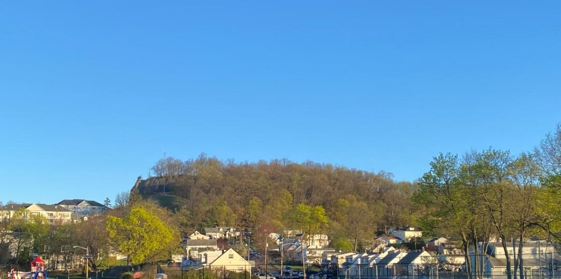
Skies are clear early on this Saturday morning and temperatures are cooler than they have been with readings at 5 a.m. ranging from 63 in Clifton down to a chilly 45 at Walpack. Winds are light from the north and the humidity remains low.

CLIFTON’S ALMANAC FOR AUG 13TH!

AVERAGE HIGH: 83 AVERAGE LOW: 65

RECORD HIGH: 100 – 2005 RECORD LOW: 54 – 1979

YESTERDAY’S HIGH: 87 LOW: 69 PRECIPITATION: NONE

Another very nice summer day today with plenty of sunshine, pleasant temperatures and continued low humidity.

Sunday will continue to be pleasant but with some increase in clouds as high pressure moves off the coast.

A trough of low pressure will give us a chance of showers late Monday through Wednesday but the chance of precipitation along with the amounts have lowered since this time yesterday as most of the rain should fall to our south so in our area the chances through this period are no more than 40%.

Dry weather with a slight warming trend at the end of next week.

THE FORECAST:

TODAY – AUG 13 – Sunny, high in the low 80s.

TONIGHT – Mostly clear, low in the upper 50s.

SUNDAY – AUG 14 – Mostly sunny in the morning then increasing cloudiness in the afternoon, high in the mid 80s.

MONDAY – AUG 15 – Mostly cloudy with a chance of showers and thunderstorms after 2 p.m., high near 80.

TUESDAY – AUG 16 – Mostly cloudy with a chance of showers, high in the upper 70s.

WEDNESDAY – AUG 17 – Partly sunny with a chance of an afternoon or evening shower, high near 80.

THURSDAY – AUG 18 – Mostly sunny, high in the mid 80s.

FRIDAY – AUG 19 – Sunny, high in the upper 80s.

MARINE FORECAST: TODAY – Northerly winds to 15 knots, seas 1-2 feet. Belmar’s ocean temperature is 77 degrees.

OUTLOOK – No advisories expected Sunday and Monday; advisories possible Tuesday and Wednesday; no advisories expected for Thursday.

Enjoy the nice summer weather this weekend!

Mostly sunny today and seasonably warm with very low humidity! Beautiful weather this weekend with continued seasonably warm temperatures and low humidity! Unsettled weather much of next week with a good chance of well needed rain especially Tuesday into Wednesday!


Good morning everyone!

Skies are partly cloudy early on this Friday morning and temperatures at 5 a.m. range from 70 in Clifton down to 55 at Walpack. The winds are light from the north and the humidity is low with dew points in the 50s.

CLIFTON’S WEATHER ALMANAC FOR AUGUST 12TH:

AVERAGE HIGH: 84 AVERAGE LOW: 65

RECORD HIGH: 97 – 2021 RECORD LOW: 54 – 1979

YESTERDAY’S HIGH: 91 LOW: 69 PRECIPITATION: .01″

Yesterday was the 10th day in a row with temperatures of 90 degrees or more, this streak will likely end today as high pressure builds into the area providing our area with plenty of sunshine with high temperatures in the mid 80s. The humidity will be quite low with some dew points falling into the 40s.

Very nice weather for the weekend with again plenty of sunshine, seasonably warm temperatures and low humidity.

Unsettled weather for much of next week as a low pressure trough will be in our area. There will be a good chance of showers mainly Monday afternoon through early Thursday with the best chance of well needed rain will be Tuesday into Wednesday.

THE FORECAST:

TODAY – AUG 12 – Sunny, high in the mid 80s.

TONIGHT – Mostly clear, low in the low 60s.

SATURDAY – AUG 13 – Sunny, high in the low 80s.

SUNDAY – AUG 14 – Mostly sunny, high in the mid 80s.

MONDAY – AUG 15 – Mostly cloudy with a chance of showers, high near 80.

TUESDAY – AUG 16 – Partly sunny with showers likely and possibly a thunderstorm, high in the upper 70s.

WEDNESDAY – AUG 17 – Partly sunny with a chance of showers, high near 80.

THURSDAY – AUG 18 – Partly sunny with a chance of showers, high in the low 80s.

MARINE FORECAST: TODAY – Northerly winds to 15 knots, seas 1-2 feet. Belmar’s ocean temperature is 76 degrees.

OUTLOOK – No advisories expected Saturday through Monday night; advisories possible Tuesday and Wednesday.

Enjoy this nice summer weather today!

Cloudy this morning with a chance of showers then becoming mostly sunny and seasonably warm! Enjoyable summer weather Friday through the weekend! Shower chances increase for early next week!


Good morning everyone!

Skies are cloudy early on this Thursday morning and temperatures at 5 a.m. range from 72 in Clifton down to 60 at Sandyston and High Point. Winds are mainly calm and the humidity is comfortable with dew points mainly in the low 60s.

CLIFTON’S ALMANAC FOR AUGUST 11TH!

AVERAGE HIGH: 84 AVERAGE LOW: 65

RECORD HIGH: 96 – 2016 RECORD LOW: 55 – 2007

YESTERDAY’S HIGH: 90 LOW: 72 PRECIPITATION: NONE

A weak disturbance riding along the front to our south will give us cloudy skies this morning with a chance of showers mainly just to our south. Sunshine should return this afternoon and it will be quite warm but with moderate humidity with dew points in the mid 60s.

Almost perfect summer weather Friday through the weekend as high pressure builds into our area. Sunny skies with near seasonable temperatures each day along with very low humidity.

A trough of low pressure will give us a chance of showers early next week. High temperatures with the clouds will be below normal Monday and Tuesday and near normal on Wednesday.

THE FORECAST:

TODAY – AUG 11 – Cloudy this morning with a chance of showers, some showers may contain heavy downpours, becoming mostly sunny this afternoon, high near 90.

TONIGHT – Mostly cloudy, low in the upper 60s.

FRIDAY – AUG 12 – Mostly sunny, high in the mid 80s.

SATURDAY – AUG 13 – Sunny, high in the low 80s.

SUNDAY – AUG 14 – Mostly sunny, high in the mid 80s.

MONDAY – AUG 15 – Partly sunny with a chance of showers, high in the upper 70s.

TUESDAY – AUG 16 – Partly sunny with a chance of showers, high near 80.

WEDNESDAY – AUG 17 – Partly sunny wih a chance of showers, high in the low 80s.

MARINE FORECAST: TODAY – Variable winds less than 5 knots, seas 1-2 feet. Belmar’s ocean temperature is 76 degrees.

OUTLOOK – Possible small craft advisories tonight through Friday; no advisories expected Saturday or Sunday.

Have a nice day and stay safe!

Partly sunny today with finally lower temperatures and humidity! Chance of showers later tonight into early Thursday morning! Delightful summer weather Friday through the weekend with near seasonably temperatures and low humidity!


Good morning everyone!

Skies are partly to mostly cloudy early on this Wednesday morning and temperatures at 5 a.m. range from 74 in Clifton down to 66 at High Point. Winds are light northerly and the humidity is lower than the last few mornings with dew points in the low 60s.

CLIFTON’S ALMANAC FOR AUGUST 10TH:

AVERAGE HIGH: 84 AVERAGE LOW 65

RECORD HIGH: 97 – 1973 RECORD LOW – 54 – 1989

YESTERDAY’S HIGH: 97 LOW: 77 PRECIPITATION: .30″

A cold front has moved to our south overnight and today will be much cooler with lower humidity as our eight day heatwave is finally over. A disturbance along the front will give us a good chance of showers from late tonight into early Thursday morning followed by clearing by the afternoon.

Very pleasant summer weather Friday through the weekend with plenty of sunshine each day with temperatures at or slightly below normal along with low humidity.

A trough of low pressure may touch off some showers Monday and Tuesday, temperatures will continue to be near normal but the humidity will slowly increase but not be nearly as humid as we experience the last few days.

THE FORECAST:

TODAY – AUG 10 – Partly sunny, not as hot and humid, high in the mid 80s.

TONIGHT – Mostly cloudy with a chance of showers after 9 p.m., low in the low 70s.

THURSDAY – AUG 11 – Mostly cloudy with a chance of shower before 9 a.m., becoming mostly sunny in the afternoon, high in the upper 80s.

FRIDAY – AUG 12 – Sunny, high in the mid 80s.

SATURDAY – AUG 13 – Sunny, high in the low 80s.

SUNDAY – AUG 14 – Mostly sunny, high in the mid 80s.

MONDAY – AUG 15 – Partly sunny with a chance of showers and thunderstorms, high in the low 80s.

TUESDAY – AUG 16 – Partly sunny with a chance of showers and thunderstorms, high in the low 80s.

MARINE FORECAST: TODAY – North-northeast winds to 10 knots, seas 2 feet. Belmar’s ocean temperature is 76 degrees.

OUTLOOK – No advisories expected Thursday through Sunday.

Have a nice day and enjoy the cooler weather!

Last day of intense heat and humidity today with showers and thunderstorms likely (70%) later today and this evening! Showers likely again on Wednesday but not as hot or humid! A chance of a morning shower on Thursday followed by clearing during the day! Very nice summer weather Friday through Sunday!


Good morning everyone!

Skies are partly to mostly cloudy early on this Tuesday morning and it is unseasonably warm and humid with temperatures at 5 a.m. ranging from 80 in Clifton down to 71 at Walpack and Sandyston. Winds are from the southwest and the humidity is high with dew points in the low to mid 70s.

CLIFTON’S ALMANAC FOR AUGUST 9TH:

AVERAGE HIGH: 84 AVERAGE LOW: 66

RECORD HIGH: 100 – 2001 RECORD LOW: 50 – 1989

YESTERDAY’S HIGH: 97 (Record) LOW: 77 PRECIPITATION: NONE

One last day of extreme heat and humidity today as the Bermuda high pressure moves further offshore and a cold front approaches from the west. Today will be partly sunny with highs well up into the 90s again and with dew points in the 70s the heat index will be over 100 degrees, a heat advisory continues in effect through this evening. The front will likely cause some shower and thunderstorms activity later this afternoon and this evening, some storms may be accompanied by heavy downpours.

The front will move to our south overnight but a disturbance along the front will likely cause more showers and thunderstorms on Wednesday, high tempertures will only be in the upper 80s and the dew points will lower a bit to the upper 60s.

After a morning shower on Thursday we should see clearing during the day and becoming less humid.

Very nice summer weather Friday through early next week with at or slightly below normal temperatures and low humidity.

THE FORECAST:

TODAY – AUG 9 – Partly sunny, very hot and humid with showers likely by later this afternoon with a chance of a thunderstorms, rain may be heavy at times, high in the mid 90s. A heat advisory remains in effect.

TONIGHT – Mostly cloudy with showers likely and a chance of thunderstorms, heavy rain possible, humid, low in the low 70s.

WEDNESDAY – AUG 10 – Partly sunny with a chance of showers and thunderstorms, not as hot, high in the mid 80s. Showers likely at night.

THURSDAY – AUG 11 – Chance of a morning shower then becoming partly sunny and becoming less humid, high in the upper 80s.

FRIDAY – AUG 12 – Sunny, high in the low 80s.

SATURDAY – AUG 13 – Sunny, high in the low 80s.

SUNDAY – AUG 14 – Mostly sunny, high in the mid 80s.

MONDAY – AUG 15 – Mostly sunny, high in the mid 80s.

MARINE FORECAST: TODAY – Southwest winds to 10 knots, seas 3 feet. Belmar’s ocean temperature is 77 degrees.

OUTLOOK – No advisories expected Wednesday through Saturday.

Have a nice day and stay safe and cool!