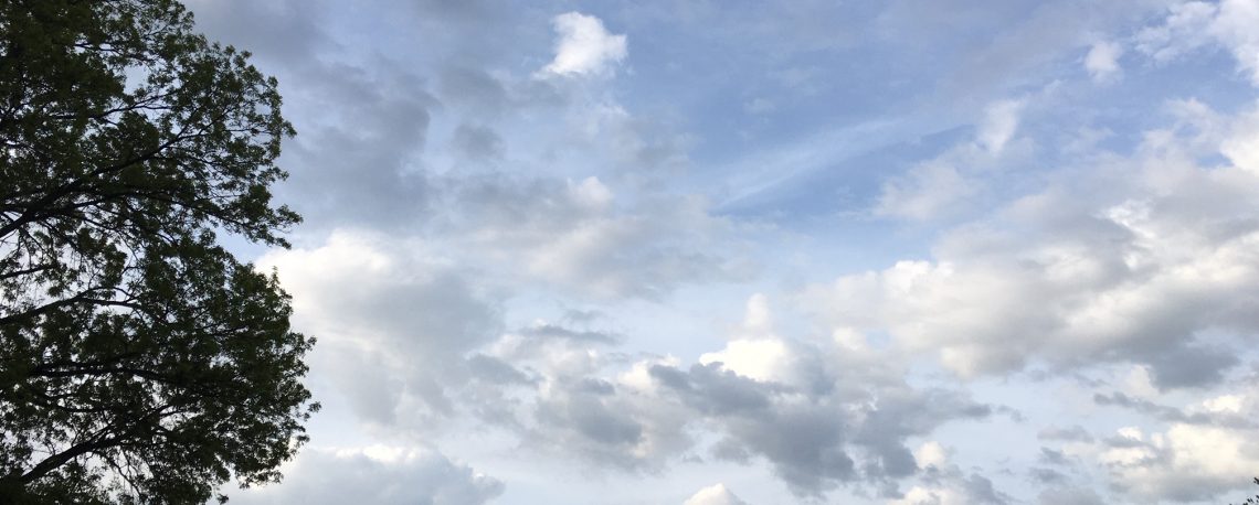
Increasing clouds and cool today with a chance of light showers tonight! Dry and cool Thursday through the day on Friday! Cool with periods of rain from late Friday night through early next week!


Good morning everyone!

Skies across the area are partly cloudy early on this Wednesday morning and early temperatures range from 42 in Clifton down to 30 at Walpack. Winds are calm or light northerly.

CLIFTON’S ALMANAC FOR APRIL 26TH:

AVERAGE HIGH: 64 AVERAGE LOW: 46

RECORD HIGH: 93 – 2009 RECORD LOW: 34 – 2002

YESTERDAY’S HIGH: 62 LOW: 42 PRECIPITATION: NONE

Today will start off mostly sunny but a weak frontal system will cause increasing cloudiness by this afternoon with a chance of light showers tonight. Rainfall amounts should be less than a tenth of an inch. Temperatures will be slightly below normal.

Main dry and cool weather Thursday through the day on Friday.

Prolonged period of unsettled weather Friday night through early next week with continued below normal temperatures as a couple of low pressure systems move through our area. The best likelihood of rain will be during the day on Saturday and then again Sunday night through Monday.

THE FORECAST:

TODAY – APR 26 – Increasing cloudiness, high near 60.

TONIGHT – Mostly cloudy with a chance of light showers, low in the mid 40s.

THURSDAY – APR 27 – Mostly sunny, highs in the low 60s.

FRIDAY – APR 28 – Mostly cloudy, high near 60. Rain likely after midnight.

SATURDAY – APR 29 – Rain, high in the upper 50s.

SUNDAY – APR 30 – Mostly cloudy with a chance of showers, highs in the mid 60s. Rain at night.

MONDAY – MAY 1 – Mostly cloudy with rain likely, highs in the low 60s.

TUESDAY – MAY 2 – Partly sunny with a chance of showers, highs near 60.

MARINE FORECAST: TODAY – South-southeast winds to 10 knots, seas 2 feet.

OUTLOOK: No advisories expected for Thursday; advisories expected Friday through Sunday.

Have a nice day and stay safe!

Mostly sunny and continued cool today! Mostly cloudy and cool on Wednesday with a chance of afternoon and evening light showers! Mainly dry Thursday into the day on Friday! Prolonged period of unsettled weather Friday night through the weekend!


Good morning everyone!

Skies are partly cloudy early on this Tuesday morning and early temperatures range from 43 in Clifton down to 30 at Pequest. Winds are calm or light northerly.

CLIFTON’S ALMANAC FOR APRIL 25TH:

AVERAGE HIGH: 64 AVERAGE LOW: 45

RECORD HIGH: 90 – 2009 RECORD LOW: 32 – 2015

YESTERDAY’S HIGH: 63 LOW: 40 PRECIPITATION: NONE

High pressure building from the west will give us a mostly sunny day today with high temperatures a couple of degrees below normal. Winds will be light.

A weak cold front will give us a mostly cloudy day on Wednesday with a chance of light showers mainly after 2 p.m., temperatures will continue to be slightly below normal.

Weak high pressure will keep our area dry Thursday into the day on Friday.

Prolonged period of unsettled weather Friday night through Monday as a couple of low pressure areas move through the area. Temperatures will continue to be cool with the clouds and an onshore wind.

THE FORECAST:

TODAY – APR 25 – Mostly sunny, highs in the low 60s.

TONIGHT – Partly cloudy, low in the low 40s.

WEDNESDAY – APR 26 – Mostly cloudy with a chance of showers after 2 p.m., highs near 60.

THURSDAY – APR 27 – Mostly sunny, highs in the mid 60s.

FRIDAY – APR 28 – Partly sunny, high near 60. Chance of showers after 8 p.m.

SATURDAY – APR 29 – Mostly cloudy with showers likely, highs near 60.

SUNDAY – APR 30 – Mostly cloudy with showers likely, highs in the low 60s.

MONDAY – MAY 1 – Mostly cloudy with a chance of showers, highs in the mid 60s.

MARINE FORECAST: TODAY – Variable winds less than 5 knots, seas 1-2 feet.

OUTLOOK: No advisories expected Wednesday and Thursday; advisories likely Friday and Saturday.

Have a nice day and stay safe!

Becoming mostly cloudy and cooler today! Cool weather to continue much of this week through the weekend with a chance of showers Wednesday night and again Friday night through the weekend!


Good morning everyone!

Skies are mostly clear early on this Monday morning and early temperatures range from 40 in Clifton down to 33 at Walpack and Pequest. Winds are light mainly from the northwest.

CLIFTON’S ALMANAC FOR APRIL 24TH:

AVERAGE HIGH: 64 AVERAGE LOW: 45

RECORD HIGH: 85 – 2001 RECORD LOW: 28 – 1989

YESTERDAY’S HIGH: 68 LOW: 49 PRECIPITATION: 1.07″ (Storm total – 2.02″)

Weak high pressure will build from the mid-west, skies will start off mostly sunny but there will be an increase in clouds this afternoon into this evening.

Cool and dry weather can be expected Tuesday into the day on Wednesday. A weak disturbance will give us a chance of showers Wednesday night.

Continued cool and mainly dry Thursday through the day on Friday.

Shower chances increase for Friday night through the weekend and with the clouds and an onshore wind temperatures will continue to be below normal.

THE FORECAST:

TODAY – APR 24 – Increasing cloudiness, highs in the low 60s.

TONIGHT – Mostly cloudy, low near 40.

TUESDAY – APR 25 – Partly sunny, highs in the low 60s.

WEDNESDAY – APR 26 – Partly sunny, highs in the low 60s, chance of showers at night.

THURSDAY – APR 27 – Partly sunny, highs in the low 60s.

FRIDAY – APR 28 – Partly sunny, high near 60, chance of showers at night.

SATURDAY – APR 29 – Mostly cloudy with a chance of showers, highs near 60.

SUNDAY – APR 30 – Mostly cloudy with a chance of showers, highs near 60.

MARINE FORECAST: TODAY – Northwest winds to 10 knots, seas 2 feet.

OUTLOOK: No advisories expected Tuesday through Thursday; possible advisories for Friday.

Have a nice day and stay safe!

Rain ending this morning and becoming mostly sunny this afternoon with seasonably mild temperatures! Mainly dry and cool Monday through Wednesday! Continued cool with showers possible Thursday into the weekend!


Good morning everyone!

Rain is falling over much of the area early on this Sunday morning and early temperatures range from 53 in Clifton down to 47 at High Point. Winds are light from the southeast.

CLIFTON’S ALMANAC FOR APRIL 23RD:

AVERAGE HIGH: 63 AVERAGE LOW: 45

RECORD HIGH: 86 – 2007 RECORD LOW: 28 – 1989

YESTERDAY’S HIGH: 67 LOW: 50 PRECIPITATION: .97″

The frontal system that gave us the rain overnight will move offshore this morning and the rain should end around 9 a.m. followed by clearing by this afternoon with only a slight chance of an afternoon shower.

Mainly dry and seasonably cool weather Monday through Wednesday as high pressure builds into the area.

Unsettled weather Thursday into next weekend with a chance of showers each day, temperatures will average slightly below normal.

THE FORECAST:

TODAY – APR 23 – Rain ending around 9 a.m. then becoming partly sunny by this afternoon, highs in the upper 60s.

TONIGHT: Mostly cloudy, low in the mid 40s

MONDAY – APR 24 – Partly sunny, highs in the low 60s.

TUESDAY – APR 25 – Partly sunny, highs in the low 60s.

WEDNESDAY – APR 26 – Mostly sunny, highs in the low 60s.

THURSDAY – APR 27 – Increasing clouds with a chance of afternoon and evening showers, highs near 60.

FRIDAY – APR 28 – Partly sunny with a chance of afternoon and evening showers, highs in the low 60s.

SATURDAY – APR 29 – Partly sunny with a chance of showers, highs in the low 60s.

MARINE FORECAST; TODAY – South-southeast winds becoming west to northwest to 10 knots, seas 3-4 feet.

OUTLOOK: No advisories expected Monday through Wednesday; possible advisories for high seas on Thursday.

Have a nice day and stay safe!

Mostly cloudy and mild today with showers and thunderstorms developing by tonight! Showers mainly ending by 8 a.m. on Sunday but there may be a lingering shower during the day! Seasonably cool much of next week with a low chance of showers Thursday and Friday!


Good morning everyone!

Skies are cloudy early on this Saturday morning with some patchy fog, early temperatures range from 49 in Clifton down to 45 at High Point. Winds are from the northeast averaging 5-10 mph.

CLIFTON’S ALMANAC FOR APRIL 22ND:

AVERAGE HIGH: 63 AVERAGE LOW: 44

RECORD HIGH: 87 – 1985 RECORD LOW: 29 – 1988

YESTERDAY’S HIGH: 71 LOW: 47 PRECIPITATION: NONE

A frontal system will move into our area today and there will be considerable cloudiness but much of the daytime will remain dry. Showers and thunderstorms will develop this evening and continue till around 8 a.m. Sunday morning. Rainfall amounts will be around an inch.

Partial clearing on Sunday but there may be a lingering shower during the day, temperatures will be near or slightly above normal.

Seasonably cool weather will be in our area next week with a low chance of showers Thursday and Friday.

THE FORECAST:

TODAY – APR 22 – Mostly cloudy with a chance of showers mainly after 5 p.m., highs in the low 70s.

TONIGHT – Showers and thunderstorms mainly after 8 p.m., low in the mid 50s.

SUNDAY – APR 23 – Showers likely mainly before 8 a.m. then partial clearing with still a chance of a lingering showers, highs in the upper 60s.

MONDAY – APR 24 – Mostly sunny, highs in the low 60s.

TUESDAY – APR 25 Mostly sunny, highs near 60.

WEDNESDAY – APR 26 – Mostly sunny, highs in the low 60s.

THURSDAY – APR 27 – Partly sunny with a chance of showers, highs in the low 60s.

FRIDAY – APR 28 – Partly sunny with a chance of showers, highs in the low 60s.

MARINE FORECAST: TODAY – East winds becoming southeast in the afternoon to 10 knots, seas 2 feet.

OUTLOOK: No advisories expected Sunday through Wednesday.

Have a nice weekend and stay safe!