Sunny and not quite as cold and windy today! Increasing clouds and milder on Wednesday! Very mild on Thursday with rain heavy at times at night along with strong gusty winds!


Good morning everyone!

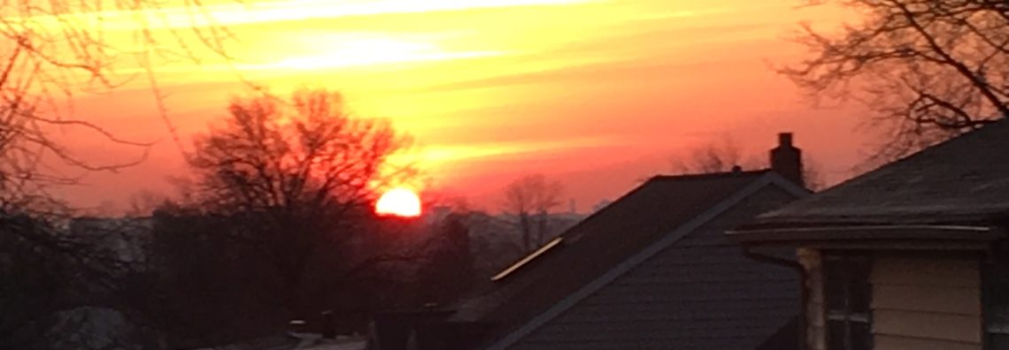
Skies are clear early on this Tuesday morning and it is quite cold again with readings at 5 a.m. ranging from 13 in Clifton down to zero at Pequest. Winds are calm or light westerly.

CLIFTON’S ALMANAC FOR FEBRUARY 15TH:

AVERAGE HIGH: 40 AVERAGE LOW: 24

RECORD HIGH: 60 – 2019 RECORD LOW: -3 – 1987

YESTERDAY’S HIGH: 25 LOW: 13 PRECIPITATION: NONE

Very strong high pressure will be over our area today providing us with plenty of sunshine, it will remain quite cold but high temperatures will be a couple of degrees higher than yesterday with less wind.

As the high pressure moves offshore a southerly flow will develop on Wednesday giving us milder temperatures but clouds will increase.

Thursday will be very mild with highs in the 60s as a strong southerly flow continues, there is a chance of showers in the afternoon but the steady and heavy rain will be at night into early Friday morning along with winds that may gust over 40 mph. Rainfall totals will be around one inch.

Gradual clearing on Friday, it will start off mild with temperatures well up in the 50s in the morning dropping off to the 40s by sunset.

The weekend weather still looks to be dry with near seasonable temperatures.

Mild weather will return by Monday and be with us much of next week.

THE FORECAST:

TODAY – FEB 15 – Sunny, high in the low 30s.

TONIGHT – Clear, low near 20.

WEDNESDAY – FEB 16 – Increasing cloudiness and becoming breezy, high in the upper 40s.

THURSDAY – FEB 17 – Mostly cloudy with a chance of afternoon showers, high in the low 60s. Rain heavy at times at night with strong winds likely.

FRIDAY – FEB 18 – Mostly cloudy in the morning then gradual clearing, early highs in the 50s will drop to the 40s by sunset.

SATURDAY – FEB 19 – Sunny, high in the mid 40s.

SUNDAY – FEB 20 – Mostly sunny, high in the low 40s.

PRESIDENTS DAY – FEB 21 – Mostly sunny and milder, high in the mid 50s.

MARINE FORECAST: TODAY – Northwest winds to 10 knots, seas 2 feet.

OUTLOOK – No advisories expected during the day on Wednesday; advisories likely at night; gales expected Thursday through Friday morning; small craft advisories to continue into Friday afternoon.

Have a nice day and stay safe!

Mostly sunny, breezy and very cold today! Sunny and not as cold on Tuesday! Milder and dry on Wednesday! Quite mild and windy with rain developing on Thursday!


Good morning everyone!

Skies are mostly clear early on this Monday morning and temperatures at 5 a.m. range from 15 in Clifton down to 6 degrees at High Point. Winds are a little gusty out of the northwest making it feel even colder.

CLIFTON’S ALMANAC FOR FEBRUARY 14TH:

AVERAGE HIGH: 39 AVERAGE LOW: 24

RECORD HIGH: 56 – 2011 RECORD LOW: -3 – 2016

YESTERDAY’S HIGH: 39 LOW: 23 PRECIPITATION: .20″ SNOWFALL: 2.5″

The storm system that gave us 2-3 inches of snow in the Clifton area and up to 5 inches across northwestern New Jersey has moved well offshore as high pressure builds into our area. Today will be very cold and breezy despite plenty of sunshine.

After a clear and very cold morning temperatures will moderate slightly during the day but stay below normal, however there will be less wind than today.

Mostly sunny and milder on Wednesday with high temperatures reaching the upper 40s.

A strong frontal system approaching from the west will cause a strong southerly flow of quite mild air with rain possibly heavy at times mainly Thursday night through early Friday morning. Winds may gust above 40 mph. Sunshine returns on Friday with cooler temperatures.

At this point the weekend looks to be dry with near seasonable temperatures.

THE FORECAST:

TODAY – FEB 14 – Sunny, breezy and quite cold, high only in the upper 20s.

TONIGHT – Mostly clear and very cold, low near 12.

TUESDAY – FEB 15 – Sunny, high in the low 30s.

WEDNESDAY – FEB 16 – Mostly sunny and milder, high in the upper 40s.

THURSDAY – FEB 17 – Cloudy with rain mainly after 6 p.m., becoming windy and very mild, high in the low 60s.

FRIDAY – FEB 18 – Becoming mostly sunny and cooler, high in the upper 40s.

SATURDAY – FEB 19 – Sunny, high in the mid 40s.

SUNDAY – FEB 20 – Sunny, high in the mid 40s.

MARINE FORECAST: A small craft advisory is in effect until 10 p.m. tonight for northwest wind gusting to 30 knots, seas 3-5 feet.

OUTLOOK – No advisories expected on Tuesday; small craft advisories developing on Wednesday; advisories expected Thursday and Friday with possible gales.

Happy Valentine’s Day!

Colder with light snow today! Sunny but very cold on Monday! Dry Tuesday and Wednesday with moderating temperatures! Rain and very mild on Thursday!


Good morning everyone!

Mainly light snow is falling over the area early on this Super Bowl Sunday and temperatures at 5 a.m. range from 30 in Clifton down to 23 at High Point. Winds are light from the north. Accumulations so far in Clifton are around 1 inch mainly on colder surfaces as of now the streets look just wet. Further to our north and west across Sussex County up to 3 inches of snow have been reported.

CLIFTON’S ALMANAC FOR FEBRUARY 13TH:

AVERAGE HIGH: 39 AVERAGE LOW: 24

RECORD HIGH: 57 – 1976 RECORD LOW: 3 – 2016

YESTERDAY’S HIGH: 58 LOW: 39 PRECIPITATION: NONE

The disturbance that is giving us snow this morning is stronger than anticipated and accumulations of 2-3 inches are expected. The steady and heaviest snowfall will be this morning tapering off this afternoon. Clearing tonight and becoming quite cold with lows in the teens.

Despite plenty of sunshine on Monday high temperatures will only top out in the upper 20s.

Dry weather is expected Tuesday and Wednesday with moderating temperatures.

A strong frontal system will give us rain mainly Thursday afternoon and night, temperatures will be quite mild with some highs in the 60s.

Dry with seasonable temperatures Friday into next weekend.

THE FORECAST:

TODAY – FEB 13 – Winter weather advisory is in effect. Cloudy with snow accumulating 2-3 inches before tapering off this afternoon, high in the mid 30s.

TONIGHT – Cloudy early with a chance of flurries then becoming partly cloudy after midnight, low in the upper teens.

MONDAY – FEB 14 – Mostly sunny and cold, high in the upper 20s.

TUESDAY – FEB 15 – Sunny, high in the mid 30s.

WEDNESDAY – FEB 16 – Increasing cloudiness, high in the upper 40s.

THURSDAY – FEB 17 – Cloudy with rain mainly in the afternoon and night, quite mild, high in the low 60s.

FRIDAY – FEB 18 – Mostly sunny and cooler, high in the upper 40s.

SATURDAY – FEB 19 – Mostly sunny, high in the mid 40s.

MARINE FORECAST: TODAY – Northerly winds to 10 knots, seas 2 feet.

OUTLOOK – Advisories likely during the day on Monday; no advisories expected Monday night through Tuesday night; advisories possible on Wednesday; advisories expected on Thursday with some gale gusts possible.

Have a nice day and stay safe. My Super Bowl prediction – Rams 27 Bengals 13!

Mostly sunny and mild today after early morning cloudiness! Colder tonight and Sunday with light snow likely Sunday morning! Cold and dry Monday and Tuesday! Mild Wednesday through Friday with rain Thursday afternoon into Friday!


Good morning everyone!

Skies are mostly cloudy early on this Saturday morning and it is unseasonably mild with readings at 5 a.m. ranging from 50 in Clifton down to 30 at Walpack, winds are light from the south.

CLIFTON’S ALMANAC FOR FEBRUARY 12TH:

AVERAGE HIGH: 39 AVERAGE LOW: 24

RECORD HIGH: 60 – 2018 RECORD LOW: 2 – 1979

YESTERDAY’S HIGH: 59 LOW: 31 PRECIPITATION: NONE

After early morning cloudiness we will enjoy another sunny and mild day with highs well up into the 50s with some 60 degree temperatures possible. A couple of cold fronts will cross the area this afternoon and tonight bringing in much colder air tonight with temperatures falling to the freezing point by midnight.

A weak disturbance will cause cloudy skies with some light snow from around 4 a.m. till 10 a.m., accumulating to a coating to possibly one inch.

Quite cold but dry Monday and Tuesday.

Milder weather once again Wednesday through Friday with rain from Thursday afternoon into Friday followed by somewhat colder air for next weekend.

THE FORECAST:

TODAY – FEB 12 – Mostly cloudy till mid morning then becoming mostly sunny, high in the upper 50s.

TONIGHT: Mostly cloudy with light snow likely mainly after 4 a.m. low in the upper 20s.

SUNDAY – FEB 13 – Mostly cloudy with light snow likely mainly before 10 a.m., high in the mid 30s.

MONDAY – FEB 14 – Mostly sunny and cold, high in the upper 20s.

TUESDAY – FEB 15 – Sunny, high in the upper 30s.

WEDNESDAY – FEB 16 – Mostly sunny, high near 50.

THURSDAY – FEB 17 – Mostly cloudy with rain developing in the afternoon and continuing at night, quite mild, high in the low 60s.

FRIDAY – FEB 18 – Mostly cloudy with a chance of showers, high in the mid 50s.

MARINE FORECAST: TODAY – Westerly winds to 10 knots, seas less than 1 foot.

OUTLOOK: No advisories expected during the day on Sunday; advisories expected Sunday night through Monday; no advisories on Tuesday; possible advisories on Wednesday.

Have a nice weekend and stay safe!

Sunny and mild with light winds today! Quite mild again on Saturday! Colder on Sunday with a chance of light snow or flurries in the morning! Dry and cold Monday and Tuesday! Milder Wednesday through Friday with a chance of showers on Thursday!


Good morning everyone!

Skies are mostly clear early on this Friday morning and temperatures at 5 a.m. range from 35 in Clifton down to 20 at Walpack and Pequest. Winds are mainly calm.

CLIFTON’S ALMANAC FOR FEBRUARY 11TH:

AVERAGE HIGH: 39 AVERAGE LOW: 23

RECORD HIGH: 64 – 2009 RECORD LOW: 0 – 1979

YESTERDAY’S HIGH: 53 LOW: 32 PRECIPITATION: NONE

High pressure in our area will give us another mild day today with mostly sunny skies and highs in the 50s, winds should be lighter than yesterday.

Saturday will be quite mild ahead of a cold front that will cross the area Saturday night.

A weak disturbance moving through the area along with a coastal low pressure well out in the ocean may touch off some light snow or flurries Sunday morning, only a coating of less than an inch is possible. It will be much colder with highs only in the low 30s.

Dry and cold weather is expected Monday and Tuesday.

The cold will be short-lived as milder air will be in our area Wednesday through Friday, so far the only chance of showers will be on Thursday.

THE FORECAST:

TODAY – FEB 11 – Sunny, high in the mid 50s.

TONIGHT – Mostly cloudy, low in the low 40s.

SATURDAY – FEB 12 – Partly sunny, high in the upper 50s.

SUNDAY – FEB 13 – Mostly cloudy and colder with a chance of morning light snow or flurries, high in the low 30s.

MONDAY – FEB 14 – Mostly sunny, high in the upper 20s.

TUESDAY – FEB 15 – Sunny, high in the mid 30s.

WEDNESDAY – FEB 16 – Mostly sunny, high in the mid 40s.

THURSDAY – FEB 17 – Mostly cloudy with a chance of showers, high in the upper 50s.

MARINE FORECAST: TODAY – Southerly winds to 15 knots, seas 2-3 feet.

OUTLOOK – Advisories expected this evening through Saturday night; advisories still likely Sunday and Monday; no advisories expected on Tuesday.

Enjoy the nice weather today and stay safe!