Mostly sunny and cool today! Milder on Sunday with afternoon and evening showers! Mainly dry weather next week! Quite chilly Tuesday through Thursday!


Good morning!

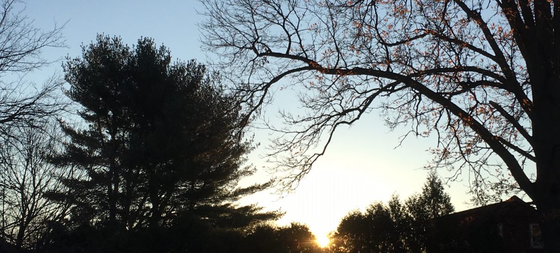
Well it looks like finally we should see a nice sunrise this Saturday morning as we have clear skies. Temperatures are seasonably cool with readings ranging from the upper 30s in Clifton to the upper 20s further inland. Winds are mainly calm or light northwesterly.

CLIFTON’S ALMANAC FOR NOVEMBER 14TH:

AVERAGE HIGH: 54 AVERAGE LOW: 36

RECORD HIGH: 72 – 1973 RECORD LOW: 13 – 1986

YESTERDAY’S HIGH: 49 LOW: 41 PRECIPITATION: .19

High pressure building over our area will give us a mostly sunny day with seasonably cool temperatures.

Sunday will be a bit milder but a cold front approaching the area will cause showers in the afternoon and evening. Models are indicating a squall line to move through in the evening possibly accompanied by strong winds and some thunder.

Mainly dry weather next week. Monday will be seasonably cool but Tuesday through Thursday will be quite cool with temperatures well below normal. Moderating temperatures by Friday that should last through next weekend.

THE FORECAST:

TODAY – NOV 14 – Sunny, high in the low 50s.

TONIGHT – Mostly clear, low in the mid 30s.

SUNDAY – NOV 15 – Becoming cloudy with showers in the afternoon and evening, high near 60.

MONDAY – NOV 16 – Sunny, high in the low 50s.

TUESDAY – NOV 17 – Mostly sunny, high in the upper 40s.

WEDNESDAY – NOV 18 – Sunny, high in the low 40s.

THURSDAY – NOV 19 – Mostly sunny, high in the upper 40s.

FRIDAY – NOV 20 – Mostly sunny, high in the upper 50s.

MARINE FORECAST: TODAY – Northerly winds to 10 knots, seas 2-3 feet.

OUTLOOK – A gale watch has been posted effective between 10 a.m. Sunday morning until 6 a.m. Monday morning; small craft advisories expected Monday through Wednesday.

Have a nice weekend and stay safe and healthy!

Cloudy with light rain or drizzle ending early this afternoon followed by clearing! Dry and cool on Saturday! Milder on Sunday with some showers likely in the afternoon and evening! Dry and cool much of next week!


Good morning!

Skies are cloudy early on this Friday morning and there is some drizzle falling in parts of the area. Temperatures are more than 20 degrees cooler than this time yesterday but still above normal with readings ranging from the mid 40s in Clifton down to the mid 30s further inland, winds are light northerly.

CLIFTON’S ALMANAC FOR NOVEMBER 13TH:

AVERAGE HIGH: 55 AVERAGE LOW: 36

RECORD HIGH: 64 – 2005 RECORD LOW: 17 – 1986

YESTERDAY’S HIGH: 65 LOW: 46 PRECIPITATION: .28″

A weak wave of low pressure along a front offshore will likely give us some rain or drizzle mainly before 2 p.m. followed by clearing by late this afternoon, temperatures will be near seasonable levels.

High pressure will then build into our area on Saturday with mostly sunny skies but cooler than average temperatures.

Sunday will be a little milder but a trough of low pressure will likely give us some showers Sunday afternoon and evening.

Dry weather much of next week as high pressure dominates. Temperatures will be near seasonable on Monday but quite cool Tuesday through Thursday with some moderation on Friday.

THE FORECAST:

TODAY – NOV 13 – Cloudy with drizzle and light rain likely mainly before 2 p.m., clearing late in the day, highs in the mid 50s.

TONIGHT – Mostly clear, low in the upper 30s.

SATURDAY – NOV 14 – Sunny, high in the low 50s.

SUNDAY – NOV 15 – Mostly cloudy with showers likely in the afternoon and evening, high near 60.

MONDAY – NOV 16 – Sunny, high in the mid 50s.

TUESDAY – NOV 17 – Mostly sunny, high in the upper 40s.

WEDNESDAY – NOV 18 – Mostly sunny, high in the mid 40s.

THURSDAY – NOV 19 – Mostly sunny, high in the upper 40s.

MARINE FORECAST: TODAY – Northwest winds to 10 knots, seas 2 feet.

OUTLOOK – No advisories expected for Saturday; advisories likely on Sunday with some gale gusts possible; advisories expected Monday and Tuesday with some gale gusts again on Tuesday.

Have a nice day and stay safe and healthy!

Cooler with some light rain continuing today into Friday morning! Mainly dry and cool weather for the weekend except for a chance of rain Sunday night!


Good morning!

Skies are cloudy early on this Thursday morning with some light rain falling in parts of the area. Temperatures are still unseasonably mild with readings ranging from the mid 60s in Clifton down to the mid 50s further inland. Winds are mainly calm and the humidity is high.

CLIFTON’S ALMANAC FOR NOVEMBER 12TH:

AVERAGE HIGH: 55 AVERAGE LOW 37

RECORD HIGH: 69 – 1982 RECORD LOW: 23 – 2019

YESTERDAY’S HIGH: 69 (New Record) LOW: 60 PRECIPITATION: 1.03

A cold front will move to our south and east this morning bringing in cooler air. A wave on the front will cause mainly light rain today, temperatures in the 60s this morning will fall to the low 50s by sunset. There may be a lull in the precipitation this evening but light rain is expected to redevelop late tonight.

The wave of low pressure will likely give our area some light rain Friday morning followed by slow clearing by late in the day, temperatures will be seasonably cool.

Mainly dry and cool weather for the weekend but another trough of low pressure may give us some more rain Sunday night.

Dry weather is then expected Monday through Wednesday. Temperatures will be near seasonable on Monday but drop to below normal readings Tuesday and Wednesday with most highs only in the 40s, which will feel quite chilly after this remarkable November stretch of unseasonably warm weather.

THE FORECAST:

TODAY – NOV 12 – Cloudy with periods of light rain, temperatures in the 60s in the morning will fall to the low 50s by sunset.

TONIGHT – Chance of light rain in the evening and again after midnight, low in the low 40s.

FRIDAY – NOV 13 – Light rain likely mainly in the morning, high in the mid 50s.

SATURDAY – NOV 14 – Sunny, high in the mid 50s.

SUNDAY – NOV 15 – Mostly sunny, high in the upper 50s, chance of rain at night.

MONDAY – NOV 16 – Sunny, high in the mid 50s.

TUESDAY – NOV 17 – Mostly sunny, high in the upper 40s.

WEDNESDAY – NOV 18 – Mostly sunny, high in the mid 40s.

MARINE FORECAST: A small craft advisory is in effect until 7 a.m. Friday morning for southwest winds becoming northerly and gusting to 25 knots, seas 4-6 feet.

OUTLOOK – No advisories expected Friday through the day on Sunday; advisories likely Sunday night into Monday with some gales possible.

Have a nice day and stay safe and healthy!

Record warmth again today followed by a soaking rain later this afternoon and night! Cooler with periods of rain Thursday into Friday morning! Dry on Saturday followed by a chance of rain on Sunday with near normal temperatures!


Good morning!

Skies have become cloudy early on this Wednesday morning and it is unseasonably mild with temperatures ranging from the low 60s in Clifton down to the low 50s further inland, these readings are nearly 25 degrees above normal.

CLIFTON’S ALMANAC FOR NOVEMBER 11TH:

AVERAGE HIGH: 55 AVERAGE LOW: 37

RECORD HIGH: 68 – 2002 RECORD LOW: 21 – 2017

YESTERDAY’S HIGH: 76 (New Record) LOW: 51 PRECIPITATION: NONE

One more day of remarkable warmth from a southerly flow of high pressure offshore. It will also be unseasonably humid with dew points rising to the mid 60s. A slow moving cold front is approaching from the west which will cause showers mainly after 3 p.m., and become moderate to heavy at times.

The front will cross the area after midnight tonight and tomorrow will be cooler. A wave of low pressure along the front to our south will cause rain much of the day through Friday morning.

Saturday looks to be dry but another trough of low pressure will give us a chance of showers on Sunday, temperatures will be near normal.

Still a chance of showers on Monday followed by clearing on Tuesday. Temperatures the rest of next week may actually be below normal.

THE FORECAST:

TODAY – NOV 11 – Cloudy, warm and humid with a chance of showers mainly after 3 p.m., rain may be heavy at times, high in the mid 70s.

TONIGHT – Cloudy with showers, low in the mid 50s.

THURSDAY – NOV 12 – Rain mainly before 3 p.m., high in the low 60s.

FRIDAY – NOV 13 – Cloudy with a chance of rain in the morning then becoming mostly sunny in the afternoon, high in the upper 50s.

SATURDAY – NOV 14 – Sunny, high in the mid 50s.

SUNDAY – NOV 15 – Mostly cloudy with a chance of rain, high near 60.

MONDAY – NOV 16 – Partly sunny with a chance of showers, high in the upper 50s.

TUESDAY – NOV 17 – Mostly sunny and cooler, high near 50.

MARINE FORECAST: A small craft advisory has been posted effective between 4 p.m. this afternoon through 6 p.m. Thursday evening. Today – Southwest winds to 25 knots, seas 3-6 feet.

OUTLOOK – Advisories still possible on Friday; no advisories expected Saturday and Sunday.

Happy Veterans Day!

Mostly sunny today with record high temperatures again likely! Warm and muggy on Wednesday with rain developing! Cooler on Thursday with showers continuing!


Good morning!

Skies are mainly clear early on this Tuesday morning and there is some patchy fog mainly inland. Temperatures range from the low 50s in Clifton down to the upper 30s further inland, winds are mainly calm.

CLIFTON’S ALMANAC FOR NOVEMBER 10TH:

AVERAGE HIGH: 55 AVERAGE LOW: 37

RECORD HIGH: 71 – 2002 RECORD LOW: 22 – 2017

YESTERDAY’S HIGH: 82 (Record high for date and tied record high for November last set on November 1st, 1974 LOW: 50 PRECIPITATION: NONE

Another record high temperature is likely today, but it should be a little cooler than yesterday, although the humidity will be rising this afternoon as the strong high pressure moves offshore.

Warm and muggy on Wednesday with rain developing as a slow moving cold front approaches from the west. Rain should develop in the afternoon and become heavy at times through Wednesday night.

The cold front will cross the area early on Thursday morning but a wave on the front will cause showers most of the day. It will be cooler with highs in the 60s dropping to the 50s by sunset.

Dry with near seasonable temperatures Friday into the day on Saturday.

Another low pressure trough will give us a chance of more showers Saturday night through Monday. Temperatures will remain near normal.

THE FORECAST:

TODAY – NOV 10 – Mostly sunny, high in the low 70s.

TONIGHT – Mostly cloudy, low in the mid 50s.

VETERANS DAY – NOV 11 – Showers developing by the afternoon, humid, high in the low 70s.

THURSDAY – NOV 12 – Showers, morning highs in the mid 60s falling to the 50s in the afternoon.

FRIDAY – NOV 13 – Partly sunny, high near 60.

SATURDAY – NOV 14 – Sunny, high in the mid 50s, chance of showers after midnight.

SUNDAY – NOV 15 – Mostly cloudy with a chance of showers, high in the upper 50s.

MONDAY – NOV 16 – Partly sunny with a chance of showers, high near 60.

MARINE FORECAST: TODAY – Southerly winds to 10 knots, seas 2 feet.

OUTLOOK – Small craft advisories likely on Wednesday; no advisories expected Thursday through Saturday.

Have a nice day and stay safe and healthy!