Mostly cloudy and humid today with a chance of afternoon and evening showers and thunderstorms! Plenty of sunshine Sunday and Monday along with warm temperatures and lower humidity!


Good morning!

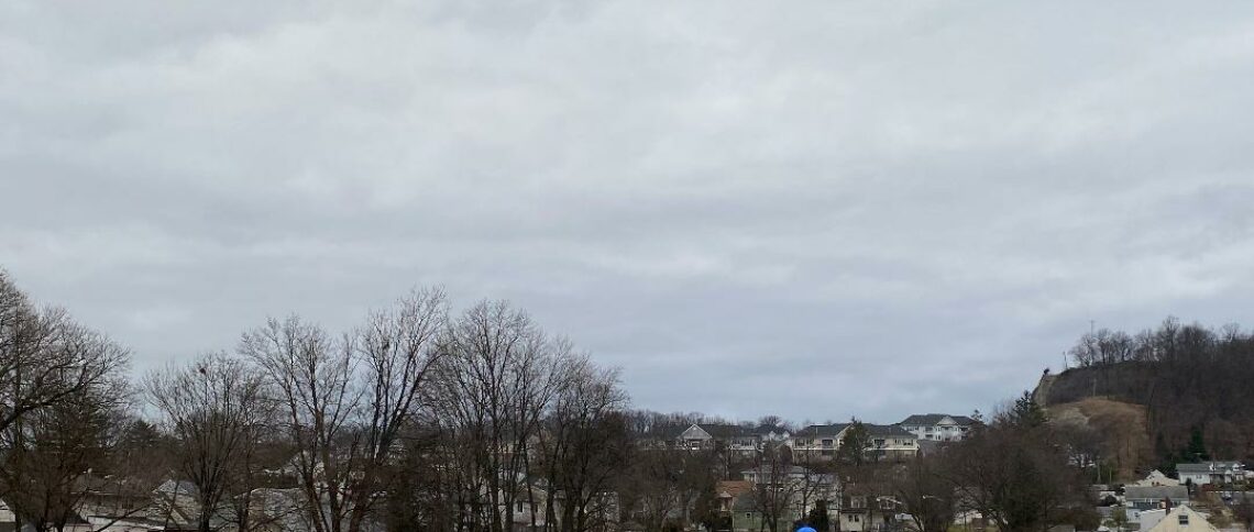
Skies across the area are partly cloudy early on this Saturday morning and temperatures range from near 70 in Clifton down to the low 60s further inland, it is a little muggy with dew points mainly in the upper 60s.

CLIFTON’S WEATHER ALMANAC FOR AUGUST 3RD.

AVERAGE HIGH: 85 AVERAGE LOW: 66

RECORD HIGH: 98 – 2006 RECORD LOW: 54 – 1985

YESTERDAY’S HIGH: 86 LOW: 70 PRECIPITATION: TRACE

Today will be a mostly cloudy day, there is a chance of afternoon and evening showers and thunderstorms as a weak front moves into our area, temperatures will be near seasonable and it will be a little muggy with dew points in the upper 60s.

High pressure will then control our weather Sunday and Monday, temperatures will be warm but the humidity will be lower, skies will be mostly sunny both days.

A front in our area will give us a chance of mainly afternoon and evening showers and thunderstorms Tuesday through Friday with the highest chance of showers will be on Wednesday. Temperatures will be seasonably warm with rather high humidity.

THE FORECAST:

TODAY – AUG 3 – Mostly cloudy and humid today with a chance of showers and thunderstorms mainly after 2 p.m. rain may be heavy, high in the mid 80s.

TONIGHT – Mostly cloudy with a chance of showers and thunderstorms mainly before midnight, rain may be heavy, low around 70.

SUNDAY – AUG 4 – Mostly sunny and becoming less humid, high in the upper 80s.

MONDAY – AUG 5 – Sunny, high in the mid 80s.

TUESDAY – AUG 6 – Mostly sunny, high in the upper 80s, chance of showers and thunderstorms at night.

WEDNESDAY – AUG 7 – Partly sunny with a chance of showers and thunderstorms, high in the upper 80s.

THURSDAY – AUG 8 – Partly sunny with a chance of showers and thunderstorms, high in the upper 80s.

FRIDAY – AUG 9 – Partly sunny with a chance of showers and thunderstorms, high in the upper 80s.

MARINE FORECAST: TODAY – South-southeast winds to 6 knots, seas 1 foot. Point Pleasant Beach ocean temperature is 72 degrees.

OUTLOOK – No advisories expected Sunday through Thursday.

Have a nice weekend!

Mostly sunny and seasonably warm today! Warm over the weekend with a chance of showers Saturday afternoon and evening!


Good morning!

Skies have become mostly cloudy early on this Friday morning and temperatures range from the low 70s in Clifton down to the upper 50s further inland, winds are mainly calm and it is still a little muggy with dew points mainly in the upper 60s.

CLIFTON’S WEATHER ALMANAC FOR AUGUST 2ND:

AVERAGE HIGH: 85 AVERAGE LOW: 66

RECORD HIGH: 99 – 2006 RECORD LOW: 56 – 1998

YESTERDAY’S HIGH: 90 LOW: 68 PRECIPITATION: NONE.

High pressure will give us another nice day today with seasonably warm temperatures along with mostly sunny skies, the humidity will not be too high with dew points in the low to mid 60s.

A weak front will give us a chance of showers Saturday afternoon and evening, temperatures will continue to be seasonable but the humidity will slowly rise.

High pressure will then give us rather nice weather Sunday and Monday with seasonably warm temperatures and lower humidity.

Tuesday will be mainly dry and the humidity will slowly rise.

Another front will give us a chance of showers Wednesday and Thursday along with higher humidity.

THE FORECAST:

TODAY – AUG 2 – Mostly sunny, high in the mid 80s.

TONIGHT – Mostly cloudy, low in the upper 60s.

SATURDAY – AUG 3 – Partly sunny with a chance of afternoon and evening showers and thunderstorms, high in the mid 80s.

SUNDAY – AUG 4 – Sunny, high in the upper 80s.

MONDAY – AUG 5 – Sunny, high in the mid 80s.

TUESDAY – AUG 6 – Partly sunny, high in the upper 80s.

WEDNESDAY – AUG 7 – Mostly cloudy with a chance of showers and thunderstorms, high near 90.

THURSDAY – AUG 8 – Partly sunny with a chance of showers and thunderstorms, high in the upper 80s.

MARINE FORECAST: TODAY – Southeast wind to 7 knots, seas 1 foot. Point Pleasant Beach ocean temperature is 72 degrees.

OUTLOOK – No advisories expected Saturday through Tuesday.

JULY 2019 CLIFTON’S MONTHLY SUMMARY:

AVERAGE TEMPERATURE: 79.4 – Warmest July and warmest month since my records began in 1973. Highest temperature 98 – 20th and 21st; Lowest – 63 – 1st. (15 days had temperatures of 90 degrees or higher)

PRECIPITATION: 8.04″ 3rd wettest since 1973.

Have a nice day!

Mostly sunny and seasonably warm both today and on Friday! Mainly dry weather for the weekend except for a low chance of a shower on Saturday!


Good morning!

Skies across the region are partly cloudy and temperatures range from near 70 in Clifton down to the low 60s further inland, winds are light and the humidity is still on the high side with dew points in the upper 60s.

CLIFTON’S ALMANAC FOR AUGUST 1ST:

AVERAGE HIGH: 85 AVERAGE LOW: 66

RECORD HIGH: 98 – 2006 RECORD LOW: 57 – 1990

YESTERDAY’S HIGH: 87 LOW: 70 PRECIPITATION: 0.13″ (much higher amounts just to our south and west)

High pressure will build into our area today and Friday providing us with plenty of sunshine both days with seasonably warm temperatures, the humidity will be somewhat lower.

Most of the upcoming weekend will be dry but there will be a low chance of showers and thunderstorms on Saturday as a weak front moves through the area.

Monday will be dry and comfortable but some showers are possible Tuesday and Wednesday as a front moves into our area. Temperatures early next week will be slightly above normal.

THE FORECAST:

TODAY – AUG 1 – Mostly sunny, high in the upper 80s.

TONIGHT – Partly cloudy, low in the upper 60s.

FRIDAY – AUG 2 – Mostly sunny, high in the mid 80s.

SATURDAY – AUG 3 – Partly sunny with a chance of showers and thunderstorms mainly in the afternoon, high in the upper 80s.

SUNDAY – AUG 4 – Sunny, high in the upper 80s.

MONDAY – AUG 5 – Sunny, high in the mid 80s.

TUESDAY – AUG 6 – Partly sunny with a chance of showers and thunderstorms, high in the mid 80s.

WEDNESDAY – AUG 7 – Partly sunny with a chance of showers and thunderstorms, high near 90.

MARINE FORECAST: TODAY – North-northeast wind to 6 knots, seas 1 foot. Point Pleasant Beach ocean temperature is 73 degrees.

OUTLOOK – No advisories expected Friday through Monday.

Have a nice day!

Not as hot today with some strong thunderstorms likely late this afternoon into this evening! Dry Thursday and Friday with seasonably warm temperatures! Continued seasonably warm over the weekend with a low chance of showers on Saturday!


Good morning!

Skies across the area are mostly clear and temperatures range from the low 70s in Clifton down to the low 60s further inland, winds are mainly calm. The humidity is moderate with dew points in the mid to upper 60s.

CLIFTON’S ALMANAC FOR JULY 31ST.

AVERAGE HIGH: 85 AVERAGE LOW: 67

RECORD HIGH: 92 – 2008 RECORD LOW: 57 – 1986

YESTERDAY’S HIGH: 96 (Tied record for date) LOW: 74 PRECIPITATION: NONE.

A cold front will approach our area today, we should see sunshine this morning followed by an increase in clouds this afternoon. Showers and thunderstorms are likely mainly from late this afternoon into early this evening. Thunderstorms may become strong to severe producing gusty winds and heavy rain. Temperatures with the clouds this afternoon will not be as hot but the humidity will remain high.

High pressure will then build into the area Thursday and dominate our weather into Friday. Temperatures will be seasonably warm with somewhat lower humidity.

Most of the upcoming weekend should be dry with seasonably warm temperatures however there is a low chance of an afternoon or evening shower on Saturday.

Very nice weather for Monday with warm temperatures and lower humidity.

Another front may cause some showers on Tuesday.

THE FORECAST:

TODAY JULY 31: Mostly sunny this morning then becoming mostly cloudy this afternoon with showers and thunderstorms likely mainly after 3 p.m., some storms may be accompanied by heavy rain and strong gusty winds, high in the upper 80s.

TONIGHT: Mostly cloudy with showers and thunderstorms likely mainly before 9 p.m., some storms may be accompanied by heavy rain and strong gusty winds, low near 70.

THURSDAY – AUG 1 – Mostly sunny, high in the upper 80s.

FRIDAY – AUG 2 – Mostly sunny, high in the mid 80s.

SATURDAY – AUG 3 – Partly sunny with a chance of an afternoon or evening shower or thunderstorm, high in the mid 80s.

SUNDAY – AUG 4 – Mostly sunny, high in the upper 80s.

MONDAY – AUG 5 – Sunny, high in the upper 80s.

TUESDAY – AUG 6 – Partly sunny with a chance of showers and thunderstorms, high in the upper 80s.

MARINE FORECAST: TODAY – Southerly winds to 13 knots, seas 1 foot. Point Pleasant Beach ocean temperature is 72 degrees.

OUTLOOK – No advisories expected Thursday through Sunday.

Have a nice day!

Another hot and humid day today! Showers and thunderstorms likely on Wednesday! Seasonably warm Thursday through the weekend with some showers possible Friday and Saturday!


Good morning!

Skies across the area are mostly clear early on this Tuesday morning and it is rather warm and muggy with temperatures ranging from the mid 70s in Clifton down to the upper 60s further inland, winds are light southwesterly and the humidity is high with dew points near 70.

CLIFTON’S ALMANAC FOR JULY 30TH.

AVERAGE HIGH: 85 AVERAGE LOW: 66

RECORD HIGH: 96 – 1988 RECORD LOW: 56 – 1997

YESTERDAY’S HIGH: 95 LOW: 69 PRECIPITATION: NONE

Another day of hot and humid weather today as high pressure is off the coast and a warm south-southwest flow continues, high temperatures will be well up into the 90s and with the humidity will cause the heat index to rise to near 100 degrees. Skies should be mostly sunny but there is a slight risk of an afternoon or evening pop up thunderstorm mainly inland.

A weak front will move into our area on Wednesday which will cause more widespread shower and thunderstorm activity mainly in the afternoon and evening. With more clouds and rain high temperatures will be lower but it still will be humid.

The front will move to our south on Thursday and we should have a mostly sunny day with seasonably warm temperatures and slightly lower humidity.

The front will then move slowly north closer to our area Friday and Saturday which will give us a chance of showers both days, temperatures will be seasonably warm with moderate humidity.

At the present time Sunday and Monday look dry with seasonably warm temperatures along with somewhat lower humidity.

THE FORECAST:

TODAY – JULY 30 – Sunny, hot and humid, high in the mid 90s.

TONIGHT – Partly cloudy, low in the low 70s.

WEDNESDAY – JULY 31 – Partly sunny with showers and thunderstorms likely mainly after 3 p.m., some storms may be accompanied by heavy rain and gusty winds, humid, with highs in the upper 80s.

THURSDAY – AUG 1 – Mostly sunny, high in the upper 80s.

FRIDAY – AUG 2 – Mostly sunny with a chance of an afternoon or evening shower and thunderstorm, high in the mid 80s.

SATURDAY – AUG 3 – Partly sunny with a chance of a shower or thunderstorm, high in the mid 80s.

SUNDAY – AUG 4 – Mostly sunny, high in the upper 80s.

MONDAY – AUG 5 – Mostly sunny, high in the mid 80s.

MARINE FORECAST: TODAY: Southerly winds to 16 knots, seas 1 foot. Point Pleasant Beach ocean temperature is 72 degrees.

OUTLOOK – No advisories expected Wednesday through Saturday.

Keep cool!