Cooler today with rain developing late this afternoon ending tomorrow morning! More rain tomorrow night into Friday!


Good morning!

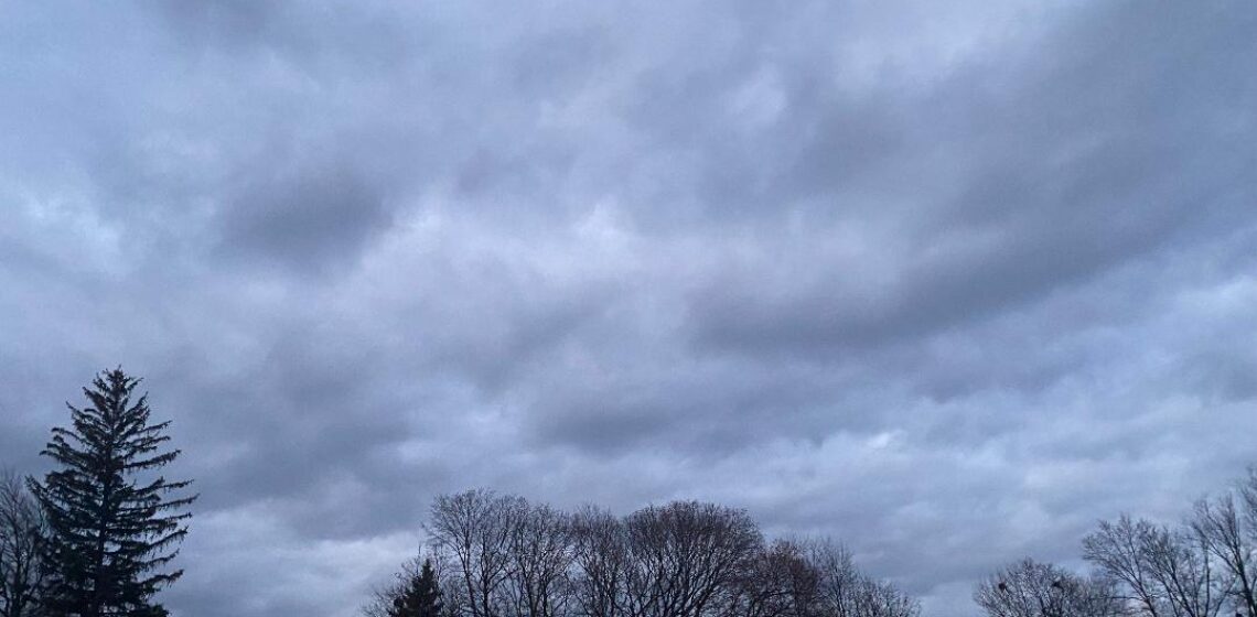
Skies are mostly cloudy early on this Wednesday morning and temperatures range from the mid 30s in Clifton down to the mid 20s further inland, winds are light.

After the mild 67 degrees yesterday today will be much cooler as high pressure noses down into our area from the northwest. A low pressure will then approach the area from the west & rain from this system will move into the area by late in the day, with rain tapering off in the early morning to drizzle and ending by noon.

Another low pressure system will give us more rain Thursday night as a warm front moves through the area. Mild with showers Friday morning then a cold front will bring in drier and colder weather at night along with some gusty winds.

The weekend looks dry with temperatures a little below normal.

Monday should be dry with seasonably temperatures.

Another low pressure area may cause some light snow on Tuesday.

THE FORECAST:

TODAY – FEB 6 – Becoming cloudy with a chance of rain mainly after 4 p.m., high in the mid 40s.

TONIGHT – Rain, low in the upper 30s.

THURSDAY – FEB 7 – Mostly cloudy with a chance of light rain or drizzle mainly before noon, high in the upper 40s, Rain at night mainly after 10 p.m.

FRIDAY – FEB 8 – Cloudy with showers in the morning then becoming mostly sunny in the afternoon, becoming windy, highs in the mid 50s in the morning dropping to the 40s by sunset.

SATURDAY – FEB 9 – Sunny, high in the mid 30s.

SUNDAY – FEB 10 – Mostly sunny, high in the upper 30s.

MONDAY – FEB 11 – Partly sunny, high near 40.

TUESDAY – FEB 12 – Mostly cloudy with a chance of snow, high in the upper 30s.

MARINE FORECAST: TODAY – North-northeast wind gusting to 9 knots, seas 2 feet.

OUTLOOK – No advisories expected during the day on Thursday; possible small craft advisories Thursday night; no advisories expected Friday morning; gales possible Friday night into Saturday afternoon; no advisories expected Saturday night and Sunday.

Have a nice day!

Another springlike day today! Cooler on Wednesday with some rain by late in the day!


Good morning!

Skies are partly cloudy early on this Tuesday morning and temperatures range from the low 40s at my station in Clifton to the mid 20s further inland, winds are mainly calm. Interesting that the valleys are much cooler than the higher elevations. At High Point it is 44 while in the valley of Walpack it is 27. Even in Clifton, while I have 42 degrees on the hill in Maple Valley, while it is only 33 degrees at a station in the Oak Ridge section of Clifton.

Today will be a mostly sunny day and temperatures again will rise into the low 60s, winds will be light. A cold front will cross the area late in the day but come through dry.

Cooler on Wednesday as high pressure from the north builds into the area. A low pressure system will then approach from the west causing a chance of rain in the afternoon with rain likely at night, the precipitation may start off as an icy mix well inland.

Unsettled weather to continue Thursday and Friday with a chance of rain both days. Temperatures will be slightly above normal on Thursday then much above normal on Friday. A cold front will cross the area Friday afternoon followed by colder but dry weather for the weekend.

THE FORECAST:

TODAY – FEB 5 – Mostly sunny, high in the low 60s.

TONIGHT – Mostly clear, low in the upper 20s.

WEDNESDAY – FEB 6 – Increasing cloudiness with a chance of rain mainly after 4 p.m., high in the low 40s. Rain at night.

THURSDAY – FEB 7 – Rain mainly before 7 a.m. then mostly cloudy, high in the upper 40s, rain likely again at night.

FRIDAY – FEB 8 – Showers likely mainly before noon, then mostly cloudy and mild, high near 60.

SATURDAY – FEB 9 – Sunny and colder, high in the mid 30s.

SUNDAY – FEB 10 – Mostly sunny, high in the upper 30s.

MONDAY – FEB 11 – Partly sunny, high near 40.

MARINE FORECAST: TODAY – West-southwest winds to 7 knots, seas 3 feet.

OUTLOOK – No advisories expected during the day on Wednesday; small craft conditions expected Wednesday night through the day on Friday; gales possible Friday night; small craft conditions likely on Saturday.

Have a nice day!

Spring preview to continue today and on Tuesday! Cooler on Wednesday! Unsettled weather Wednesday night through Friday!


Good morning!

Skies are mostly clear early on this Monday morning and temperatures range from the mid 30s in Clifton down to the upper teens further inland, winds are mostly light. There may be some patchy black ice in parts of the area.

Today will be a mostly sunny and mild day as high pressure moves off the coast and a light southwest flow dominates our weather, daytime highs will be in the 50s.

A cold front is expected to come through dry Tuesday night, mild air will precede the front and temperatures will rise to near 60.

Not as mild on Wednesday as a cooler air mass comes in from the northwest.

A couple of waves of low pressure will cause unsettled weather from late Wednesday through Friday, at this time most if not all the precipitation will fall as rain, however some wintery mix is possible well inland Thursday morning. Temperatures should be slightly above normal on Thursday and well above normal on Friday.

High pressure will dominate our weather over the weekend with seasonably cold temperatures and dry conditions.

THE FORECAST:

TODAY – FEB 4 – Sunny, high in the low 50s.

TONIGHT – Partly cloudy with patchy fog, low in the upper 30s.

TUESDAY – FEB 5 – Mostly cloudy with some fog early then becoming mostly sunny and mild, high near 60.

WEDNESDAY – FEB 6 – Increasing cloudiness with rain likely after 5 p.m., not as mild, high in the mid 40s.

THURSDAY – FEB 7 – Rain mainly before 11 a.m., mostly cloudy, high in the upper 40s, Rain likely again after midnight.

FRIDAY – FEB 8 – Mostly cloudy with showers likely, mild, with highs in the upper 50s.

SATURDAY – FEB 9 – Sunny and colder, high in the mid 30s.

SUNDAY – FEB 10 – Mostly sunny, high in the upper 30s.

MARINE FORECAST: TODAY – Light and variable winds, seas 1 foot.

OUTLOOK – No advisories expected Tuesday and Wednesday; possible small craft conditions on Thursday; advisories likely on Friday with gales possible Friday night.

Have a nice day!

Mostly sunny and milder today! Even milder Monday and Tuesday with mainly dry weather continuing!


Good morning!

Skies are mostly clear early on this Super Bowl Sunday and temperatures are quite a bit milder than the last couple of mornings ranging from near 30 in Clifton down to the low teens further inland, winds are calm or very light.

High pressure will provide us with mostly sunny skies today and milder temperatures as highs reach the 40s, winds will be light.

Remaining mainly dry Monday and Tuesday, although there is a low chance of a shower Monday night, daytime highs will reach the 50s both days giving our area a nice spring preview after the frigid weather of the past few days.

A cold front will cross the area dry late Tuesday night and Wednesday will be cooler.

Unsettled weather from Wednesday night through Friday, there will be a chance of rain during this period, however some wintery mix may occur early Thursday morning mainly over inland sections.

Seasonably cold weather is expected next weekend with mainly dry conditions.

THE FORECAST:

TODAY – FEB 3 – Mostly sunny, high in the mid 40s.

TONIGHT – Mostly cloudy, low in the low 30s.

MONDAY – FEB 4 – Mostly sunny, high in the low 50s, chance of a shower after midnight.

TUESDAY – FEB 5 – Mostly sunny, high in the upper 50s.

WEDNESDAY – FEB 6 – Mostly sunny and cooler, high in the mid 40s, chance of rain at night.

THURSDAY – FEB 7 – Cloudy with rain likely, high in the upper 40s.

FRIDAY – FEB 8 – Mostly cloudy with a chance of rain, high in the low 50s.

SATURDAY – FEB 9 – Sunny and colder, high in the mid 30s.

MARINE FORECAST: TODAY – West-southwest winds to 7 knots, seas 1 foot.

OUTLOOK: No advisories expected Monday through Thursday.

Have a nice day! My Super Bowl Prediction: New England Patriots 35 Los Angeles Rams 31.

Dry weather this weekend! Not as cold today! Milder on Sunday! Even milder Monday and Tuesday!


Good morning!

Skies are mostly clear early on this Saturday morning and temperatures are still chilly ranging from 11 in Clifton down to -10 at Walpack, winds are calm or light westerly.

Arctic high pressure will be moving into the area and then off the coast as a milder southwest flow develops. it will be a dry weekend with highs in the 30s today and rise into the 40s on Sunday, winds will be light so it will feel much more comfortable than the last few days.

Dry weather will persist Monday and Tuesday with quite mild temperatures both days, with highs mainly in the 50s.

Cooler on Wednesday as high pressure builds in from the north. A weak disturbance will give us the next chance of precipitation Wednesday night into Thursday, rain may start off as snow Wednesday night and change to rain on Thursday.

Mild on Friday with a chance of showers.

THE FORECAST:

TODAY – FEB 2 – Mostly sunny, high in the mid 30s.

TONIGHT – Mostly cloudy, low in the upper 20s.

SUNDAY – FEB 3 – Mostly sunny, high in the mid 40s.

MONDAY – FEB 4 – Mostly sunny, high in the low 50s.

TUESDAY – FEB 5 – Partly sunny, high in the upper 50s.

WEDNESDAY – FEB 6 – Mostly sunny, high in the mid 40s, chance of snow at night mixed with rain at night.

THURSDAY – FEB 7 – Cloudy with a chance of snow changing to rain, high in the mid 40s.

FRIDAY – FEB 8 – Mostly cloudy with a chance of showers, high in the low 50s.

MARINE FORECAST: A small craft advisory is in effect until midnight tonight for southwest winds gusting to 25 knots, seas 1-3 feet.

OUTLOOK – No advisories expected Sunday through Wednesday.

JANUARY 2019 CLIFTON WEATHER SUMMARY!

Temperatures during January averaged 29.9 degrees which is .3 degrees above normal. Highest temperature was 59 degrees on the 24th, the lowest was -1 degree set on the 31st. Precipitation was just a bit above normal with 4.40 inches falling, the most fell on the 24th with 1.56 inches. Snowfall was well below normal with only 3.7 inches accumulating, the most accumulation was on the 19th with 2 inches.

Happy Groundhog Day!