Much colder and windy today! Quite cold on Saturday but with less wind! Snow and rain likely for Sunday!


FRIDAY  FEBRUARY 2, 2018  6:02 A.M.

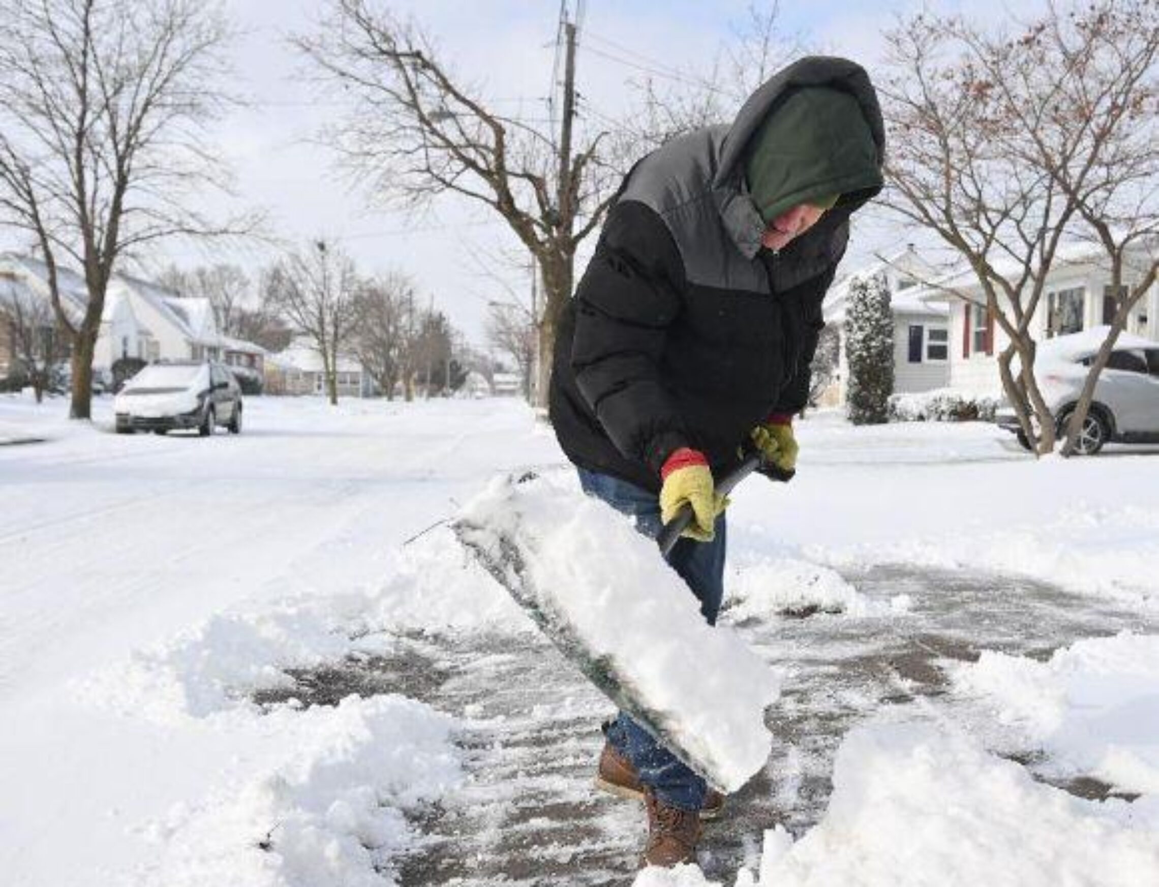
Colder air is moving into the area early on this Groundhog Day and rain has changed to snow in many parts of the area, temperatures have fallen to 30 in the Clifton area ranging down to 20 further inland, winds are gusty out of the northwest.  As of now it appears that the precipitation has stopped in the Clifton area with no snow accumulation however in the higher elevations well inland up to 4 inches of snow has been reported.   Be careful heading out early this morning because any wet roads or sidewalks may freeze and become slippery.

Cold Arctic high pressure will be building into the area today and despite skies becoming sunny temperatures will fall through the 20s this afternoon, gusty northwest winds will make it feel even colder.

After a frigid night tomorrow will be sunny with lighter winds with highs still be only around freezing.

Milder on Sunday but a low pressure frontal system will likely give us snow changing to rain and then back to snow before ending on late at night, we make pick up an inch or two of snow with more falling inland.

Fair and cold Monday and Tuesday.

Still another disturbance will give us a chance of snow or rain late Tuesday night into Wednesday.

Not sure if the groundhog will see his shadow but I think cold winter weather will be with us for a couple of weeks and then get warmer after the middle of February.  Too early to know how March will turn out.


THE FORECAST:

TODAY – FEB 2 – Becoming mostly sunny and windy, temperatures falling through the 20s, winds gusting to 30 mph.

TONIGHT – Mostly clear and very cold, low near 10.

SATURDAY – FEB 3 – Mostly sunny, high in the low 30s.

SUNDAY – FEB 4 – Snow likely in the morning then changing to rain, high in the low 40s,  snow likely at night with light snow accumulations.

MONDAY – FEB 5 – Mostly sunny, high in the upper 30s.

TUESDAY – FEB 6 – Partly sunny in the morning then increasing cloudiness, high in the upper 30s,  chance of snow late at night.

WEDNESDAY – FEB 7 – Snow or rain in the morning then rain likely, high in the mid 40s.

THURSDAY – FEB 8 – Mostly sunny, high in the mid 30s.


MARINE FORECAST:   A gale warning will be in effect from 1 p.m this afternoon until 10 p.m tonight for northwest winds gusting to 35 knots, seas 3-6 feet.

OUTLOOK – Small craft conditions Saturday morning; no advisories expected Saturday afternoon through Sunday morning; small craft advisories expected Sunday afternoon through the day on Monday; no advisories expected Monday night through Tuesday.


JANUARY 2018  CLIMATE SUMMARY.

The month’s temperature averaged just below normal with temperatures much below normal for the first couple of weeks and then milder than normal for the last half of the month.  The high temperature was 63 degrees on the 12th, with the coldest a frigid 1 degree above zero on the 7th.      Precipitation was below normal with 2.83 inches falling.  Snowfall was slightly below normal with 8.6 inches accumulating with the biggest snow of 5.5 inches falling during the strong storm on the 4th.


Happy Groundhog Day!

Cloudy and milder today with light rain developing by evening changing to snow before ending early Friday morning! Cold and dry Friday afternoon into Saturday!


THURSDAY  FEBRUARY 1,  2018  5:39 A.M.

Our area has cloudy skies early on this first day of February and temperatures are milder than this time yesterday ranging from around 30 in the Clifton area down to the mid 20s further inland, winds are light.

Today will be a milder and cloudy day as high pressure moves off the coast and a cold front approaches from the west.  Light rain will develop by late this afternoon and continue into this evening, the front will move to our east by midnight and the rain will change to snow before ending by daybreak, possible accumulations would be less than an inch but might affect Friday morning’s commute as the colder air moves in.

Clearing Friday as high pressure moves into the area but it will be quite cold and windy.  It will be continued cold with less wind on Saturday, early morning temperatures early Saturday morning will dip down to the low teens.

Another stronger disturbance will likely give us snow and rain on Sunday and Sunday night along with milder temperatures.

Seasonably cold and dry Monday into the day on Tuesday but still another disturbance will give us a chance of rain or snow Tuesday night into Wednesday.


THE FORECAST:

TODAY – FEB 1 – Cloudy and milder today with a chance of rain after 4 p.m., high in the upper 40s.

TONIGHT –  Light rain likely at night changing to snow before ending by sunrise, low in the upper 20s, accumulations less than 1/2 inch.

FRIDAY – FEB 2 – Becoming mostly sunny, windy and much colder, morning high in the low 30s dropping to the mid 20s by sunset.

SATURDAY – FEB 3 – Mostly sunny, high in the low 30s.

SUNDAY – FEB 4 – Cloudy with a chance of snow after 2 p.m. changing to rain, high in the low 40s,  chance of snow and rain at night.

MONDAY – FEB 5 – Mostly cloudy, high in the upper 30s.

TUESDAY – FEB 6 – Partly sunny, high in the upper 30s, chance of snow late at night.

WEDNESDAY – FEB 7 – Cloudy with a chance of snow changing to rain, high in the mid 40s.


MARINE FORECAST:  A small craft advisory is in effect until 6 a.m. Friday morning for southwest winds gusting to 30 knots, seas 3-6 feet.

OUTLOOK –  A gale watch is posted for Friday and Friday evening; no advisories expected during the day on Saturday; small craft advisories expected Saturday night into Monday.


Have a nice day!

Cold but dry today! Milder on Thursday with some light rain! Rain changing to snow before ending Friday morning! Quite cold Friday and Saturday!


WEDNESDAY  JANUARY 31, 2018  6:01 A.M.

Skies are clear early on this last day of January and temperatures are quite cold ranging from the mid teens in the Clifton area down to some single digits well inland, winds are light out of the northwest.   There is the super blue moon outside now but we will see very little blood across the moon since the lunar eclipse starts at 6:48 but then the moon sets at 7:08 a.m.  so unless you have a clear view of the western sky for those 20 minutes you will not see any of the eclipse.

High pressure across the southern Appalachians will give us a partly sunny day but it will be cold with highs just above the freezing mark.

Tomorrow we have milder conditions ahead of a frontal system, light rain may begin by the afternoon and may change to snow before ending after midnight, accumulations will be light.

Cold and dry Friday and Saturday as high pressure builds over the area.

Milder again on Sunday but another frontal system will likely give us some light rain by the afternoon changing to snow at night and continuing into Monday morning.  Accumulations will again be light.

Slightly colder than normal temperatures early next week.


THE FORECAST:

TODAY – JAN 31 – Partly sunny, high in the mid 30s.

TONIGHT – Mostly cloudy, low in the upper 20s.

THURSDAY – FEB 1 – Cloudy with a chance of rain, high in the mid 40s, rain changing to snow after midnight.

FRIDAY – FEB 2 – Partly sunny, high in the low 30s.

SATURDAY – FEB 3 – Mostly sunny, high in the low 30s.

SUNDAY – FEB 4 – Cloudy with a chance of rain showers, high near 40.  Light snow likely at night.

MONDAY – FEB 5 – Mostly cloudy with a chance of snow, high in the upper 30s.

TUESDAY – FEB 6 – Partly sunny, high in the mid 30s.


MARINE FORECAST:  A small craft advisory is in effect till 6 p.m. Thursday evening.  Today – Southwest winds to 30 knots seas 4-7 feet.

OUTLOOK – Small craft conditions possible extending from Thursday evening through the day on Friday;  no advisories expected Friday night through Saturday morning; small craft conditions likely with possible gales Saturday afternoon through Sunday.


Have a nice day!

Light snow this morning! Snow showers this afternoon! Dry and colder tonight and Wednesday! Chance of rain changing to snow late Thursday into Friday morning!


TUESDAY  JANUARY 30, 2018  5:50 A.M.

Light snow is falling in the Clifton area but has stopped further inland, temperatures have fallen to around 30 in the Clifton area ranging down to the mid 20s in some inland spots.  Snow accumulation is less than an inch mainly on colder surfaces, however some untreated roads and sidewalks may have some icy spots.

The snow should end this morning but there may be snow showers this afternoon, a heavier snow shower is possible that may give us another brief accumulation.  Much colder tonight so any wet areas may freeze.

Cold and dry on Wednesday.

Milder on Thursday but a weak cold front will give us a chance of rain in the afternoon, changing to snow before ending at night,  accumulations at this time should be light.

Quite cold and dry on Friday and Saturday, a little milder on Sunday with another chance of rain or snow.

Dry but cold early next week.


THE FORECAST:

TODAY – JAN 30 – Cloudy with light snow ending shortly, chance of snow showers this afternoon, high in the upper 30s.

TONIGHT – Clearing and colder, low in the upper teens.

WEDNESDAY – JAN 31 – Mostly sunny, high in the mid 30s.

THURSDAY – FEB 1 – Cloudy and milder with a chance of rain in the afternoon, high in the mid 40s.   Rain changing to snow before ending at night.

FRIDAY – FEB 2 – Partly sunny, high in the low 30s.

SATURDAY – FEB 3- Mostly sunny, high near 30.

SUNDAY – FEB 4 – Mostly cloudy with a chance of rain or snow, high near 40.

MONDAY – FEB 5 – Partly sunny, high in the low 30s.


MARINE FORECAST:  A small craft advisory is in effect until 6 a.m. Tuesday morning for northerly winds gusting to 30 knots, seas 6-9 feet.

OUTLOOK – No advisories expected Wednesday and Thursday; small craft conditions likely on Friday; no advisories expected on Saturday.


Despite the light snow try to have a good day today!

Cloudy today with some light snow late this afternoon into Tuesday morning with little or no accumulation!


MONDAY  JANUARY 29, 2018  5:40 A.M.

Skies are cloudy early on this Monday morning and temperatures are above normal ranging from the upper 30s in the Clifton area down to the mid 20s much further inland, winds are light northerly.

Today will be a mostly cloudy day and it will be cooler than the weekend with highs not raising much from our present readings.  A weak disturbance offshore will give us a chance of some light snow from late this afternoon into Tuesday morning with little or no accumulation.

Colder Tuesday and Wednesday but we will remain dry.

Milder again on Thursday but another weak front may give our area some rain changing to snow Thursday night into Friday morning.

Cold and dry on Saturday but another weak disturbance may give us some light rain or snow on Sunday followed by much colder air for the beginning of next week.


THE FORECAST:

TODAY – JAN 29 – Mostly cloudy with a chance of light snow mainly after 3 p.m. high in the low 40s.

TONIGHT – Cloudy with a chance of light snow, low in the upper 20s.

TUESDAY – JAN 30 – Chance of light snow in the morning, remaining cloudy, high in the upper 30s.

WEDNESDAY – JAN 31 – Partly sunny, high in the mid 30s.

THURSDAY – FEB 1 – Mostly cloudy, high in the mid 40s, chance of rain changing to snow at night.

FRIDAY – FEB 2 – Chance of light snow in the morning then becoming partly sunny, high in the mid 30s.

SATURDAY – FEB 3 – Mostly sunny, high near 30.

SUNDAY – FEB 4 – Mostly cloudy with a chance of rain or snow, high in the upper 30s.


MARINE FORECAST:  A small craft advisory is in effect until 6 a.m. Tuesday morning for northeast winds gusting to 30 knots, seas building to 6-9 feet.

OUTLOOK – Small craft conditions likely to continue Tuesday into Wednesday morning; no advisories expected Wednesday afternoon and night; small craft conditions possible Thursday and Friday.


Enjoy your Monday!