Deep freeze to continue through at least the end of next week! Light snow likely on Saturday!


FRIDAY  DECEMBER 29, 2017  5:44 A.M.

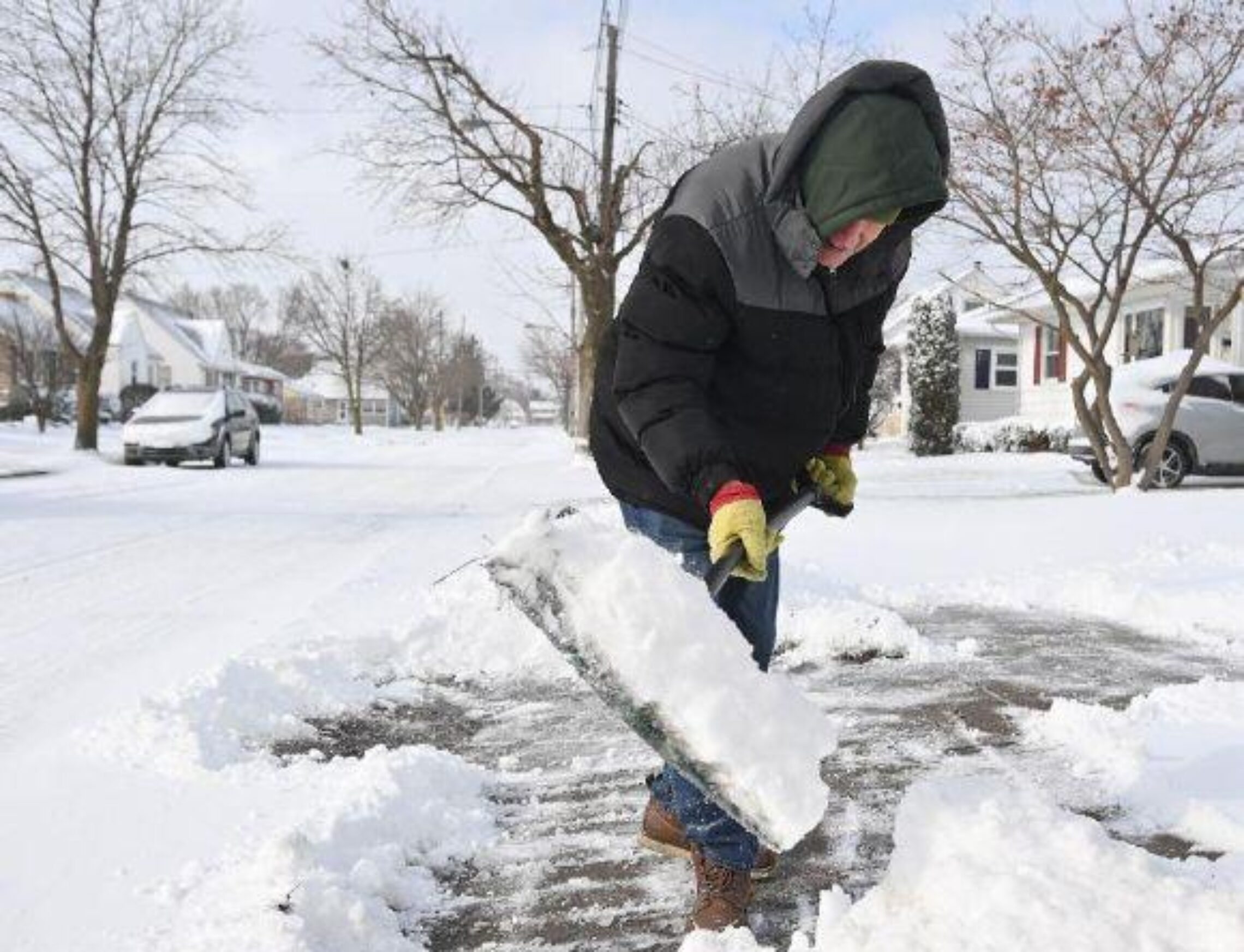
Skies have become mostly cloudy early on this Friday morning and once again it is bitterly cold with temperatures ranging from around 10 in the Clifton area to the low single digits well inland, High Point is the coldest in the state right now with a reading of 1 above zero. Winds are northwest averaging 5-10 mph.

Today will start off cloudy then become mostly sunny,  temperatures will be a few degrees higher than on Thursday but still be well below normal, we should stay dry but a flurry or two can’t be ruled out especially inland.

Light snow is likely on Saturday mostly falling during the daylight hours, temperatures may be a couple of degrees higher than today, accumulations of around an inch is expected.

Frigid again Sunday night into Tuesday morning but we should remain dry.

Well below normal temperatures to continue through next week, there is still a potential of a snowstorm on Thursday however the latest models have the storm well out to sea but this system still needs to be watched as the computer models have been inconsistent in this longer range lately.


THE FORECAST:

TODAY – DEC 29 – Cloudy this morning then becoming mostly sunny, high in the low 20s.

TONIGHT – Increasing cloudiness, low around 12.

SATURDAY – DEC 30 – Cloudy with light snow likely, high in the mid 20s, accumulations around an inch.

SUNDAY – DEC 31 – Mostly sunny, high near 20.

NEW YEAR’S DAY – JAN 1 – Sunny, high only in the upper teens.

TUESDAY – JAN 2 – Sunny, high in the mid 20s.

WEDNESDAY – JAN 3 – Mostly sunny, high near 30, chance of snow at night.

THURSDAY – JAN 4 – Mostly cloudy with a chance of snow, high in the mid 20s.


MARINE FORECAST:  TODAY – West-northwest wind to 16 knots, seas 1-2 feet.

OUTLOOK – No advisories likely Saturday morning; advisories expected Saturday afternoon through Tuesday with gales possible Saturday night into Sunday.


Have a nice day and stay warm!

Bitter cold to continue into next week! Light snow or flurries possible on Saturday!


THURSDAY  DECEMBER 28, 2017  5:46 A.M.

Very cold air continues over the area early this morning and temperatures range from around 12 in the Clifton area falling to the single digits inland,  the lowest reading right now is 2 degrees at the High Point monument.  Skies are mostly clear and there is a west-northwest wind averaging 5-10 MPH.

If you thought yesterday was cold today will be even colder with high temperatures struggling to reach the 20 degree mark and with gusty winds it will drop wind chill values down to zero even though there will be plenty of sunshine.

Frigid Arctic air will be with us into next week, some flurries are possible on Friday and some light snow during the day on Saturday, accumulations on Saturday will be less than an inch.

The latest European model is indicating a stronger coastal storm around Jan 3-4th, while the GFS  model continues the dry pattern.


THE FORECAST:

TODAY – DEC 28 – Sunny, high near 20.

TONIGHT – Increasing clouds, low around 8.

FRIDAY – DEC 29 – Mostly cloudy with a chance of flurries, high in the mid 20s.

SATURDAY – DEC 30 – Mostly cloudy with a chance of light snow, high in the mid 20s.

SUNDAY – DEC 31 – Mostly sunny, high near 20.

NEW YEAR’S DAY – JAN 1 –  Sunny, high near 20.

TUESDAY – JAN 2 – Sunny, high in the mid 20s.

WEDNESDAY – JAN 3 – Mostly sunny, high near 30.


MARINE FORECAST:  A small craft advisory is in effect until midnight tonight for northwest winds gusting to 30 knots, seas 3-6 feet.

OUTLOOK – No advisories expected Friday through the day on Saturday; small craft conditions expected Saturday night through Monday with possible gale gusts on Saturday night.


Have a good day and if going outside make sure you dress warmly with lots of layers!

Bitterly cold weather to continue into next week! Possible snow late Friday night into Saturday!


WEDNESDAY  DECEMBER 27, 2017  5:52  A.M.

We have mostly cloudy skies early on this Wednesday morning and temperatures are quite cold ranging from the middle teens in the Clifton area down to the single digits inland.  Walpack in Sussex County is down to zero, winds are light.

Today will start off mostly cloudy but become mostly sunny by later this morning, the sunshine will not help temperatures rise much as highs will be in the mid 20s.

A prolonged period of bitterly cold weather will continue Thursday through at least the middle of next week, most high temperatures will be in the 20s while overnight lows will be mostly in the single digits.   The computer models are still wide apart for any storm over the weekend, the European model shows some  snow falling from late Friday night into Saturday while the American model is indicating no snow for the area.  It will be extremely cold for people watching the ball drop at Times Square as the temperature at midnight will be around a frigid 12 degrees.


THE FORECAST:

TODAY – DEC 27 – Mostly cloudy early then becoming mostly sunny, high in the mid 20s.

TONIGHT – Mostly clear, low around 10.

THURSDAY – DEC 28 – Sunny, high around 20.

FRIDAY – DEC 29 – Partly sunny, high in the mid 20s, chance of snow after midnight.

SATURDAY – DEC 30 – Mostly cloudy with a chance of snow, high in the mid 20s.

SUNDAY – DEC 31 – Sunny, high in the low 20s.

NEW YEAR’S DAY – JAN 1 – Mostly sunny, high near 20.

TUESDAY – JAN 2 – Sunny, high in the low 20s.


MARINE FORECAST:  A small craft advisory is in effect from 4 p.m. this afternoon until 4 p.m. Thursday afternoon for northwest winds gusting to 30 knots, seas 3-5 feet.

OUTLOOK – No advisories expected Thursday night through the day on Saturday!  Small craft advisories expected Saturday night into Sunday.


Have a nice day and keep warm!

Frigid weather for the next several days! Possible snow over the weekend!


TUESDAY  DECEMBER 26, 2017  5:44 A.M.

Good morning, I hope everyone had a good Christmas weekend!

We start off today with partly cloudy skies, temperatures are cold ranging from the low 20s in the Clifton area down to the middle teens further inland, winds are gusty at times out of the west.

Today we should have partly to mostly sunny skies, temperatures will struggle to reach the freezing mark, winds will be gusty this morning but diminish this afternoon.

An Arctic cold front will cross the area tonight, no precipitation is expected with the front.

Arctic air with much below freezing temperatures tomorrow through the New Year’s holiday weekend.  Low confidence in the forecast Friday through New Year’s Day as far as snow possibilities are concerned,  since the computer models are not agreeing on the position or strength of any potential low pressures that may develop.


THE FORECAST:

TODAY – DEC 26 – Partly sunny, high near 30.

TONIGHT – Partly cloudy, low in the mid teens.

WEDNESDAY – DEC 27 – Mostly sunny, high in the mid 20s.

THURSDAY – DEC 28 – Sunny, high in the low 20s.

FRIDAY – DEC 29 – Partly sunny with a chance of snow, high in the mid 20s.

SATURDAY – DEC 30 – Partly sunny with a chance of snow, high in the mid 20s.

SUNDAY – DEC 31 – Mostly sunny, high in the mid 20s.

NEW YEAR’S DAY – JAN 1 – Mostly sunny, high in the mid 20s.


MARINE FORECAST:  A small craft advisory is in effect until 4 a.m. Wednesday morning for westerly winds gusting to 30 knots, seas 3-6 feet.

OUTLOOK – Possible small craft advisories Wednesday afternoon through day on Thursday;  no advisories expected Thursday night through Saturday.


Have a nice day!

Snow and rain ending this morning then becoming very windy! Bitterly cold Tuesday through the weekend!


MONDAY  DECEMBER 25, 2017  6:01 A.M.

Good morning and Merry Christmas!

Snow is falling early on this Christmas morning and temperatures range from the low 30s in the Clifton area down to the upper 20s further inland, winds now are light.

Low pressure off the coast will rapidly intensify as the storm moves off the New England coast.  Snow associated with this system will end shortly after sunrise and we will have clearing by late this morning.  Winds will become strong later this morning and may gust to near 50 mph, winds will slowly diminish by late in the afternoon.  Accumulations of snow will be around 1 to 2 inches.

Bitterly cold Tuesday through the weekend!   Still watching for the possibility of snow Friday into the weekend.


THE FORECAST:

TODAY – DEC 25 – Snow ending then becoming mostly sunny and very windy, high near 40.  Wind gusts to 45 mph possible, a wind advisory is in effect.

TONIGHT – Partly cloudy, low around 20.

TUESDAY – DEC 26 – Partly sunny, high in the low 30s.

WEDNESDAY – DEC 27 – Mostly sunny, high in the mid 20s.

THURSDAY – DEC 28 – Mostly sunny, high in the mid 20s.

FRIDAY – DEC 29 – Mostly cloudy with a chance of snow, high in the mid 20s.

SATURDAY – DEC 30 – Mostly cloudy with a chance of snow, high in the mid 20s.

SUNDAY – DEC 31 – Mostly cloudy with a chance of snow, high in the mid 20s.


MARINE FORECAST:   A gale warning is in effect until 4 a.m. Tuesday morning, winds westerly to 45 knots, seas 4-7 feet.

OUTLOOK – Advisories possible during the day on Tuesday; no advisories Tuesday night into the day on Wednesday; possible advisories Wednesday night, no advisories expected Thursday and Friday.


Have a very Merry and safe Christmas!