Mostly cloudy and seasonably cool today! Some snow and sleet late tonight into early Christmas morning! Very windy Christmas Day!


SUNDAY  DECEMBER 24, 2017  5:50 A.M.

Skies are mostly cloudy early on this Christmas Eve morning and temperatures range from the upper 30s in the Clifton area down to the low 30s further inland, winds are from the northwest from 5-10 mph.

Today we will start out partly sunny but we should see an increase in clouds this afternoon, temperatures will be seasonably cool today with highs in the low 40s.

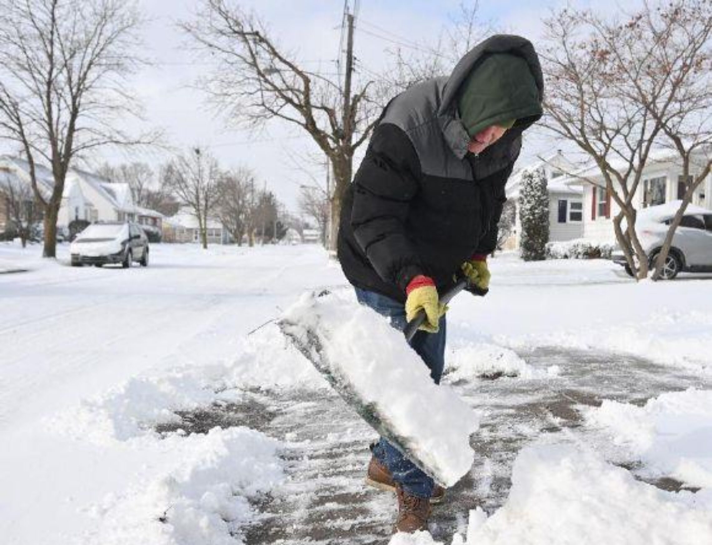
A small but rather potent low pressure will affect our area from late tonight into early Christmas morning with snow that will mix with sleet and some rain, accumulations around an inch is expected in the Clifton area however inland where there will be mostly snow accumulations will be around 2-5 inches.

The storm will pull away with clearing on Christmas Day but it will become very windy, wind gusts of 45 -50 mph are possible.

Bitterly cold weather is expected Tuesday through next weekend, high temperatures will average in the 20s while lows will be mostly in the low teens.

Still watching for a  potential coastal storm late Friday into Saturday that would give us snow.


THE FORECAST:

TODAY – DEC 24 – Partly sunny this morning then increasing cloudiness this afternoon, high in the low 40s.

TONIGHT – Cloudy with a chance of snow or rain before 11 p.m. then rain, snow and sleet ending around 6 a.m.  low in the low 30s,  accumulations of around an inch in Clifton, 2-5 inches inland.

CHRISTMAS DAY – DEC 25 – Becoming mostly sunny and very windy, high near 40, wind gusts to 45 mph possible.

TUESDAY – DEC 26 – Mostly sunny, high in the low 30s.

WEDNESDAY – DEC 27 – Mostly sunny, high in the upper 20s.

THURSDAY – DEC 28 – Mostly sunny, high in the mid 20s.

FRIDAY – DEC 29 – Mostly cloudy with a chance of snow, high in the mid 20s.

SATURDAY – DEC 30 – Mostly cloudy with a chance of snow, high in the upper 20s.


MARINE FORECAST: TODAY – Northeast wind to 15 knots, seas 3 feet.

OUTLOOK – A gale warning is posted effective from 7 a.m. Monday morning until 10 p.m. Monday night.  Small craft conditions lingering into Tuesday morning; no advisories expected Tuesday afternoon through Thursday.


Have a nice and safe Christmas Eve!

Mild with rain today! Dry most of Sunday! Some snow late Christmas Eve into early Christmas Day!


SATURDAY  DECEMBER 23, 2017  5:58 A.M.

Our area has cloudy skies and there is light rain falling in most spots, temperatures are cool ranging from the upper 30s in Clifton down to the lower 30s further inland, winds are light.

A warm front just to our south associated with low pressure over Tennessee will give us rain most of today ending this evening, once the warm front moves through the area temperatures should rise into the 50s.   A cold front will pass our area late at night.

Sunday will be dry during the day with seasonable temperatures however a disturbance moving off the coast will give us some snow late Sunday night into early Christmas Day, snow accumulations look to be 1-3 inches, less along the coast where the snow may mix with sleet and rain. The precipitation should end before daybreak on Christmas with clearing and it will be breezy and seasonably cold

Colder weather most of next week it should be dry until Friday or the weekend when a developing storm may give us snow.


THE FORECAST:

TODAY – DEC 23 – Cloudy with periods of rain, high in the low 50s.

TONIGHT – Mostly cloudy with a chance of rain in the evening then becoming partly cloudy, low in the low 30s.

SUNDAY – DEC 24 – Mostly sunny, high in the low 40s.  Snow likely at night.

CHRISTMAS DAY  – DEC 25 – Mostly cloudy in the morning then becoming mostly sunny and breezy, high in the upper 30s.

TUESDAY – DEC 26 – Partly sunny, high in the mid 30s.

WEDNESDAY – DEC 27 – Mostly sunny and quite cold, high in the upper 20s.

THURSDAY – DEC 28 – Partly sunny and quite cold, high in the upper 20s.

FRIDAY – DEC 29 – Mostly cloudy with a chance of snow, quite cold, high in the mid 20s.


MARINE FORECAST:  A small craft advisory is in effect from 10 a.m. this morning valid until 6 a.m. Sunday morning for southwest wind gusting to 30 knots, seas building to 6-9 feet.

OUTLOOK – No advisories expected during the day on Sunday, possible small craft conditions late Sunday night; gales possible during the day on Christmas; small craft conditions Christmas night into Tuesday morning; no advisories expected Tuesday afternoon through Wednesday.


Despite the rain try to have  a nice day!

Milder with light rain developing by this afternoon! Periods of rain and mild on Saturday! Light snow likely late Christmas Eve into Christmas morning!


FRIDAY  DECEMBER 22, 2017  5:55 A.M.

Skies have become cloudy early on this Friday morning and temperatures range from the low 30s here in Clifton down to the low 20s further inland, winds are light.

A warm front will slowly approach our area today with some light rain developing by this afternoon with periods of rain continuing tonight into Saturday, some of the precipitation well inland especially over Connecticut will be in the form of some freezing rain tonight.  Temperatures will rise to the low 50s by Saturday evening.

A cold front will cross the area Saturday night and it will be cooler and dry during the day on Sunday.

A low pressure area is expected to form off our coast and then move northeast, light snow from this system is likely from late Christmas Eve night into early Christmas morning, possible accumulation of 1-2 inches.   Sunshine will return in the afternoon on Christmas Day but it will be windy and colder.

Mainly fair with quite cold temperatures much of next week with a possible storm by next weekend, if this storm develops it will be cold enough for snow.


THE FORECAST:

TODAY – DEC 22 – Cloudy with a chance of light rain this afternoon, high in the upper 40s.

TONIGHT – Cloudy with rain likely, low in the upper 30s.

SATURDAY – DEC 23 – Periods of rain, high in the low 50s.

SUNDAY – DEC 24 – Partly sunny, high in the mid 40s, light snow likely at night.

CHRISTMAS DAY – DEC 25 – Mostly cloudy in the morning with a chance of light snow becoming mostly sunny and windy in the afternoon,  high in the upper 30s.

TUESDAY – DEC 26 – Mostly sunny, high in the mid 30s.

WEDNESDAY – DEC 27 – Mostly sunny, high in the low 30s.

THURSDAY – DEC 28 – Partly sunny, high in the upper 20s.


MARINE FORECAST:  TODAY – Southerly winds to 12 knots seas 1 foot.

OUTLOOK – A small craft advisory is posted effective from 10 a.m. Saturday morning until 6 a.m Sunday morning; no advisories expected during the day on Sunday;  small craft advisories likely Sunday night;  gales likely on Christmas; no advisories expected on Tuesday.


Have an enjoyable Friday!


Mostly sunny and seasonably cold as winter arrives at 11:28 A.M. Rain likely late Friday night into Saturday!


THURSDAY  DECEMBER 21, 2017  5:51 A.M.

Skies are partly cloudy early on this Thursday morning and temperatures range from the upper 20s in the Clifton area down to the low 20s further inland, winds are light.

High pressure building into our area will give us a mostly sunny day today with seasonably cold temperatures, winds will be lighter than yesterday.

A warm front approaching the area on Friday will cause increasing cloudiness with rain likely by evening, possibly starting off as a wintery mix inland.  Rain will continue on Saturday, rainfall amounts around an inch.  A cold front will cross the area at night possibly changing the rain to snow before ending well inland.

Most of Sunday looks to be dry and seasonably cold.  An area of low pressure then is expected to develop off the coast which will possibly give our area a wintery mix of snow, sleet and freezing rain late on Christmas Eve ending early on Christmas morning, at this time amounts should be light.

Much colder Tuesday through the end of next week but mainly dry.


THE FORECAST:

TODAY – DEC 21 – Mostly sunny, high near 40.

TONIGHT – Mostly cloudy, low in the upper 20s.

FRIDAY – DEC 22 – Mostly cloudy, high in the mid 40s, rain likely mainly after midnight.

SATURDAY – DEC 23 – Rain, high in the low 50s.

SUNDAY – DEC 24 – Mostly sunny, high in the mid 40s.   Snow, sleet and freezing rain likely late at night.

CHRISTMAS DAY – DEC 25 – Chance of snow showers before 9 a.m. then becoming partly sunny, high in the upper 30s.

TUESDAY – DEC 26 – Sunny, high in the low 30s.

WEDNESDAY – DEC 27 – Partly sunny, high in the low 30s.


MARINE FORECAST:  TODAY – North winds to 9 knots, seas 1 foot.

OUTLOOK – No advisories expected on Friday; small craft advisories likely on Saturday; no advisories expected on Sunday;  small craft conditions with possible gales Sunday night into Christmas Day.


Happy Winter!

Dry and colder today and on Thursday! Milder on Friday with rain likely at night! Quite mild on Saturday with periods of rain!


WEDNESDAY  DECEMBER 20, 2017  5:54 A.M.

Our area has mostly clear skies early on this Wednesday morning, temperatures are still mild ranging from the mid 40s in the Clifton area down to the mid 30s further inland,  winds are a bit gusty out of the west.

A cold front came through overnight and today will be cooler than yesterday, winds will be brisk.  A second cold front will cross the area late this afternoon bringing colder air tonight into Thursday, no precipitation is expected.

On Friday a warm front is expected to approach the area, there will be a slight chance of rain, inland a mix of freezing rain, sleet and snow is possible changing to all rain Friday night.

Saturday will be a mild day with periods of rain likely.

A cold front will cross the area Saturday night bringing in colder air for Sunday and Christmas, a disturbance offshore may give us some light snow early on Christmas morning with snow showers during the day.

Quite cold air will be with us most of next week.


THE FORECAST:

TODAY – DEC 20 – Partly sunny and breezy, high in the mid 40s.

TONIGHT – Mostly clear and colder, low in the low 20s.

THURSDAY – DEC 21 – Mostly sunny, high in the upper 30s.

FRIDAY – DEC 22 – Mostly cloudy with a slight chance of mixed precipitation by the afternoon, high in the mid 40s,  rain likely at night.

SATURDAY – DEC 23 – Cloudy and mild with rain likely, high in the upper 40s.

SUNDAY – DEC 24 – Mostly sunny, high in the mid 40s, rain likely at night mixing with snow late at night.

CHRISTMAS DAY – DEC 25 – Partly sunny with a chance of snow showers, high in the upper 30s.

TUESDAY – DEC 26 – Partly sunny and cold, high only around 30.


MARINE FORECAST:  A small craft advisory is in effect until 1 p.m. this afternoon for northwest winds gusting to 30 knots, seas 2-4 feet.

OUTLOOK – No advisories expected Thursday through the day on Friday;  possible small craft conditions Friday night through Sunday.


Have an enjoyable day!