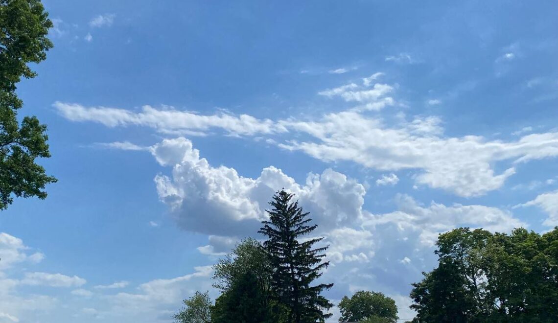
Milder today after some early morning light freezing rain! Rain tonight then becoming even milder on Thursday!


WEDNESDAY  FEBRUARY 14, 2018  5:54 A.M.

Good Wednesday morning everyone!    Skies are cloudy early on this Wednesday morning and there was some light rain that moved through the area, some spots the rain froze on untreated roads and sidewalks so be careful heading out this morning.  Temperatures range from the low 30s in the Clifton area down to the upper 20s further inland, winds are mostly calm.

We should see some sunshine by this afternoon after early morning clouds and temperatures will rise to above normal values.

A weak disturbance will give us some light rain from late tonight into Thursday morning.  After the rain we should see some sunshine and temperatures rise to the 60s in most areas.

More showers are possible from late tomorrow night as a cold front crosses the area., temperatures will continue to be mild during the day on Friday but become much colder at night as a cold front moves through the area.

Chilly and dry on Saturday, but another low pressure disturbance may give us some snow Sunday morning followed by clearing and milder during the afternoon.

Quite mild next week but more rain is possible especially on Tuesday.


THE FORECAST:

TODAY – FEB 14  – Cloudy with a chance of light freezing rain early this morning then becoming mostly sunny and mild, high near 50.

TONIGHT – Rain likely mainly after 9 p.m., low around 40.

THURSDAY – FEB 15 – Mostly cloudy and quite mild, high in the low 60s. Rain likely at night.

FRIDAY – FEB 16 – Cloudy with rain likely in the morning, morning highs in the 50s dropping to the 40s in the afternoon.

SATURDAY – FEB 17 – Mostly sunny, high in the upper 30s.   Chance of snow late at night.

SUNDAY – FEB 18 – Becoming mostly sunny, high in the mid 40s.

PRESIDENTS DAY – FEB 19 – Partly sunny in the morning then becoming mostly cloudy, high in the upper 40s, chance of rain at night.

TUESDAY – FEB 20 – Mostly cloudy with a chance of rain, high in the mid 50s.


MARINE FORECAST:  TODAY – Southwest wind to 10 knots, seas 2 feet.

OUTLOOK – No advisories expected during the day on Thursday;  possible small craft conditions for high seas Thursday night; small craft conditions likely on Friday;  no advisories expected Saturday and Sunday.


Happy Valentine’s Day!


Mostly sunny but chilly today! Milder Wednesday and Thursday with showers likely late Wednesday night into Thursday!


TUESDAY  FEBRUARY 13, 2018  5:42 A.M.

Good Tuesday morning everyone!   The area has mostly clear skies and temperatures are much cooler than this time yesterday ranging from the mid 20s in the Clifton area to the middle teens further inland, there is a light northerly wind.

Strong high pressure over the area will give us a mostly sunny day with temperatures slightly below normal. There is a slight chance of freezing drizzle after midnight tonight inland.

Milder on Wednesday and we should remain dry until late at night when a weak trough in the area may touch off some showers into Thursday morning.

Very mild on Thursday but more showers are likely late at night as a cold front crosses the area.

Friday will be cooler with a chance of showers.

The weekend looks to be dry with chilly conditions on Saturday but become milder on Sunday.

Unsettled weather early next week but it again will be quite mild.


THE FORECAST:

TODAY – FEB 13 – Sunny, high in the upper 30s.

TONIGHT – Mostly cloudy, low around 30.

WEDNESDAY – FEB 14 – Partly sunny, high near 50, chance of rain after 9 p.m.

THURSDAY – FEB 15 – Mostly cloudy with a chance of showers before noon, high in the low 60s, showers again likely after midnight.

FRIDAY – FEB 16 – Cloudy with a chance of rain, high in the mid 50s.

SATURDAY – FEB 17 – Mostly sunny, high in the upper 30s.

SUNDAY – FEB 18 – Sunny, high in the mid 40s, chance of rain at night.

PRESIDENT’S DAY – FEB 19 – Mostly cloudy with a chance of rain, high in the low 50s.


MARINE FORECAST:  TODAY – North-northeast wind to 13 knots, diminishing this afternoon, seas 2-3 feet.

OUTLOOK – No advisories expected Wednesday through the day on Thursday; possible small craft conditions Thursday night through Friday night; no advisories expected on Saturday.


Have a nice day!

Becoming mostly sunny today with cooler temperatures! Dry and seasonably cold on Tuesday! Milder Wednesday and Thursday with possible showers on Thursday!


MONDAY  FEBRUARY 12, 2018  5:41 A.M.

Good Monday morning!   Skies are mostly cloudy to cloudy early this morning and temperatures have fallen to the mid 40s in the Clifton area down to the mid 30s further inland, winds are gusty out of the west.   The temperature in Clifton at 1 a.m. was a balmy 60 degrees.

A cold front has crossed the area this morning and a brisk westerly flow of colder air is moving in.  Today will start off cloudy but become mostly sunny by this afternoon, high temperatures will not rise much today staying mostly in the 40s.

Colder overnight tonight as temperatures fall to near 20.  Tomorrow will be seasonably cold but dry with highs mostly in the 30s.

The cold air won’t last long as milder temperatures can be expected Wednesday and Thursday, Wednesday should be dry but showers are likely especially on Thursday morning.

Colder air will move in again later on  Friday into Saturday but we should remain dry.

Not as cold on Sunday with continued dry conditions.

Next week looks to be mainly unseasonably warm..


THE FORECAST:

TODAY – FEB 12 – Cloudy this morning then becoming sunny, high in the mid 40s.

TONIGHT – Clear and cold, low around 20.

TUESDAY – FEB  13 – Mostly sunny, high in the upper 30s.

WEDNESDAY – FEB 14 – Mostly sunny, high near 50.

THURSDAY – FEB 15 – Mostly cloudy and quite mild with showers likely, high near 60.

FRIDAY – FEB 16 – Mostly cloudy, high in the low 50s.

SATURDAY – FEB 17 – Mostly sunny and colder, high in the upper 30s.

SUNDAY – FEB 18 – Mostly sunny, high in the upper 40s.


MARINE FORECAST:  A small craft advisory is in effect until 6 a.m. Tuesday morning for northwest winds gusting to 25 knots, seas 3-6 feet.

OUTLOOK – No advisories are expected Tuesday into the day on Wednesday;  small craft conditions possible Wednesday night through Friday.


Have a nice day!


Mild with rain today into this evening! Clearing and seasonably mild on Monday!


SUNDAY  FEBRUARY 11, 2018  5:38 A.M.

Good morning on this soggy Sunday!   Rain continues to fall across the area early this morning and temperatures range from the low 40s in the Clifton area down to the mid 30s in some of the colder areas inland, winds are mainly light southerly.

Today we will continue to have rain which will fall moderately to occasionally heavy at times into this evening, an inch of additional rainfall is likely with some higher amounts possible.  A slow moving front will be across the area today and slowly move off the coast tonight, rain should end this evening.

Tomorrow we will see clearing with temperatures slightly above normal.

Mostly fair and seasonably cold on Tuesday as high pressure moves to our area.

A weak warm front may give us some light rain or snow early Wednesday morning followed by clearing and mild later Wednesday into Thursday.  A cold front may give us some showers on Thursday.

Near seasonably temperatures Friday into next weekend along with mainly dry conditions.


THE FORECAST:

TODAY – FEB 11 – Periods of rain, heavy at times this morning, highs near 50.

TONIGHT – Showers mainly this evening, low in the upper 30s

MONDAY – FEB 12 – Mostly cloudy in the morning then becoming mostly sunny, high in the mid 40s.

TUESDAY – FEB 13 – Sunny, high in the upper 30s, chance of light snow or rain after midnight.

WEDNESDAY – FEB 14 – Mostly sunny, high in the low 50s.

THURSDAY – FEB 15 – Mostly cloudy with a chance of showers, high in the upper 50s.

FRIDAY – FEB 16 – Partly sunny and cooler, high in the low 40s.

SATURDAY – FEB 17 – Partly sunny, high near 40.


MARINE FORECAST:  A small craft advisory is in effect until 5 p.m. Monday afternoon.  Today – southwest wind to 30 knots seas 5-8 feet.

OUTLOOK – No advisories expected Monday night through Wednesday; possible small craft conditions for high seas on Thursday.


Despite the dreary weather try to have a good day!


Cloudy and mild with a chance of light rain this afternoon! Heavy rain and mild weather likely tonight into Sunday!


SATURDAY  FEBRUARY 10, 2018  5:34 A.M.

Good Saturday morning!     Skies are cloudy early this morning and temperatures are milder than the last few mornings ranging from the mid 30s here in Clifton to the upper 20s further inland, winds are mainly calm.

A slow moving frontal system will approach the area today with a southerly flow of mild and moist air moving into our area, there is a chance of light rain this afternoon but most of the heavy rain will not occur until tonight.

Rain heavy at times and continued mild on Sunday as the front moves slowly into our area, the rain should taper off by Sunday night.  Total rainfall of 1-2 inches possible.

Dry weather is expected Monday and Tuesday, temperatures will be slightly above normal on Monday and near normal on Tuesday.

There is a low chance of some mixed precipitation Wednesday morning but then it will become mild and dry Wednesday afternoon through Thursday.

Cooler on Friday through the beginning of next weekend.


THE FORECAST:

TODAY – FEB 10 – Cloudy with a chance of light rain this afternoon, high near 50.

TONIGHT – Rain heavy at times, low in the low 40s.

SUNDAY – FEB 11 – Rain heavy at times, high in the low 50s.  Rainfall amounts of 1-2 inches possible.

MONDAY – FEB 12 – Partly sunny, high in the mid 40s.

TUESDAY – FEB 13 – Mostly sunny, high near 40.

WEDNESDAY – FEB 14 – Chance of rain or snow early in the morning then becoming mostly sunny and mild, high in the low 50s.

THURSDAY – FEB 15 – Partly sunny, high in the mid 50s.

FRIDAY – FEB 16 – Partly sunny and cooler, high in the low 40s.


MARINE FORECAST:  TODAY – Southerly winds to 11 knots, seas 2-3 feet.

OUTLOOK – A small craft advisory is posted effective from 4 a.m. Sunday morning valid until 6 a.m. Monday morning; no advisories expected from later Monday morning through Wednesday.


Have a great weekend!