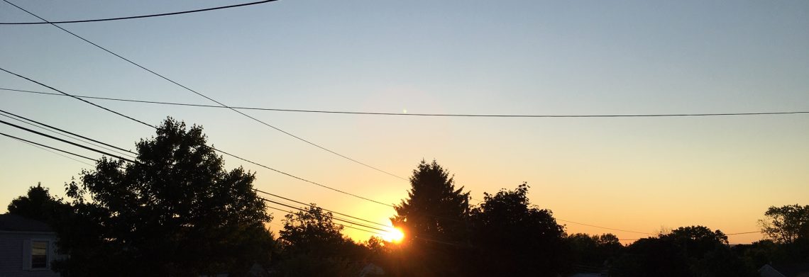
Very warm today and Wednesday!


We are starting out with clear skies again this morning, temperatures are a few degrees higher than the last few mornings with readings in the mid 60s.

Today we will enjoy plenty of sunshine and temperatures will again reach the upper 80s.

Temperatures will be even warmer on Wednesday with readings rising to the low 90s, humidity will be moderate.

A cold front will cross the area Wednesday night with a chance of thunderstorms.

Pleasantly cool and dry weather Thursday and Friday with low humidity.

Very warm weather will return for the Labor Day weekend with a chance of thunderstorms on Sunday and Monday.


THE FORECAST:

TODAY – Sunny, high in the upper 80s.

TONIGHT – Mostly clear, low in the mid 60s.

WEDNESDAY – Partly sunny, high in the low 90s, chance of showers and thunderstorms in the evening.

THURSDAY – Mostly sunny, cooler and less humid, high in the low 80s.

FRIDAY – Sunny, high around 80.

SATURDAY – Partly sunny, high in the low 80s.

SUNDAY – Partly sunny with a chance of showers and thunderstorms, high near 90.

LABOR DAY – Partly sunny with a chance of showers and thunderstorms, high in the mid 80s.


MARINE FORECAST:  TODAY – Southeast wind to 7 knots, seas 2 feet.

OUTLOOK – Advisories may be needed for high seas Wednesday and Thursday as Hurricane Cristobal move 500 miles east of the coast, sub-advisory level conditions expected Thursday night through Saturday.


Have a good day!

Warmer and dry weather through Wednesday!


We have clear skies this morning, temperatures range from 60 degrees in the Clifton area to the 50s in most inland suburbs, winds are light.

Today we will have plenty of sunshine and temperatures will rise to about five degrees warmer than on Sunday, humidity will still be on the low side with dew points in the 50s.

Even warmer weather tomorrow and Wednesday along with mostly sunny skies both days, temperatures may even climb above 90 on Wednesday, humidity however will not be oppressive.

A cold front will cross the area Wednesday evening accompanied by some showers.

Mostly fair and cooler Thursday and Friday.

At this point the weekend will be on the warm side but there will be chances of showers from late Saturday into Labor Day as another cold front moves into our area.


THE FORECAST:

TODAY – Sunny, high in the mid 80s.

TONIGHT – Mostly clear, low in the low 60s.

TUESDAY – Sunny, high in the upper 80s.

WEDNESDAY – Mostly sunny, high in the low 90s, chance of showers at night.

THURSDAY – Sunny, high in the mid 80s.

FRIDAY – Mostly sunny, high near 80.

SATURDAY – Partly sunny, high in the low 80s, chance of showers at night.

SUNDAY –  Partly sunny with a chance of showers and thunderstorms, high in the mid 80s.


MARINE FORECAST:  TODAY – North-northeast wind to 10 knots, seas 3-4 feet.

OUTLOOK – Sub advisory level conditions on Tuesday, advisories may be needed Wednesday through Friday for high swells as Tropical Storm Cristobal moves well off the coast.


Have a good day!


More sunshine today! Warm and mainly dry most of this week!


Skies are mostly clear this morning and temperatures have fallen to near the 60 degree mark here in Clifton and it is in the 50s in most inland area.

Today high pressure will build down from Eastern Canada providing us with more sunshine than the last couple of days along with slightly warmer temperatures.

Look forward to a warm week with temperatures possibly hitting the 90 degree mark Wednesday and Thursday, humidity will not be oppressive with dew points ranging form the upper 50s to the low 60s.  The next chance of showers will not be until late Friday into Saturday.


THE FORECAST:

TODAY – Sunny, high near 80.

TONIGHT – Mostly clear, low around 60.

MONDAY – Sunny, high in the mid 80s.

TUESDAY – Sunny, high in the mid 80s.

WEDNESDAY – Sunny, high in the upper 80s.

THURSDAY – Mostly sunny, high in the upper 80s.

FRIDAY – Mostly sunny, high in the low 80s, chance of showers at night.

SATURDAY – Mostly cloudy with a chance of showers and thunderstorms, high in the low 80s.


MARINE FORECAST:  TODAY – North-northeast wind to 12 knots, seas 4 feet.

OUTLOOK – Sub-advisory level conditions Monday through Wednesday with swells possible increasing on Thursday due to the tropical system well offshore.


Have a good day!

Mostly cloudy Saturday! Warm and dry most of next week!


At daybreak this morning we have mostly cloudy conditions with temperatures across the area are mainly in the low 60s, winds are light northeasterly and the humidity is on the high side.

We should have a dry but mostly cloudy day today, an area of rain over Eastern Pennsylvania this morning will dissipate and not affect our weather. Temperatures today will be similar to yesterday rising only to the upper 70s.

It will clear overnight and Sunday will be the best day of the weekend weather wise with warmer temperatures along with plenty of sunshine.

Dry and warmer conditions next week with the next chance of rain will be around Friday as a cold front moves through the area.


THE FORECAST:

TODAY – Cloudy, high in the upper 70s.

TONIGHT – Mostly cloudy then becoming mostly clear, low in the low 60s.

SUNDAY – Mostly sunny, high in the low 80s.

MONDAY – Sunny, high in the mid 80s.

TUESDAY – Sunny, high in the mid 80s.

WEDNESDAY – Sunny, high in the upper 80s.

THURSDAY – Mostly sunny, high in the mid 80s.

FRIDAY – Partly sunny, high in the mid 80s.


MARINE FORECAST:  Small craft advisory in effect until 8am Sunday morning for northeast wind gusting to 25 knots, seas 3-5 feet.

OUTLOOK – Sub-advisory level conditions expected later on Sunday through the middle of next week.


Have a good day!

More showers possible today! Weekend should remain dry!


Skies are cloudy in the Clifton area with temperatures in the mid 60s, winds are light and humidity is on the high side.

Showers have moved offshore this morning,  overnight we received .30 inches of rain but a couple of inches fell in parts of Sussex County.

Today will be mostly cloudy with a chance of mainly afternoon and evening showers, with the clouds and a light onshore wind temperatures will be cooler with highs in the 70s.

Saturday will remain mostly cloudy, there is only a slight chance of a morning shower but most areas will remain dry, temperatures will still be below normal.

More sunshine with slightly warmer temperatures on Sunday.

The weather most of next week will be dry along with warmer temperatures.


THE FORECAST:

TODAY – Mostly cloudy with a chance of showers and thunderstorms, high in the mid 70s.

TONIGHT – Mostly cloudy with a chance of showers and thunderstorms before midnight, low in the low 60s.

SATURDAY – Mostly cloudy, high in the upper 70s.

SUNDAY – Mostly sunny, high near 80.

MONDAY – Sunny, high in the low 80s.

TUESDAY – Sunny, high in the low 80s.

WEDNESDAY – Mostly sunny, high in the mid 80s.

THURSDAY – Mostly sunny, high in the upper 80s.


MARINE FORECAST:  TODAY – East-northeast wind to 12 knots, seas 2-3 feet.

OUTLOOK – Advisories possible on Saturday with below advisory level conditions Sunday through Tuesday.


Have a good day!