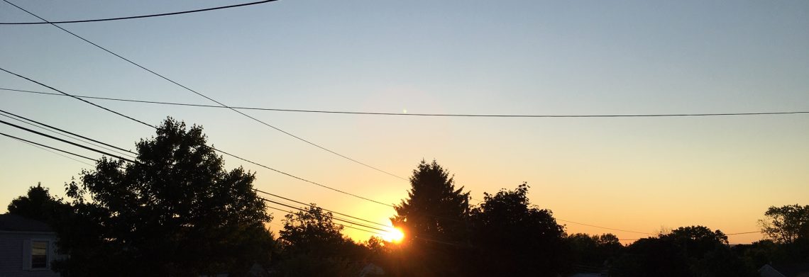
Another hot and humid September day!


A very warm start to the day with temperatures in the low 70s, it is also quite muggy, winds are light or calm and skies are clear.

Today we will have plenty of sunshine that will help boast temperatures to the low and some mid 90s, it will remain quite humid with dew points around 70.

A cold front will be coming through tonight that may cause some thunderstorms activity this evening, some of these storms may be accompanied by heavy downpours.

Much less humid with plenty of sunshine on Wednesday but temperatures will be quite warm.

Dry weather with very warm temperatures with a slow increase in humidity Thursday and Friday.

Continued quite warm on Saturday but a cold front may cause some thunderstorms.

Much cooler and drier Sunday and Monday.

Latest indications that next week it will warm again after a brief cool down early in the week.


THE FORECAST:

TODAY – Mostly sunny and humid, high in the low 90s.

TONIGHT – Mostly cloudy with a chance of showers and thunderstorms, some storms may be accompanied by heavy rain, low in the upper 60s.

WEDNESDAY – Sunny and less humid, high in the upper 80s.

THURSDAY – Sunny, high in the upper 80s.

FRIDAY – Sunny, more humid, high near 90.

SATURDAY – Partly sunny and humid with a chance of showers and thunderstorms, high near 90.

SUNDAY – Mostly sunny, cooler and less humid, high in the upper 70s.

MONDAY – Mostly sunny, high in the upper 70s.


MARINE FORECAST:  TODAY – South-southwest winds to 11 knots, seas 2 feet.

OUTLOOK – Below advisory level conditions to continue through Saturday!


Have a good day!


Very warm and humid weather for the beginning of September!


We have cloudy skies at daybreak this morning and temperatures are mostly in the low 70s, humidity is high with a dew point of 70 degrees, winds are light.

Today will be a mostly cloudy, very warm and humid with high temperatures approaching the 90 degree mark, showers and thunderstorms should develop over the area this afternoon and continue tonight, some of these storms may be accompanied by very heavy rain, these storms will be scattered so some areas may remain dry all day while others may have flooding rains.

Tuesday we will have more sunshine raising temperatures into the 90s along with continued high humidity.  A cold front approaching will give us the chance of showers and thunderstorms late in the day and evening.

Much less humid Wednesday through Friday with plenty of sunshine but temperatures will continue to be well above normal for the beginning of September.

Another cold front will cross the area on Saturday with continued warm temperatures along with a chance of showers and thunderstorms.

The front will be followed by cooler and drier air on Sunday.


THE FORECAST:

TODAY – Mostly cloudy with a chance of afternoon showers and thunderstorms, some storms may be accompanied by heavy rain, humid, high in the upper 80s.

TONIGHT – Mostly cloudy and humid with a chance of showers and thunderstorms till around 10pm, some storms may be accompanied by heavy rain, low around 70.

TUESDAY – Mostly sunny with a chance of late afternoon and evening showers and thunderstorms, humid, high in the low 90s.

WEDNESDAY – Sunny and much less humid, high in the upper 80s.

THURSDAY – Sunny, high in the upper 80s.

FRIDAY – Sunny, high near 90.

SATURDAY – Partly sunny with a chance of showers and thunderstorms, high in the upper 80s.

SUNDAY – Partly sunny, cooler and less humid, high in the upper 70s.


MARINE FORECAST:  TODAY – Southwest wind to 10 knots, seas 2-3 feet.

OUTLOOK – Below advisory level conditions expected through Saturday.


Have a very happy Labor Day!

Pleasant weather to start the holiday weekend! Warmer, more humid with a chance of showers Sunday and Monday!


We have clear skies at daybreak this Friday morning and temperatures have dropped into the upper 50s in the Clifton area to some 40s further inland, winds are light and the humidity is low.

High pressure will be in control of our weather through Saturday providing the area with mostly fair skies, low humidity and pleasant temperatures.

A warm front will cross the area Saturday night bringing in warmer and much more humid air Saturday night through Labor Day, also there is a chance of shower and thunderstorms mainly Sunday afternoon and on Labor Day.

Still very warm and humid on Tuesday with a chance of showers as a cold front moves through.

Humidity will lower Wednesday and Thursday but it still remain quite warm with mostly sunny conditions.


THE FORECAST:

TODAY – Sunny, high in the upper 70s.

TONIGHT – Mostly clear, low around 60.

SATURDAY – Mostly sunny, high near 80.

SUNDAY – Mostly cloudy, warmer and more humid with a chance of afternoon and evening showers and thunderstorms, high in the upper 80s.

LABOR DAY – Partly sunny with a chance of showers and thunderstorms, humid, high in the upper 80s.

TUESDAY – Partly sunny and humid with a chance of showers and thunderstorms, high near 90.

WEDNESDAY – Mostly sunny and less humid, high in the upper 80s.

THURSDAY – Sunny, high in the upper 80s.


MARINE FORECAST:  TODAY – North wind to 9 knots, seas 2-3 feet.

OUTLOOK – Possible small craft conditions late Sunday into Labor Day otherwise below advisory level winds and seas through Tuesday!


Next weather blog will be on Monday September 1st.

Enjoy your holiday weekend!


Comfortably warm with low humidity today through Saturday! Warmer and more humid with a chance of showers Sunday and on Labor Day!


We have clear skies at 6am this morning, temperatures have fallen to the mid 60s in the Clifton area, humidity is lower as dew points dropped into the 50s.

A cold front came through overnight and cooler and much less humid air is following the front, with plenty of sunshine temperatures will rise to the low 80s.   Tonight under clear skies temperatures will fall into the comfortable 50s.

Plenty of sunshine Friday and Saturday with continued comfortable temperatures and humidity.

Warmer and more humid air will move back to our area on Sunday and continue through Labor Day, temperatures will rise to near 90 both days and with dew points approaching 70 degrees it will feel rather uncomfortable.

Warm weather will continue much of next week with a chance of showers on Tuesday.


THE FORECAST:

TODAY – Sunny, high in the low 80s.

TONIGHT – Mostly clear, low in the upper 50s.

FRIDAY – Sunny, high near 80.

SATURDAY – Mostly sunny, high in the low 80s.

SUNDAY – Partly sunny, more humid with a chance of showers and thunderstorms after 3pm, high near 90.

LABOR DAY – Partly sunny and humid with a chance of showers and thunderstomrs, high in the upper 80s.

TUESDAY – Mostly sunny with a chance of showers and thunderstorms, high in the upper 80s.

WEDNESDAY – Mostly sunny and less humid, high in the upper 80s.


MARINE FORECAST: Small craft advisory for high seas in effect till 10pm this evening.  Northwest winds to 15 knots, seas 4-7 feet.

OUTLOOK – Sub-advisory level conditions expected Friday through early next week.

Strong rip currents expected today as Hurricane Cristobal moves well offshore.


Have a good day!


A hot hump day! Cooler and less humid tomorrow and Friday! Warmer for the holiday weekend!


Skies are mostly clear at daybreak this morning and temperatures are in the mid 60s, winds are light.

Today will be another hot day with highs reaching the low 90s, humidity will be moderate.

A cold front will cross the area this evening with a low chance of some shower and thunderstorm activity.

Cooler and less humid with plenty of sunshine Thursday and Friday.

Saturday may be the best day of the upcoming Labor Day weekend with plenty of sunshine and pleasantly warm temperatures.

Warmer and more humid air will move into the region on Sunday and Labor Day along with a chance of showers and thunderstorms both days with the best chance of rain Sunday evening through Monday morning.

Warm weather will extend through most of next week.


THE FORECAST:

TODAY – Mostly sunny, high in the low 90s.

TONIGHT – Mostly cloudy with a chance of evening showers and thunderstorms, low in the mid 60s.

THURSDAY – Sunny and less humid, high in the low 80s.

FRIDAY – Sunny, high near 80.

SATURDAY – Mostly sunny, high in the low 80s.

SUNDAY – Partly sunny with a chance of afternoon and evening showers and thunderstorms, high near 90.

LABOR DAY – Mostly cloudy with a chance of showers and thunderstorms, high in the upper 80s.

TUESDAY – Mostly sunny, high in the upper 80s.


MARINE FORECAST:  Small craft advisory will be in effect from 2pm today till 6pm on Thursday for high seas ranging from 4-7 feet, winds light and variable.

OUTLOOK – Sub-advisory level conditions Thursday night through the weekend.


Have a good day!