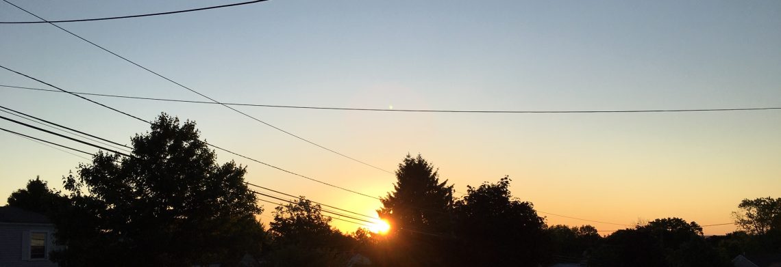
Some showers early this morning then some sunshine! Heavy storms possible this evening!


We have cloudy skies at daybreak this morning,  some light showers are passing through the area, temperatures are near 70 degrees with high humidity, winds are light.

Today we should have a break in the rain and we will have some sunshine it will be quite warm and humid.

A cold front approaching from the west will cause showers and thunderstorms to develop mainly late this evening, some of these storms may be quite strong to severe with strong gusty winds, heavy rain and small hail.

Showers and thunderstorms should continue into Monday until the cold front crosses the area.

Very pleasant weather Tuesday through the end of the workweek as a Canadian air mass will be in our area.  We will have plenty of sunshine and low humidity along with seasonably cool temperatures.


THE FORECAST:

TODAY – Some scattered showers early this morning then partial sunshine, humid, high in the upper 80s.

TONIGHT – Showers and thunderstorms likely mainly after 9pm, some storms may be accompanied by heavy rain, strong gusty winds and small hail, humid, low in the low 70s.

MONDAY – Mostly cloudy with a chance of showers and thunderstorms, high in the mid 80s.

TUESDAY – Mostly sunny and less humid, high near 80.

WEDNESDAY – Mostly sunny, high near 80.

THURSDAY – Mostly sunny, high in the low 80s.

FRIDAY – Mostly sunny, high in the low 80s.

SATURDAY – Mostly cloudy, high in the low 80s.


MARINE FORECAST:  TODAY – Southwest wind to  13 knots, seas 3 feet.

OUTLOOK – Advisories may be needed for Monday then below advisory level conditions expected through the end of the workweek.


Have a good day!


A dry and warm day today! Good chance of thunderstorms late tonight though Monday!


Mostly cloudy skies at daybreak this morning, temperatures are a couple of degrees higher than yesterday morning ranging from the mid 60s in the Clifton area to some upper 50s further inland, winds are light.

Today will be the best day of the weekend with partly sunny skies and warm temperatures, humidity will only slowly rise from yesterday’s levels.

Chances of thunderstorms developing mainly after midnight tonight as a warm front crosses the area.

We may have a break in the storms during the middle part of Sunday but thunderstorms are likely to develop in the afternoon and continuing into Sunday night, some of these storms may be strong with heavy rain, small hail and gusty winds.  It also will become more humid.

Showers and thunderstorms may continue on Monday as a cold front swings through the area.

Another refreshing Canadian air mass will dominate our weather from Tuesday through the end of the week with cooler air along with low humidity and plenty of sunshine.


THE FORECAST:

TODAY – Partly sunny, high in the mid 80s.

TONIGHT – Mostly cloudy with a chance of showers and thunderstorms mainly after midnight, low in the upper 80s.

SUNDAY – Partly sunny and humid with a good chance of showers and thunderstorms, some of these storms may be accompanied by heavy rain, small hail and gusty winds, high in the upper 80s.

MONDAY – Partly sunny with a chance of thunderstorms, high in the mid 80s.

TUESDAY – Mostly sunny and less humid, high in the low 80s.

WEDNESDAY – Mostly sunny, high in the low 80s.

THURSDAY – Sunny, high in the low 80s.

FRIDAY – Mostly sunny, high in the low 80s.


MARINE FORECAST:  TODAY – South-southwest wind to 9 knots, seas 2 feet.

OUTLOOK – Near advisory level seas Sunday and Monday with below advisory level conditions Tuesday and Wednesday.


Have a good day!

Dry and comfortably warm weather today through most of Saturday! Good chance of thunderstorms late Saturday night through Monday!


Under clear skies at daybreak temperatures range from around 60 in the Clifton area with upper 40s reported in some spots of Sussex County.

Today will be a very pleasant summer day with seasonably warm temperatures and low humidity along with mostly sunny skies.

Most of Saturday will be dry, temperatures and humidity levels will be a little higher than today but still comfortable.

A warm front will be pushing through on Sunday morning preceded by some scattered thunderstorms from late Saturday night into Sunday, humidity levels will rise and temperatures will be warm.

A cold front pushing through will produce more scattered thunderstorms on Monday.

Another high pressure will build in Tuesday from the middle of the country and we will have very pleasant weather Tuesday through most of next week with comfortably warm temperatures and low humidity and mostly clear skies.

No signs of any extended periods of heat through the first half of August.


THE FORECAST:

TODAY – Sunny, high in the low 80s.

TONIGHT – Mostly clear, low in the mid 60s.

SATURDAY – Mostly sunny, high in the mid-upper 80s, chance of showers and thunderstorms at night.

SUNDAY – Partly sunny, more humid with a chance of showers and thunderstorms, high in the upper 80s.

MONDAY – Partly sunny with a chance of showers and thunderstorms, high in the mid 80s.

TUESDAY – Mostly sunny, high in the low 80s.

WEDNESDAY – Mostly sunny, high in the low 80s.

THURSDAY – Mostly sunny, high in the low 80s.


MARINE FORECAST:  TODAY – Northeast wind to 11 knots, seas 2-3 feet.

OUTLOOK – Chance of advisories for high seas Saturday night otherwise below advisory level condition through early next week.


Have a good day!

Pleasant summer weather today and Friday!


We have partly cloudy skies at daybreak this morning and temperatures have fallen into the 60s, humidity is also lower as dew points are now in the low 60s.

Yesterday the thunderstorms went around the Clifton area with only a few drops of rain although we had a vivid lightning display.  At Yankee Stadium the game between the Yanks and the Texas Rangers was ended in the 5th inning as a storm dropped an inch of rain in less than 30 minutes making the field unplayable, at least it was an official game and the Yanks came out on top which is a good thing.

High pressure building in from the Great Lakes will give us a much cooler and less humid day today and we should have mostly sunny skies.

The pleasant weather will continue on Friday.

On Saturday we will have somewhat warmer and more humid air move into the area with a chance of thunderstorms at night.

Thunderstorms are likely Sunday and Sunday night with continued warm and humid conditions.

Another cold front will be moving through the area to start off the workweek with a chance of thunderstorms followed by cooler and less humid air once again for next Tuesday and Wednesday.


THE FORECAST:

TODAY – Becoming mostly sunny, less humid, high in the low-mid 80s.

TONIGHT – Partly cloudy, low around 60.

FRIDAY – Sunny, high in the low-mid 80s.

SATURDAY – Mostly sunny, high in the mid-upper 80s, chance of thunderstorms at night.

SUNDAY – Mostly cloudy with showers and thunderstorms likely, high in the mid-upper 80s.

MONDAY – Partly sunny with a chance of thunderstorms, high in the mid 80s.

TUESDAY – Mostly sunny, high in the low 80s.

WEDNESDAY – Mostly sunny, high in the low 80s.


MARINE FORECAST:  TODAY – North wind to 10 knots, seas 2 feet.

OUTLOOK – Below advisory level conditions through Saturday with advisories possible Sunday and Monday.


Have a good day!

Hot and humid hump day with thunderstorms likely by this evening!


Temperatures in the Clifton area at daybreak are around the 70 degree mark, skies are mostly clear and winds are light.

Today will be the hottest day of the week as temperatures  reach the low 90s along with high humidity as the dew point climbs to near 70.

A cold front approaching from the west will likely cause showers and thunderstorms to develop mainly this evening and tonight, some of these storms may be accompanied by heavy rain and strong gusty winds along with dangerous cloud to ground lightning.

Showers and thunderstorms should persist into Thursday morning with clearing late in the day, temperatures will not be as hot and we could expect lower humidity by the afternoon.

Friday and Saturday will be excellent summer days with warm temperatures, low humidity and plenty of sunshine

Chances of showers increase from Saturday night through Tuesday, temperatures will be seasonably warm and humidity will slowly rise.

Another cold front will cross the area on Tuesday with cooler and less humid air returning for later next week.


THE FORECAST:

TODAY – Mostly sunny, hot and humid with a chance of thunderstorms later this afternoon, some storms may be accompanied by heavy rain and gusty winds, high in the low 90s.

TONIGHT – Mostly cloudy and humid with showers and thunderstorms likely, some storms may be accompanied by heavy rain and gusty winds, low in the low 70s.

THURSDAY – Showers and thunderstorms mainly in the morning, mostly cloudy, less humid by evening, high in the low 80s.

FRIDAY – Sunny, high in the mid 80s.

SATURDAY – Partly sunny, high in the mid 80s, chance of showers and thunderstorms at night.

SUNDAY – Partly sunny with a chance of showers and thunderstorms, high in the upper 80s.

MONDAY – Partly sunny with a chance of showers and thunderstorms, high in the mid 80s.

TUESDAY – Partly sunny with a chance of showers and thunderstorms, high in the low 80s.


MARINE FORECAST:  TODAY – South wind to 11 knots, seas 2 feet.

OUTLOOK – Sub-advisory level conditions through Saturday with advisories possible on Sunday.


Have a good day!