Heat and humidity continue today with possible strong thunderstorms; Tropical storm Arthur to move off the coast on Friday!


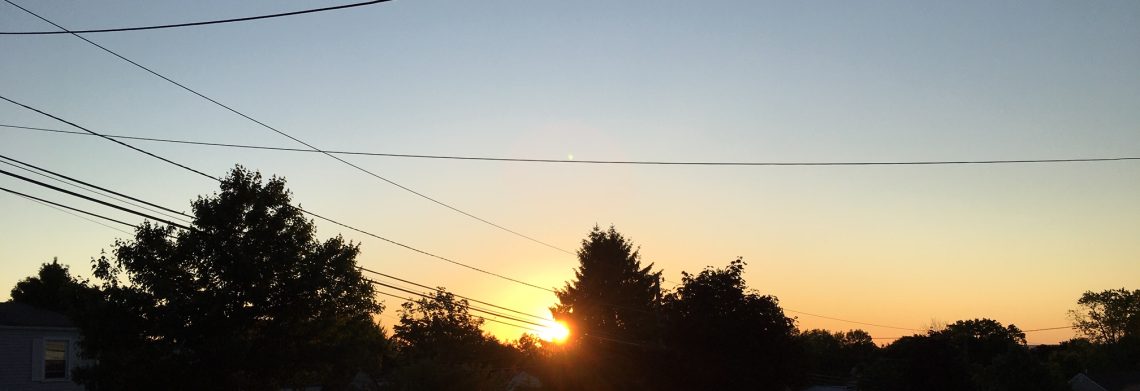
Skies are mostly clear at daybreak this morning and temperatures are in the low 70s with rather high humidity.

Yesterday was the hottest day of the year so far as the high reached 93 degrees.

Another hot and humid day today with temperatures again reaching the low 90s.  There will be a greater chances of thunderstorms later today and this evening, these storms may be accompanied by strong gusty winds and heavy rain.

A cold front will be moving into the area on Thursday with rain heavy at times likely, temperatures with more cloud cover will be around five degrees cooler than today but the humidity will remain quite high.

Meanwhile Tropical Storm Arthur is off the coast of Florida this morning and is expected to become a weak hurricane as it reaches the Outer Banks of North Carolina on Friday morning and then move about 250 miles off our coast by late on Friday.   Interaction between the storm and a cold front in our area may cause heavy rain Thursday night into Friday morning.  We should have clearing late in the day on Friday but it will be breezy.

Much less humid conditions for the weekend, temperature will be seasonably warm.  Breezy conditions on Saturday along with strong rip currents along the coast as Arthur pulls away.  Plenty of sunshine both Saturday and Sunday as we will  have another nice weather weekend.

More heat and humidity next week.


THE FORECAST:

TODAY – Partly sunny, hot and humid with a chance of thunderstorms after 3pm, some of these storms may be accompanied by strong winds and heavy rain, high in the low 90s.

TONIGHT – Mostly cloudy with showers and thunderstorms likely, some heavy rain possible, humid, low in the low 70s.

THURSDAY – Mostly cloudy with showers and thunderstorms likely, some heavy rain possible, high in the upper 80s.

FRIDAY – Chance of showers in the morning then clearing, breezy and less humid by the afternoon, high in the low 80s.

SATURDAY – Sunny and breezy, high in the mid 80s.

SUNDAY – Sunny, high in the mid 80s.

MONDAY – Mostly sunny, high near 90.

TUESDAY – Mostly sunny and more humid, high in the low 90s.


MARINE FORECAST:  TODAY – South wind to 16 knots, seas 2-3 feet.

OUTLOOK – Advisories likely Thursday through Saturday morning.


JUNE CLIMATE STATS:   Temperatures were about one degree above normal, rainfall was a bit above normal with 4.54″ falling mostly in the first half of the month.


Have a good day!

Heat and humidity today and Wednesday; Heavy rain possible Thursday into the 4th; Watching Arthur?!


Skies are mostly clear at daybreak this morning in the Clifton area, temperatures are in the upper 60s and the humidity is high.

After a quiet weather pattern most of June things are more interesting as we start off July.  Today will be hot and humid with a chance of an afternoon and evening thunderstorm, it will be hot with temperatures reaching the 90 degree mark along with high humidity.

Heat and humidity will continue on Wednesday with possible severe thunderstorms mainly again in the afternoon and evening, these storms may be accompanied by strong gusty winds and heavy rain.

On Thursday and slow moving cold front will be approaching from the west, humidity will remain high with possible heavy rain, temperatures will be slightly lower as we should have more cloudiness.

Meanwhile a tropical depression has formed off the coast of Florida and is expected to become a weak hurricane by Thursday passing over the Outer Banks of North Carolina late Thursday night and move off the New Jersey coast Friday.  Most of the winds from this storm should remain offshore but there is a chance of flooding rains from late in the day on Thursday into Friday morning.  This forecast depends on the track of what will probably become Arthur.

Arthur along with the frontal system will be well offshore by Friday night giving us another very pleasant weather weekend.

Heat and humidity is expected to return early next week.


THE FORECAST:

TODAY –  Mostly sunny, hot and humid, chance of a shower or thunderstorm after 4pm, high in the low 90s.

TONIGHT –  Mostly cloudy and humid, chance of a shower or thunderstorm before 8pm, low in the low 70s.

WEDNESDAY – Partly sunny, hot and humid with a chance or afternoon and evening showers and thunderstorms, some storms may be accompanied by heavy rain and strong gusty winds, high in the low 90s.

THURSDAY – Mostly cloudy with showers and thunderstorms likely, some heavy rain possible, humid, high in the upper 80s.

INDEPENDANCE DAY – Mostly cloudy with a chance of rain in the morning, some of the rain may be heavy, not as warm, high near 80.

SATURDAY – Mostly sunny, high in the low 80s.

SUNDAY – Sunny, high in the mid 80s.

MONDAY – Mostly sunny, high in the upper 80s.


MARINE FORECAST:  TODAY – South wind increasing to 14 knots by this afternoon, seas 1 foot.

OUTLOOK – Advisories possible Wednesday and Thursday afternoon.  Advisories again possible Friday into Saturday depending on the track of the tropical system.


Have a good day!   Go USA beat Belgium!


Comfortably warm Monday; Hot and more humid Tuesday and Wednesday; Heavy rain possible Thursday and on the 4th!


At daybreak this morning we have partly cloudy skies, temperatures are mainly in the lower 60s, winds are calm.

The nice weather of the weekend will extend into today with seasonably warm temperatures and reasonable humidity levels.

Tonight the humidity will rise and tomorrow will be a hot and humid day with highs approaching the 90 degree mark, we should stay rainfree.

Continued hot and very humid on Wednesday with shower chances increasing in the afternoon and night.

A front approaching from the west will likely cause showers and thunderstorms on Thursday, some of the rain may be heavy.

The biggest change in the forecast is for Independance Day as the front stalls over our area and a possible tropical system (Arthur?) moves up the coast.  Rain is likely and again some of the rain may be heavy.

The systems move offshore and it looks like Saturday and Sunday will be comfortably warm.


THE FORECAST:

TODAY – Partly sunny, high in the mid 80s.

TONIGHT – Mostly cloudy becoming more humid, low around 70.

TUESDAY – Partly sunny and humid, high near 90.

WEDNESDAY – Mostly cloudy with a chance of showers and thunderstorms in the afternoon and night, high near 90.

THURSDAY – Cloudy with showers and thunderstorms likely, rain may be heavy at times, high in the upper 80s.

FRIDAY – Mostly cloudy with showers and thunderstorms likely, some rain may be heavy, not as warm, high around 80.

SATURDAY – Mostly sunny, high in the mid 80s.

SUNDAY – Sunny, high in the mid 80s.


MARINE FORECAST:  TODAY – South wind to 10 knots, seas 1-2 feet.

OUTLOOK – Small craft advisories possible Tuesday night.  Advisories possible on Friday depending on the track of the tropical system to our south.


Have a good day!

Great weather to end the weekend; Heat and humidity to rise by midweek!


A mostly clear start to this Sunday with temperatures at daybreak are in the low 60s in the Clifton area to the 50s inland, humidity remains on the low side and the winds are calm.

Another nice ending to the weekend as we will enjoy plenty of sunshine, continued warm temperatures and rather low humidity.

Dry and warm weather will continue on Monday with only a slow rise in humidity.

Very warm to hot Tuesday through Thursday with much higher humidity, there is a chance of showers Tuesday night through Thursday.

A cold front will cross the area around Thursday night with cooler and drier air in our area for Independance Day.

At the present time it appears that the string of nice weather weekends will continue for the first weekend of July.


THE FORECAST:

TODAY – Sunny, high in the mid 80s.

TONIGHT – Mostly clear, low in the low 60s.

MONDAY – Partly sunny, high in the upper 80s.

TUESDAY – Partly sunny and humid, chance of showers and thunderstorms at night, high near 90.

WEDNESDAY – Partly sunny with a chance of showers and thunderstorms, very humid, high near 90

THURSDAY – Mostly cloudy with a chance of showers and thunderstorms, high in the upper 80s.

INDEPENDANCE DAY – Becoming mostly sunny and less humid, high in the low 80s.

SATURDAY – Sunny, high in the mid 80s.


MARINE FORECAST:  TODAY – South-southeast wind to 9 knots, seas 1 foot.

OUTLOOK – Sub-advisory level conditions to continue through the mid-week period.


Have a great day!

Another gorgeous weekend!


Skies are clear at daybreak at temperatures range from around 60 in the Clifton area to some low 50s in the cooler spots of Northwest New Jersey.

Plenty of sunshine with low humidity will prevail both today and Sunday with seasonably warm temperatures and rather low humidity.

Dry weather will continue on Monday with a slow increase in humidity levels.

Very warm and humid both Tuesday and Wednesday with a risk of thunderstorms both days.

A cold front will cross the area early Thursday with some showers still possible.

At this point Independance Day will be warm and less humid along with mostly sunny conditions.


THE FORECAST:

TODAY – Sunny, high in the mid 80s.

TONIGHT – Mostly clear, low in the low 60s.

SUNDAY – Mostly sunny, high in the mid 80s.

MONDAY – Partly sunny, high in the mid 80s.

TUESDAY – Partly sunny, humid, with a chance of showers and thunderstorms, high in the upper 80s.

WEDNESDAY – Partly sunny, humid, with a chance of showers and thunderstorms, high near 90.

THURSDAY – Chance of early morning showers then becoming mostly sunny, less humid,  high in the mid 80s.

INDEPENDANCE DAY – Mostly sunny, high in the low 80s.


MARINE FORECAST:  TODAY – South-southeast wind to 8 knots, seas 2 feet.

OUTLOOK – Sub-advisory level conditions through Tuesday with near advisory levels on Wednesday.


Enjoy this nice weekend weather!