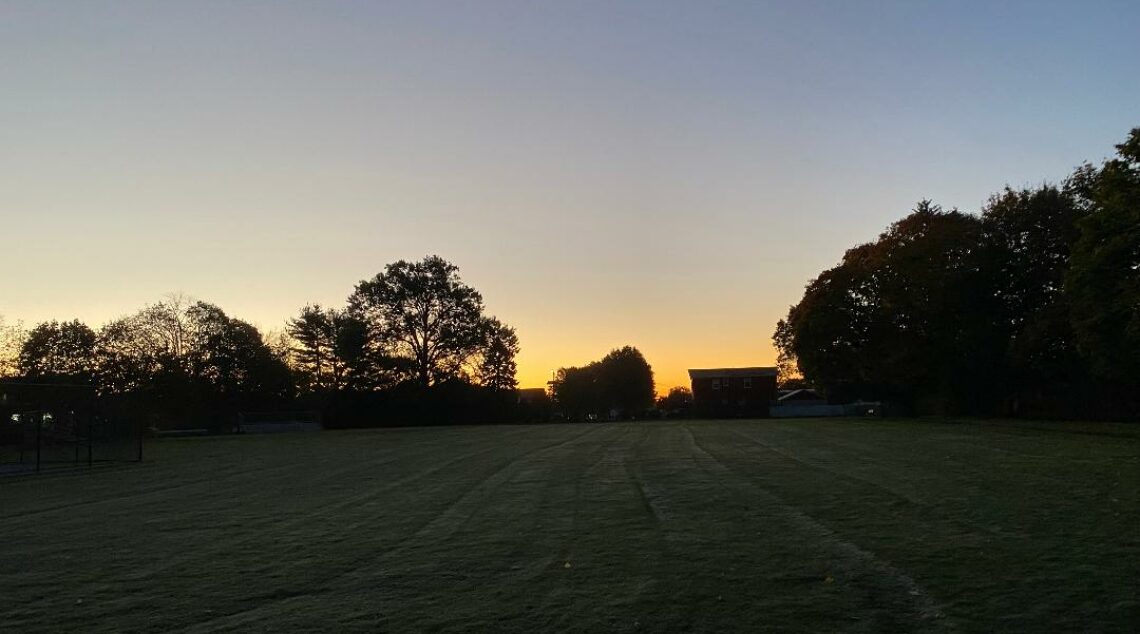
Sunshine this afternoon and seasonably mild after this morning’s light snow! Dry and cool weather for Christmas!


Good morning!

Skies are cloudy early on this Christmas Eve morning and there is some very light snow falling, temperatures range from around freezing in Clifton to the upper 20s further inland. Some dusting of snow has accumulated mostly on colder surfaces and the roads and sidewalks are mainly just wet.

The weak disturbance that is giving us the light snow will be moving off the coast while high pressure builds into the area. No further accumulation is expected in the Clifton area but the higher elevations inland may receive up to an inch of snowfall. Partial sunshine this afternoon and with highs in the 40s will melt any of the snow that has fallen this morning.

Dry and cool weather for Christmas Day through the day on Thursday as high pressure builds into the area.

A low pressure system will likely give us more rain on Friday possibly beginning as a wintery mix, temperatures on Friday will rise into the 50s. Rainfall amounts should average around an inch.

Mainly dry weather next weekend, temperatures will be above normal on Saturday and then be closer to normal on Sunday.

THE FORECAST:

TODAY – DEC 24 – Light snow ending this morning then becoming partly sunny, high in the mid 40s.

TONIGHT – Partly cloudy early then becoming mostly clear, low in the upper 20.

CHRISTMAS DAY – DEC 25 – Mostly sunny, high in the low 40s.

WEDNESDAY – DEC 26 – Mostly sunny, high in the low 40s.

THURSDAY – DEC 27 – Sunny, high near 40, rain and snow likely after midnight.

FRIDAY – DEC 28 – Rain in the morning tapering off to showers in the afternoon, quite mild with highs in the upper 50s.

SATURDAY – DEC 29 – Mostly sunny, high in the upper 40s.

SUNDAY – DEC 30 – Partly sunny, high near 40.

MARINE FORECAST: A small craft advisory has been issued effective from 1 p.m. this afternoon until 6 a.m. Tuesday morning for northwest winds gusting to 30 knots, seas 2-4 feet.

OUTLOOK – No advisories expected Tuesday through the day on Thursday; small craft advisories likely Thursday night through Friday.

Have a nice day!

Partly sunny and cool today! Light snow and rain likely tonight! Dry and cool weather for Christmas Day!


Good morning!

Skies are mostly clear early on this Sunday morning and temperatures range from the mid 30s in Clifton down to the upper 20s further inland, winds are from the west around 10 mph.

Weak high pressure will give us a partly sunny day today with seasonably mild temperatures.

A weak disturbance will likely give us light snow or rain mainly from midnight tonight until sunrise on Sunday morning. A dusting of snow is possible in the Clifton area with an inch or two across northwestern New Jersey.

Mainly dry weather with near seasonable temperature Christmas Day through Thursday as high pressure build over the area.

Another rainy day is expected on Friday as a low pressure system moves into the area. Precipitation may begin as a wintery mix especially inland early Friday morning but change to rain as much milder air moves into the area.

THE FORECAST:

TODAY – DEC 23 – Partly sunny, high in the mid 40s.

TONIGHT – Cloudy with light rain and snow likely, low in the low 30s, snow accumulation of less than a half inch.

MONDAY – DEC 24 – Chance of light snow before 8 a.m. then becoming mostly sunny, high in the mid 40s.

CHRISTMAS DAY – DEC 25 – Mostly sunny, high in the low 40s.

WEDNESDAY – DEC 26 – Mostly sunny, high in the low 40s.

THURSDAY – DEC 27 – Mostly sunny, high near 40, chance of rain mixed with snow after midnight.

FRIDAY – DEC 28 – Cloudy with rain likely, high in the mid 50s.

SATURDAY – DEC 29 – Mostly sunny, high near 50.

MARINE FORECAST: TODAY – Westerly winds to 12 knots, seas 2 feet.

OUTLOOK – Small craft advisories expected for Monday; no advisories expected Christmas Day through Thursday.

Have a nice day!

Cooler and windy with some sunshine today! Chance of light snow Sunday night!


Good morning!

Skies are mostly cloudy early on this Saturday morning and temperatures are still mild ranging from the low 50s in Clifton down to around 40 further inland, winds are light.

Rainfall from this last storm totaled 2.24″ in Clifton.

The low pressure that gave us the heavy rain yesterday is moving up into New England as a cold front associated with this system moves through our area this morning. The front will be followed by a brisk northwest wind, the high temperature in the low 50s this morning will drop to around 40 by sunset. After a mostly cloudy start we should see more sunshine this afternoon.

Seasonably cool on Sunday but a weak low pressure system may give us some light snow at night, only a dusting is expected in our area but an inch or two is possible well inland.

Fair weather with near seasonable temperatures Monday through the day on Thursday as high pressure will dominate.

Another low pressure will give us a good chance of rain on Friday with the precipitation possibly starting out as a wintery mix inland.

THE FORECAST:

TODAY – DEC 22 – Mostly cloudy this morning then becoming mostly sunny, breezy, temperatures in the low 50s this morning will drop to around 40 by sunset.

TONIGHT – Mostly clear with diminishing winds, low in the upper 20s.

SUNDAY – DEC 23 – Partly sunny, high in the mid 40s, chance of light snow at night.

MONDAY – DEC 24 – Mostly cloudy in the morning then becoming mostly sunny, high in the mid 40s.

CHRISTMAS DAY – DEC 25 – Mostly sunny, high near 40.

WEDNESDAY – DEC 26 – Mostly sunny, high in the low 40s.

THURSDAY – DEC 27 – Mostly sunny, high in the low 40s, chance of rain at night possible beginning as a wintery mix.

FRIDAY – DEC 28 – Cloudy with a chance of rain, milder, high in the mid 50s.

MARINE FORECAST: A gale warning is in effect until 6 p.m. this evening for west-northwest wind gusting to 35 knots, seas 7-10 feet this morning lowering the afternoon.

OUTLOOK – No advisories expected on Sunday; small craft advisories expected on Monday; no advisories expected Tuesday and Wednesday.

Have a good weekend!

Heavy flooding rains and near record warmth! Winter begins at 5:23 PM this afternoon!


Good morning!

Moderate to heavy rain is falling across the area early on this Friday morning and temperatures have risen to the upper 50s in Clifton down to the low 50s further inland, winds are gusty out of the southeast.

A strong low pressure will move up the from the south moving to our west this morning. Moderate to heavy rain this morning will taper off to showers this afternoon, rainfall amounts of 2-3 inches are expected with some higher amounts possible. There is even a chance of a rare December thunderstorm. Winds will be gusty out of the southeast. Record high temperatures are also possible as temperatures rise to above 60 degrees. A flood watch is in effect.

Some lingering showers are possible Saturday morning followed by cooler and windy conditions.

Mainly dry Sunday through Wednesday with only a low chance of some flurries Sunday night, temperatures during the period will be near normal.

Another rainstorm is possible late Thursday into Friday along with milder temperatures.

THE FORECAST:

TODAY – DEC 21 – Rain heavy at times with a chance of a thunderstorm, rain tapering off to showers this afternoon, quite mild and windy with highs in the low 60s. Rainfall amounts of 2-3 inches likely with higher amounts possible.

TONIGHT – Cloudy with a chance of showers, low in the mid 40s.

SATURDAY – DEC 22 – Becoming partly sunny and breezy, high near 50.

SUNDAY – DEC 23 – Mostly sunny, high in the mid 40s, chance of flurries after midnight.

MONDAY – DEC 24 – Partly sunny, high in the low 40s.

CHRISTMAS DAY – DEC 25 – Mostly sunny, high near 40.

WEDNESDAY – DEC 26 – Mostly sunny, high in the low 40s.

THURSDAY – DEC 27 – Increasing cloudiness with a chance of rain in the afternoon, high in the low 40s.

MARINE FORECAST: A gale warning is in effect until 4 p.m. this afternoon for south-southeast winds gusting to 40 knots, seas 7-12 feet.

OUTLOOK – Small craft conditions expected tonight through Saturday night with some gale gusts possible; no advisories expected Sunday through Monday morning; possible small craft advisories Monday afternoon and night; no advisories expected on Christmas.

Despite the stormy weather try to have a nice day!

Rain developing late this afternoon and becoming heavy at times tonight into Friday! Flood watch in effect!


Good morning!

Skies are mostly clear early on this Thursday morning and temperatures range from the upper 20s in Clifton down to the upper teens further inland, winds are mainly calm.

After a sunny start we should see some increase in cloudiness as a strong low pressure approaches from the south. Rain from this system should begin after 3 p.m. and become heavy at times after midnight, temperatures will rise through the 40s.

Heavy rain is expected on Friday along with near record high temperatures as readings will rise into the upper 60s. A flood watch is effect with 2-3 inches of rain expected with higher amounts possible. The heaviest rain will occur between midnight and 8 p.m.

Some lingering showers on Saturday, temperatures will start off mild but slowly decrease in the afternoon, it will become windy.

As of this time Sunday through Christmas should be dry but there is a slight possibility of some snow flurries Sunday night. Temperatures will be near normal.

No bitter cold or widespread snow is expected through the end of the year.

THE FORECAST:

TODAY – DEC 20 – Increasing cloudiness with a chance of rain mainly after 3 p.m., high in the mid 40s.

TONIGHT – Rain possibly heavy at times, temperatures rising to the upper 50s by sunrise.

FRIDAY – DEC 21 – Rain and breezy, rain will be heavy at times with possibly a thunderstorm, high in the low 60s.

SATURDAY – DEC 22 – Chance of a morning shower then remaining mostly cloudy, high near 50.

SUNDAY – DEC 23 – Mostly sunny, high in the mid 40s.

MONDAY – DEC 24 – Partly sunny, high in the mid 40s.

CHRISTMAS DAY – DEC 25 – Mostly sunny, high near 40.

WEDNESDAY – DEC 26 – Mostly sunny, high in the low 40s.

MARINE FORECAST: TODAY – Easterly winds to 10 knots, seas 1 foot.

OUTLOOK – A gale warning has been posted effective between midnight tonight until 4 p.m. Friday afternoon; small craft advisories likely Friday night through Saturday; no advisories expected for Sunday; possible small craft advisories again on Monday.

Have a nice day!