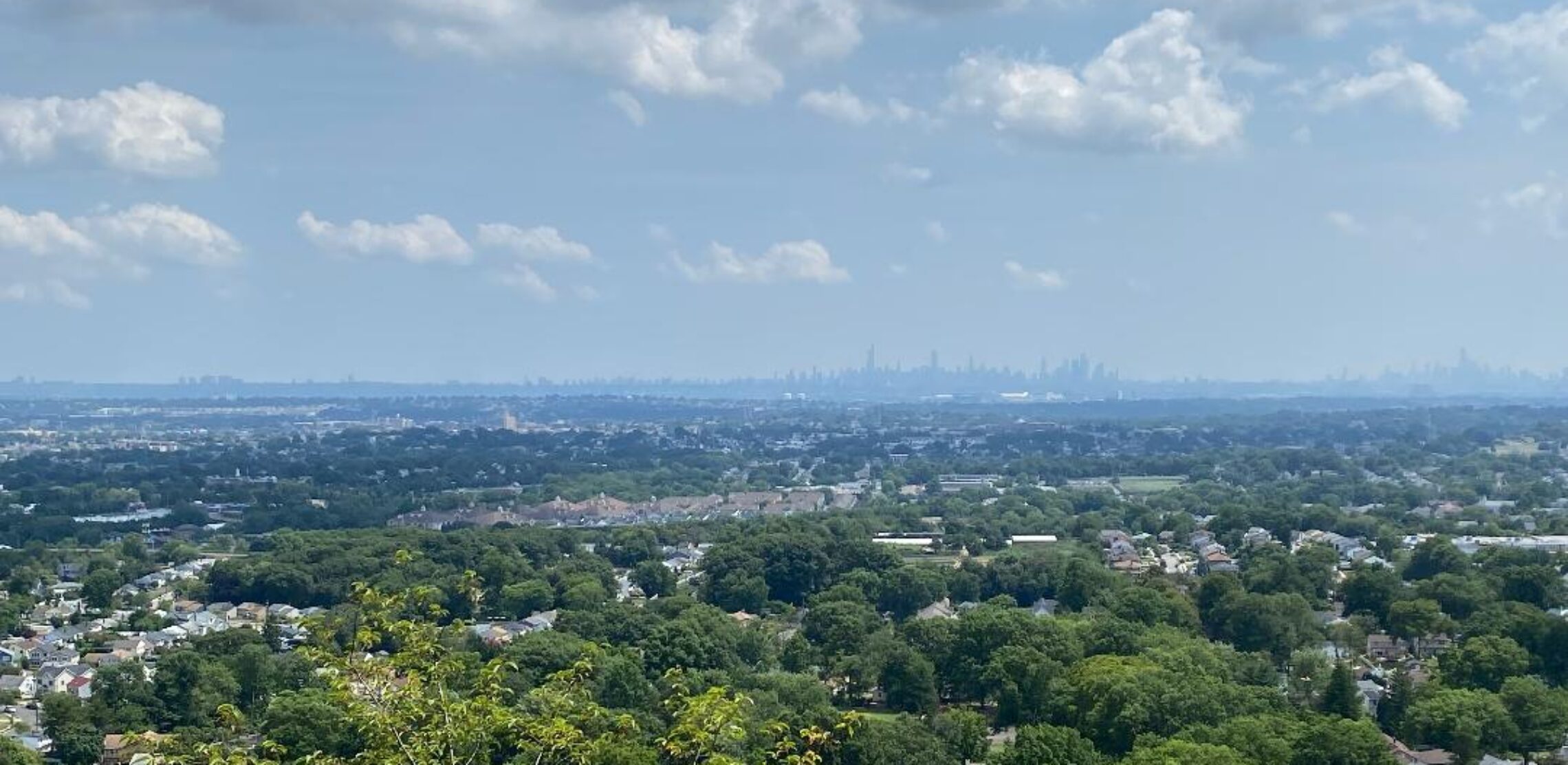
Very pleasant weather today with plenty of sunshine, seasonable temperatures and low humidity! Nice weather to continue Wednesday through Friday! Chance of showers on the weekend!


Good morning everyone!

Skies are mostly clear early on this Tuesday morning and early temperatures range from 55 in Clifton down to 48 at Walpack. Winds are calm or light westerly. The air quality is good with and index of 28.

CLIFTON’S ALMANAC FOR SEPTEMBER 19TH:

AVERAGE HIGH: 74 AVERAGE LOW: 56

RECORD HIGH: 92 – 1983 RECORD LOW: 41 – 1990

YESTERDAY’S HIGH: 66  LOW 58 PRECIPITATION: 1.29″ STORM TOTAL 1.59″

The storm system that gave us the rain yesterday is moving to the Canadian Maritimes as high pressure builds from the Midwest which will give us a mostly sunny day with near seasonable temperatures and low humidity.

The nice weather will continue Wednesday through Friday as the high continues to dominate.

Unsettled weather for the weekend into early next week as a low pressure off the southeast coast may develop some tropical characteristics as it slowly moves up the coast. So depending on the track we could have some showers from Saturday into early next week.

THE FORECAST:

TODAY – SEP 19 – Sunny, highs in the mid 70s.

TONIGHT – Mostly clear, low in the low 50s.

WEDNESDAY – SEP 20 – Sunny, highs in the mid 70s.

THURSDAY – SEP 21 – Sunny, highs in the upper 70s.

FRIDAY – SEP 22 – Mostly sunny, highs in the mid 70s.

SATURDAY – SEP 23 – Mostly cloudy with a chance of showers mainly after 2 p.m., highs near 70.

SUNDAY – SEP 24 – Mostly cloudy with a chance of showers, highs in the low 70s.

MONDAY – SEP 25 – Mostly cloudy with a chance of showers, highs in the low 70s.

MARINE FORECAST: TODAY – West-northwest winds to 10 knots, seas 1 foot.

OUTLOOK: No advisories expected Wednesday and Thursday; advisories possible on Friday with gales possible for Saturday.

Enjoy this nice weather but please stay safe!

Cloudy with rain that will end by this afternoon! Very pleasant September weather Tuesday through Friday with plenty of sunshine each day, low humidity and seasonably mild temperatures! Good chance of rain for the weekend!


Good morning everyone!

Rain is falling over much of the area early on this Monday morning and it is milder than the last couple of mornings with temperatures ranging from 63 in Clifton down to 58 at High Point. Winds are calm and the air quality is good with an index of 48.

CLIFTON’S ALMANAC FOR SEPTEMBER 18TH:

AVERAGE HIGH: 75 AVERAGE LOW 56

RECORD HIGH: 86 – 2015 RECORD LOW: 38 – 1990

YESTERDAY’S HIGH: 80 LOW: 55 PRECIPITATION: .30″

A frontal system moving through our area will give us rain which should end by the middle part of this afternoon. High temperatures will be lower than yesterday but the humidity will be higher.

High pressure will then dominate our weather Tuesday through Friday with low humidity, plenty of sunshine each day and seasonably mild temperatures.

An area of moisture is expected to move up the coast for the weekend with a good chance of rain especially Saturday night into Sunday.

THE FORECAST:

TODAY – SEP 18 – Cloudy with rain ending around 2 p.m., highs in the low 70s.

TONIGHT – Clearing, lows in the mid 50s.

TUESDAY – SEP 19 – Sunny, highs in the mid 70s.

WEDNESDAY – SEP 20 – Sunny, highs in the upper 70s.

THURSDAY – SEP 21 – Sunny, highs in the upper 70s.

FRIDAY – SEP 22 – Mostly sunny, highs in the mid 70s.

SATURDAY – SEP 23 – Partly sunny, highs in the low 70s, chance of showers at night.

SUNDAY – SEP 24 – Mostly cloudy with a chance of showers, highs in the low 70s.

MARINE FORECAST: TODAY – Variable winds less than 5 knots, seas 1-3 feet.

OUTLOOK: No advisories expected Tuesday and Wednesday; possible advisories for Thursday and Friday.

Have a nice day and please stay safe!

Sunny this morning then increasing clouds with showers developing by this evening and continuing through Monday afternoon! Very pleasant September weather Tuesday through Friday!


Good morning everyone!

Skies are clear early on this Sunday morning and once again it is seasonably cool with temperatures ranging from 56 in Clifton down to 43 at Sandyston. Winds are mainly calm. The air quality is good with and index of 47.

CLIFTON’S ALMANAC FOR SEPTEMBER 17TH:

AVERAGE HIGH: 75 AVERAGE LOW: 56

RECORD HIGH: 93 – 1991 RECORD LOW – 38 – 1986

YESTERDAY’S HIGH: 76 LOW: 55 PRECIPITATION: NONE

High pressure will be moving off the coast today as a frontal system approaches from the west. Today will start off sunny but we should see an increase in clouds by this afternoon with a chance of showers this evening. Showers are likely late tonight through Monday afternoon. High temperatures today will be in the upper 70s but only rise to the low 70s on Monday with an increase in humidity.

High pressure will then dominate our weather Tuesday through at least Friday with plenty of sunshine each day and seasonably mild temperatures.

THE FORECAST:

TODAY – SEP 17 – Sunny this morning then increasing clouds this afternoon with a chance of showers after 3 p.m., highs in the upper 70s.

TONIGHT – Cloudy with a chance of showers and thunderstorms before 8 p.m. then showers likely and possible some thunderstorms, lows in the low 60s.

MONDAY – SEP 18 – Cloudy with showers and possibly some thunderstorms mainly before 4 p.m., highs in the low 70s.

TUESDAY – SEP 19 – Sunny, highs in the upper 70s.

WEDNESDAY – SEP 20 – Sunny, highs in the upper 70s.

THURSDAY – SEP 21 – Sunny, highs in the upper 70s.

FRIDAY – SEP 22 – Sunny, highs in the upper 70s.

SATURDAY – SEP 23 – Partly sunny, highs in the mid 70s.

MARINE FORECAST: TODAY – West-northwest winds to 10 knots, seas 1-2 feet. Belmar’s ocean temperature is 74 degrees.

OUTLOOK: No advisories expected Monday through Friday.

Have a nice day but please stay safe!

Partly sunny, breezy and a little milder today! Increasing clouds on Sunday with showers possible at night continuing into Monday! Fair with near seasonable temperatures Tuesday through the rest of next week!


Good morning everyone!

Skies are partly cloudy early on this Saturday morning and once again it is cool with temperatures ranging from 56 in Clifton down to 44 at Walpack. Winds are light from the north. The air quality is good with an index of 36.

CLIFTON’S ALMANAC FOR SEPTEMBER 16TH:

AVERAGE HIGH: 75 AVERAGE LOW: 57

RECORD HIGH: 93 – 1991 RECORD LOW: 42 – 1984

YESTERDAY’S HIGH: 72 LOW: 55 PRECIPITATION: NONE

NOTE: 24 years ago today Hurricane Floyd caused massive flooding as more than 11 inches of rain fell in our area.

High pressure to our west and Hurricane Lee about 300 miles to our east will give us another breezy day today on north winds. Some of the clouds associated with Lee may once again filter our sunshine, high temperatures will be a couple of degrees higher than yesterday.

During the day on Sunday it should be dry but a weak low pressure area will likely give us showers late Sunday night into Monday.

High pressure will then build into our area on Tuesday and should dominate our weather the rest of next week with plenty of sunshine each day with near normal temperatures.

THE FORECAST:

TODAY – SEP 16 – Partly sunny and breezy, highs in the upper 70s.

TONIGHT – Mostly clear, lows in the mid 50s.

SUNDAY – SEP 17 – Increasing cloudiness, highs in the upper 70s. Chance of showers at night.

MONDAY – SEP 18 – Mostly cloudy with showers likely mainly before 2 p.m., highs in the low 70s.

TUESDAY – SEP 19 – Sunny, highs in the upper 70s.

WEDNESDAY – SEP 20 – Sunny, highs in the upper 70s.

THURSDAY – SEP 21 – Sunny, highs in the upper 70s.

FRIDAY – SEP 22 – Mostly sunny, highs in the upper 70s.

MARINE FORECAST: A small craft advisory is in effect until 6 a.m. Sunday morning for northwest winds gusting to 25 knots, seas 6-9 feet. A high surf advisory is in effect, also a high risk of rip currents. Belmar’s ocean temperature is 75 degrees.

OUTLOOK: No advisories expected the rest of Sunday through Wednesday.

Have a nice weekend but please stay safe!

Mostly sunny, breezy and seasonably cool today! Pleasant weather continues for the weekend! Chance of showers late Sunday night into Monday! Dry with near seasonable temperatures the rest of next week!


Good morning everyone!

Skies are mostly clear early on this Friday morning and tempertures are the coolest since early June with readings ranging from 55 in Clifton down to a chilly 42 at Walpack. Winds are from the north. The air quality is good with an index of 28.

CLIFTON’S ALMANAC FOR SEPTEMBER 15TH:

AVERAGE HIGH: 76 AVERAGE LOW: 57

RECORD HIGH: 88 – 1993 RECORD LOW: 43 – 1986

YESTERDAY’S HIGH: 78 LOW 60 PRECIPITATION: NONE

High pressure near Buffalo, and Hurricane Lee about 300 miles to our east, will combine to give us a northerly flow of cool air today; some high clouds from Lee may move into our area.

The weekend continues to look quite pleasant with seasonably mild temperatures and low humidity. We may continue to see some high clouds from Lee Saturday morning, but skies should become mostly sunny in the afternoon.

A weak area of low pressure along with a cold front may touch off some showers late Sunday night into early Monday afternoon.

Very pleasant September weather with near seasonable temperatures the rest of next week.

THE FORECAST:

TODAY – SEP 15 – Mostly sunny and breezy, highs in the low 70s.

TONIGHT – Partly cloudy, lows in the upper 50s.

SATURDAY – SEP 16 – Mostly sunny, highs in the upper 70s.

SUNDAY – SEP 17 – Mostly sunny, highs near 80. Chance of showers late at night.

MONDAY – SEP 18 – Mostly cloudy with a chance of a shower before 2 p.m. then becoming mostly sunny, highs in the upper 70s.

TUESDAY – SEP 19 – Sunny, highs in the upper 70s.

WEDNESDAY – SEP 20 – Sunny, highs in the upper 70s.

THURSDAY – SEP 21 – Mostly sunny, highs in the upper 70s.

MARINE FORECAST: A small craft advisory is in effect until 6 a.m. Sunday morning for northerly winds gusting to 30 knots, seas 7-12 feet. There is a high risk of dangerous rip currents. Belmar’s ocean temperature is 75 degrees.

OUTLOOK: No advisories expected the rest of Sunday through Tuesday.

TROPICS: Hurricane Lee with top winds of 85 mph will move about 300 miles to our east and should come ashore near the New Brunswick and Nova Scotia on Saturday.

Have a nice day and please stay safe!