Much cooler and breezy today with showers and thunderstorms likely! Dry and seasonably mild Thursday and Friday!


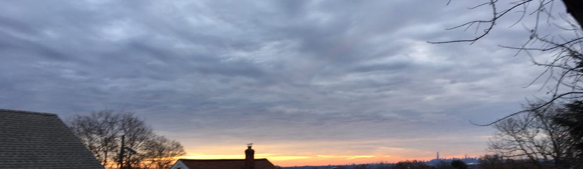
Skies are mostly clear early on this Wednesday morning and temperatures are cooler than the last few mornings ranging from the upper 50s here in Clifton to the upper 40s in some spot further inland, winds are light.

A strong upper air low in our area today will likely cause showers and thunderstorms mostly from around noon to early this afternoon, some storms may be heavy with small hail and strong gusty winds, it will be quite cool with most high temperatures only reaching the upper 60s and with a brisk wind it will feel even cooler.  Tonight will be quite cool with temperatures falling to the 40s in most areas.

Some nice late spring weather is expected for Thursday and Friday with plenty of sunshine and near normal temperatures.

The weekend looks a bit unsettled as a warm front will move into the area on Saturday followed by a cold front late Saturday night, these fronts may be accompanied by some showers late in the day on Saturday and Saturday night although most of the time it will be dry, temperatures will be seasonably warm.

Mostly sunny skies Monday and Tuesday with near seasonable temperatures.


THE FORECAST:

TODAY – Increasing cloudiness with showers and thunderstorms likely mainly from noon till early this afternoon, some storms may be accompanied by strong gusty winds and small hail, highs only in the upper 60s.

TONIGHT – Partly cloudy and cool, low in the upper 40s.

THURSDAY – Sunny, high in the mid 70s.

FRIDAY – Sunny, high in the upper 70s.

SATURDAY – Partly sunny with a chance of showers late in the day, high near 80.

SUNDAY – Partly sunny, high in the upper 70s.

MONDAY – Mostly sunny, high in the mid 70s.

TUESDAY – Mostly sunny, high near 80.


MARINE FORECAST:  Small craft advisory in effect till 6 p.m. on Thursday for northwest winds gusting to 30 knots, seas 3-5 feet.

OUTLOOK – No advisories expected Friday through the day on Saturday, with advisories possible Saturday night into Sunday.


Have a good day!


Warm today with widely scattered showers! Much cooler and breezy with afternoon showers likely!


Skies are mostly fair early on this Tuesday morning and temperatures range from the upper 60s here in Clifton to near 60 inland, winds are nearly calm.

Today will be warm ahead of a cold front that will cross the area this afternoon, this front does not have much moisture associated with it so there is only a low chance of an afternoon shower or thunderstorm. The front will be followed by cooler and much drier air for tonight.

Wednesday will be much cooler and it will be breezy, an upper level low will cause instability in the afternoon with showers and thunderstorms likely.

Dry with below normal temperatures Thursday and Friday.

At this point most of Saturday looks dry but a cold front will be approaching from the northwest that may touch off showers Saturday night into early Sunday morning, temperatures over the weekend should be near normal.


THE FORECAST:

TODAY – Sunny this morning becoming partly sunny this afternoon with a chance of a shower or thunderstorm, high in the mid 80s.

TONIGHT – Partly cloudy, breezy, cooler and less humid, low in the upper 50s.

WEDNESDAY – Partly sunny with a showers and thunderstorms likely in the afternoon, breezy and cool, highs only around 70.

THURSDAY – Mostly sunny, high in the mid 70s.

FRIDAY – Mostly sunny, high in the mid 70s.

SATURDAY – Partly sunny, high in the upper 70s, chance of showers at night.

SUNDAY – Chance of a morning showers then partly sunny, high in the upper 70s.

MONDAY – Mostly sunny, high again in the upper 70s.


MARINE FORECAST:  TODAY – Southwest wind to 10 knots, seas 2 feet.

OUTLOOK – A small craft advisory as been issued effective from 8 a.m. on Wednesday till 8 a.m. on Thursday.  Advisories possibly continuing during the day on Thursday with no advisories expected Thursday night through Saturday.


Have a good day!


Warm and dry today! Warm again on Tuesday with a chance of a shower! Much cooler on Wednesday!


Skies have become mostly fair early on this Monday morning and temperatures range from the mid 60s here in Clifton to around 60 further inland, winds are light.

Today we will have plenty of sunshine and warm temperatures reaching the upper 80s, a good beach day although water temperatures are still only in the low 60s.

A cold front will be crossing the area Tuesday afternoon preceded by some sunshine but also a chance of a shower and thunderstorm, tempertures will continue to be warm.

Much cooler weather expected for Wednesday, there may still be an afternoon shower, it will be breezy and also much less humid.

Dry weather with temperatures slightly below normal Thursday and Friday.

The weekend doesn’t look too bad with near seasonable tempertures, there is a chance of a shower around Saturday evening.  No big storms are expected through the next several days unlike Florida that will be dealing with heavy rain from Tropical Storm Colin.


THE FORECAST:

TODAY – Sunny, high in the mid-upper 80s.

TONIGHT – Partly cloudy, low in the upper 60s.

TUESDAY – Partly sunny with a chance of an afternoon shower and thunderstorm, high in the mid 80s.

WEDNESDAY – Partly sunny, cooler and much less humid, with a chance of an afternoon shower, breezy, high only in the low 70s.

THURSDAY – Mostly sunny, high in the low 70s.

FRIDAY – Mostly sunny, high in the upper 70s.

SATURDAY – Partly sunny with a chance of an afternoon or evening shower, high in the upper 70s.

SUNDAY – Partly sunny, high in the upper 70s.


MARINE FORECAST:  TODAY – Southwest wind to 11 knots, seas 2 feet.

OUTLOOK – No advisories expected during the day on Tuesday, possible advisories Tuesday night through Thursday, no advisories expected on Friday.


Have a good day!

Humid with some strong thunderstorms mainly this afternoon and evening! Warm and dry on Monday!


Skies are cloudy early on this Sunday morning and there are some showers mostly across the extreme northern parts of New Jersey up to the Hudson Valley; it is humid with nearly calm winds, temperatures are mainly in the mid 60s.

Today will be mainly cloudy and humid as a southerly flow of moist air is in the area ahead of a cold front approaching from the west.  This morning may turn out to be rain free across the area but showers and thunderstorms should develop this afternoon and continue into this evening, some storms may be accompanied by heavy rain and strong gusty winds along a chance of some small hail, with the cloudy conditions high temperatures will be mainly in the 70s.

A weak high pressure will give us a mostly sunny and warm day on Monday.

Tuesday will again be warm but a cold front could cause some showers in the afternoon

Plenty of sunshine with cooler temperatures and low humidity Wednesday through Friday.

At this time next weekend looks warmer and mainly dry.


THE FORECAST:

TODAY – Cloudy with an occasional shower this morning, showers and thunderstorms this afternoon, some storms may be accompanied by very heavy rain, strong gusty winds and small hail, high in the mid 70s.

TONIGHT – Cloudy this evening with showers and thunderstorms, some storms again may be accompanied by very heavy rain, strong gusty winds and small hail, becoming partly cloudy after midnight, low in the mid 60s.

MONDAY – Mostly sunny, high in the mid 80s.

TUESDAY – Partly sunny with a chance of an afternoon shower, high in the mid 80s.

WEDNESDAY – Mostly sunny, cooler and much less humid, high in the mid 70s.

THURSDAY – Mostly sunny, high in the mid 70s.

FRIDAY – Mostly sunny, high in the upper 70s.

SATURDAY – Partly sunny, high near 80.


MARINE FORECAST:  TODAY – Southerly winds to 15 knots seas 1-2 feet.   Small craft advisory will be in effect from 4 p.m. this afternoon till 5 a.m. Monday morning.

OUTLOOK – No advisories expected Monday into the day on Tuesday but advisories possible Tuesday night through Thursday.


Have a good day!

Warm and rather muggy today with some sunshine! Heavy rain likely on Sunday with possibly some severe thunderstorms!


Skies are mostly cloudy early on this Saturday morning and temperatures are rather uniform over the area with readings mostly in the low to mid 60s, humidity is on the high side and winds are nearly calm.

Today we will have a mix of clouds and sun, temperatures will be warm and the humidity will be on the muggy side as dew points will be in the 60s,  some showers may develop this evening but become more likely after midnight.

Sunday will be a cloudy and humid day as a warm front passes to our north and a cold front approaches from the west, there will be showers in the morning then heavier rain is likely in the afternoon and evening, some thunderstorms may also contain small hail and locally damaging winds, rainfall should average 1-2 inches with higher amounts possible.

Monday will be dry and warm.

A weaker front may cause an afternoon shower on Tuesday followed by cooler and much less humid air Wednesday through Friday along with plenty of sunshine.


THE FORECAST:

TODAY – Partly sunny, high in the low 80s.

TONIGHT – Cloudy with a chance of an evening shower, showers likely after midnight, low in the upper 60s.

SUNDAY – Cloudy with showers and thunderstorms, some storms may contain heavy rain, strong winds and small hail, high in the upper 70s.

MONDAY – Mostly sunny, high in the mid 80s.

TUESDAY – Mostly sunny with a chance of an afternoon shower, high in the low 80s.

WEDNESDAY – Mostly sunny, cooler and less humid, high in the mid 70s.

THURSDAY – Mostly sunny, high in the upper 70s.

FRIDAY – Partly sunny, high near 80.


MARINE FORECAST:  TODAY – Southerly winds to 6 knots, seas 1 foot.

OUTLOOK – Near advisory level conditions on Sunday with below advisory level conditions Monday through Wednesday.


Have a good day!