Cloudy and cool with periods of rain and drizzle through Friday! Milder over the weekend with showers still possible! Warmer next week!


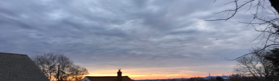
Skies are cloudy early this Wednesday morning and there are some drizzle or light rain falling across the area, temperatures range from around 50 here in Clifton to the mid 40s inland, winds are light.

More of the same damp and dreary weather through at least Friday as a trough of low pressure will be over the area.  Periods of rain or drizzle along with cloudy skies through Friday with daytime highs only in the 50s each day, the best chance of heavier rain appears to be this afternoon and again Friday afternoon.

The upper low pressure is expected to slowly move offshore over the weekend, it will be milder but there is still a chance of showers both Saturday and during the morning on Sunday.

Finally some sunshine with warmer temperatures early next week!


THE FORECAST:

TODAY – Cloudy with periods of rain or drizzle, high in the mid 50s.

TONIGHT – Periods or light rain or drizzle, low in the mid 40s.

THURSDAY – Cloudy with a chance of light rain or drizzle, high in the upper 50s.

FRIDAY – Cloudy with a chance of light rain and drizzle in the morning with rain likely in the afternoon, high in the upper 50s.

SATURDAY – Mostly cloudy with a chance of showers, high in the mid 60s.

SUNDAY – Mostly cloudy in the morning with a chance of showers becoming mostly sunny in the afternoon, high in the upper 60s.

MONDAY – Mostly sunny, high in the upper 60s.

TUESDAY – Mostly sunny, high in the mid 70s.


MARINE FORECAST:  Small craft advisory in effect till 6 p.m. on Thursday for northeast winds gusting to 30 knots, seas 5-7 feet.

OUTLOOK – Advisories expected to be continued through Friday and drop to below advisory levels on the weekend.


Despite this weather try to have a good day!

Rain tapering off this afternoon! Continued cool with showers through Friday! Some improvement for the weekend!


It is raining this Tuesday morning but temperatures are a little milder than the last few morning ranging from the low 50s here in Clifton to some upper 40s inland,  there is a light easterly wind.

Today rain will continue most of the morning with the heaviest rain tapering off this afternoon to light rain or drizzle, with the clouds and an onshore wind temperatures will remain in the 50s.

Mainly cloudy and cool weather Wednesday through Friday with some showers as an upper level low pressure will be in our area, the best chance of steady rain will be on Friday.

Finally some improvement for the weekend with milder temperatures however there still is a chance of showers especially on Saturday night.

Mostly sunny skies with milder temperatures early next week..


THE FORECAST:

TODAY – Rain this morning tapering off to drizzle this afternoon, high in the upper 50s.

TONIGHT – Mostly cloudy with a chance of rain after midnight, low in the upper 40s.

WEDNESDAY – Mostly cloudy with a chance of rain in the morning and a chance of showers in the afternoon, high in the upper 50s.

THURSDAY – Mostly cloudy with a chance of showers, high near 60.

FRIDAY – Mostly cloudy with a chance of rain, high in the low 60s.

SATURDAY – Partly sunny, high near 70, chance of showers at night.

SUNDAY – Partly sunny with a chance of morning showers, high near 70.

MONDAY – Sunny, high near 70.


MARINE FORECAST:  TODAY – East wind to 14 knots, seas 3-4 feet.

OUTLOOK – Possible small craft advisories

Considerable cloudiness with periods of rain or showers most of this week!


Skies are cloudy early on this Monday morning and some areas drizzle is falling, temperatures are mainly in the low to mid 40s with light winds.

Today will be cloudy day with some light rain mainly falling this morning as a stationary front is to our south and we are stuck with a cool and moist onshore flow, temperatures may not be as chilly as on Sunday with highs today about 10 degrees milder.

Another disturbance on the front to ours south will cause more rain on Tuesday again mainly falling in the morning.

An upper level trough in the area Wednesday through the weekend will continue the chance of showers each day but we should see more sunshine on the weekend with milder temperatures.


THE FORECAST:

TODAY – Cloudy with rain likely mainly falling this morning, high in the low 60s.

TONIGHT – Mostly cloudy with rain likely mainly after midnight, low in the low 50s.

TUESDAY – Cloudy with rain likely mainly in the morning, high in the low 60s.

WEDNESDAY – Mostly cloudy with a chance of showers, high in the low 60s.

THURSDAY – Mostly cloudy with a chance of showers, high in the low 60s.

FRIDAY – Mostly cloudy with a chance of showers, high in the mid 60s.

SATURDAY – Partly sunny with a chance of showers, high near 70.

SUNDAY – Partly sunny with a chance of showers, high in the low 70s.


MARINE FORECAST:  Small craft advisory in effect till 4 p.m. this afternoon for high seas, winds northeast to 9 knots, seas 3-5 feet.

OUTLOOK – No advisories expected Tuesday through Saturday.


Have a good day!

Chilly with rain today! Considerable cloudiness with periods of rain much of this upcoming week!


Skies are cloudy early on this Sunday morning and temperatures range from the upper 40s here in Clifton to the low 40s in some inland spots, winds are light.  Rain is approaching the area and should begin in most areas shortly.

Today will be quite cool with periods of rain, high temperature will struggle to reach the low 50s as we will have cloudy skies and winds off the cool ocean.

Periods of rain or drizzle will continue for Monday and Tuesday, temperatures will not be as cool as today but highs will continue to be below normal.

Wednesday may be the only dry day of this week as a cut off low pressure will be in our area continuing a chance of showers Thursday into early next weekend,  high temperatures will be a little below normal with low temperatures a little above normal.


THE FORECAST:

TODAY – Cloudy with periods of rain, quite cool with highs only in the low 50s.

TONIGHT – Cloudy with periods of rain, low in the upper 40s.

MONDAY – Mostly cloudy with a chance of rain, high in the upper 60s.

TUESDAY – Mostly cloudy with rain likely, high in the low 60s.

WEDNESDAY – Becoming partly sunny, chance of morning drizzle and fog, high in the mid 60s.

THURSDAY – Mostly cloudy with a chance of showers, high in the mid 60s.

FRIDAY – Mostly cloudy with a chance of showers, high in the mid 60s.

SATURDAY – Partly sunny with a chance of showers, high in the upper 60s.


MARINE FORECAST:  TODAY – East-southeast win to 12 knots, seas 2-3 feet.

OUTLOOK – Small craft advisory will be in effect for high seas form 11 p.m. tonight till 5 p.m. on Monday.  Mainly sub-advisory level conditions Monday night through Wednesday, however near advisory conditions Wednesday night into Thursday.


Have a good day!

Dry with some sunshine today! Quite chilly with rain on Sunday!


Skies are cloudy early on this Saturday morning and temperatures range from the mid 40s here in Clifton to around 40 further inland, winds are light.

We should see some sunshine today after early morning cloudiness, temperatures will be seasonably cool with highs mainly in the low 60s.

A low pressure system will move into the area tonight with rain developing after midnight and continuing into Sunday, temperatures will be unseasonably cool.

Rain should mainly end by noon on Monday, temperatures will not be as cool as on Sunday.

Tuesday should be the nicest day of this upcoming week with plenty of sunshine and milder temperatures.

Unsettled weather Wednesday through Friday with a chance of showers, especially Wednesday night into Thursday.


THE FORECAST:

TODAY – Partly sunny, high in the low 60s.

TONIGHT- Becoming cloudy with rain developing after midnight, low in the mid 40s.

SUNDAY – Rain and chilly, high only in the low 50s.

MONDAY – Rain likely mainly in the morning, high in the low 60s.

TUESDAY – Mostly sunny, high in the upper 60s.

WEDNESDAY – Partly sunny with a chance of afternoon and evening showers, high in the upper 60s.

THURSDAY – Mostly cloudy with a chance of rain, high in the mid 60s.

FRIDAY – Becoming partly sunny, high in the upper 60s.


MARINE FORECAST:  Small craft advisory is in effect for high seas till 11 p.m. this evening.  Winds northeast to 9 knots, seas 4-6 feet.

OUTLOOK – Advisories expected Sunday through Monday night.  No advisories expected Tuesday through the day on Wednesday.


Have a good day!