Light snow and sleet changing to light rain before ending this afternoon with little or no additional accumulation! Mostly sunny and seasonably mild on Wednesday! Quite mild on Thursday with a chance of showers in the morning! Cooler with rain or snow on Friday! Mainly dry weather for the weekend with seasonably cool temperatures!


Good morning everyone!

Light snow occasionally mixed with sleet is falling over our area early this morning with early temperatures ranging from 30 in Clifton down to 24 at High Point. Winds are a little gusty out of the east-northeast. Overnight accumulations of snow averaged 3-5 inches.

CLIFTON’S ALMANAC FOR FEBRUARY 28TH:

AVERAGE HIGH: 43 AVERAGE LOW: 28

RECORD HIGH: 66 – 1976 RECORD LOW: 5 – 2014

YESTERDAY’S HIGH: 45 LOW: 29 PRECIPITATION: .20″ SNOW: 2.0″

A coastal low pressure area will slowly move further off the coast today. We should remain cloudy most of the day with occasional light snow and sleet this morning changing to a cold rain before ending this afternoon with little or no additional snow accumulation. Skies will slowly clear tonight.

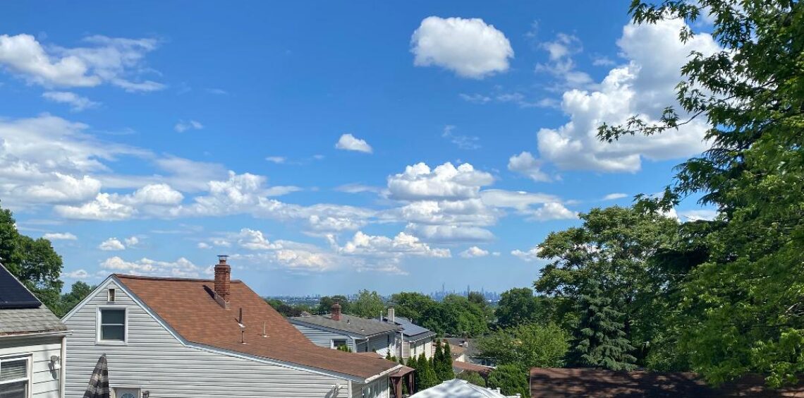
Wednesday will be a nice day with plenty of sunshine and seasonably mild temperatures.

A frontal system moving into our area will produce some rain showers Thursday morning followed by clearing and quite mild in the afternoon. A cold front will cross the area at night.

A strong low pressure area will give us rain or snow Friday afternoon and night.

At this point the weather for the weekend will mainly be dry with temperatures slightly below normal.

THE FORECAST:

TODAY – FEB 28 – Cloudy with light snow and sleet this morning changing to rain before ending this afternoon, high near 40. Little or no additional accumulations.

WEDNESDAY – MAR 1 – Mostly sunny, high in the mid 40s.

THURSDAY – MAR 2 – Mostly cloudy in the morning with a chance of showers then becoming partly sunny and quite mild, high in the mid 50s.

FRIDAY – MAR 3 – Cloudy and cooler with rain and snow, high near 40.

SATURDAY – MAR 4 – Mostly cloudy, high in the mid 40s.

SUNDAY – MAR 5 – Partly sunny, high in the mid 40s.

MONDAY – MAR 6 – Sunny, high in the mid 40s.

MARINE FORECAST: A gale warning is in effect until 9 a.m. this morning for east-northeast winds to 30 knots diminishing this afternoon, seas 4-5 feet.

OUTLOOK: Advisories possible for high seas Wednesday morning; no advisories expected for Wednesday afternoon and night; advisories possible for Thursday; advisories expected for Friday with some gales possible Friday night; advisories likely on Saturday with some gale gusts in the morning; advisories still possible for Sunday.

Have a nice day and stay safe!

Increasing cloudiness during the day with snow developing this evening with accumulations of 3-6 inches expected, a winter storm warning has been posted! Snow mixing with sleet and rain before ending on Tuesday! Dry and seasonably mild on Wednesday! Rain likely and mild Wednesday night into Thursday! Cooler with rain and or snow on Friday!


Good morning everyone!

Skies across the area are mostly clear and early temperatures range from 30 in Clifton down to 24 at High Point. Winds are from the northwest 5-10 mph.

CLIFTON’S ALMANAC FOR FEBRUARY 27TH:

AVERAGE HIGH: 43 AVERAGE LOW: 27

RECORD HIGH: 73 – 1997 RECORD LOW: 7 – 1994

YESTERDAY’S HIGH: 50 LOW: 23 PRECIPITATION: NONE

Low pressure over the mid-Mississippi valley will move east. We should see an increase in clouds today and become cloudy this afternoon. Snow from this system should begin around 7 p.m. and become steady and heavier overnight and then mixing with sleet early Tuesday morning. The precipitation may mix with rain before ending Tuesday afternoon. Accumulations in our area will average 3-6 inches and a Winter Storm Warning will be in effect as we will have our biggest snowstorm of this mild and rather snowless winter.

During the day on Wednesday it will be dry with seasonably mild temperatures.

Another low pressure area will likely give us rain Wednesday night into the day on Thursday with mild temperatures.

Cooler on Friday and still another storm will likely give us rain or snow.

At this point the weekend looks dry with seasonably cold temperatures.

THE FORECAST:

TODAY – FEB 27 – Increasing cloudiness, high in the low 40s.

TONIGHT – Snow developing around 7 p.m. mixing with sleet after 4 a.m. low in the low 30s. Snow accumulations of 3-6 inches expected.

TUESDAY – FEB 28 – Cloudy with snow and sleet till 10 a.m. rain and snow which will end around 4 p.m. Additional accumulations of less than 1 inch, high near 40.

WEDNESDAY – MAR 1 – Mostly sunny, high in the upper 40s. Chance of rain at night.

THURSDAY – MAR 2 – Cloudy in the morning with a chance of rain, clearing in the afternoon, mild with highs in the upper 50s.

FRIDAY – MAR 3 – Cloudy with rain and snow likely, high in the low 40s.

SATURDAY – MAR 4 – Mostly sunny, high in the low 40s.

SUNDAY – MAR 5 – Mostly sunny, high in the low 40s.

MARINE FORECAST: TODAY – Northwest winds to 10 knots, seas 1-2 feet.

OUTLOOK: A gale warning has been posted effective between 6 p.m. this evening through 7 a.m. Tuesday morning; small craft advisory likely the rest of Tuesday into Wednesday; possible advisories Wednesday night through Thursday night; advisories expected on Friday with a good chance of gales. Advisories likely to continue on Saturday for high seas.

Have a good day and stay safe!

Mostly sunny, breezy and milder today! Snow Monday afternoon with possible accumulations of 2-4 inches before changing to rain before ending Tuesday morning! Sunny and seasonably mild during the day on Wednesday! Good chance of rain Wednesday night into Thursday! Rain and snow likely on Friday!


Good morning everyone!

Skies are mainly clear early on this Sunday morning and with calm winds temperatures are quite chilly with early readings ranging from 22 in Clifton down to 10 at Walpack.

CLIFTON’S ALMANAC FOR FEBRUARY 26TH:

AVERAGE HIGH: 43 AVERAGE LOW: 27

RECORD HIGH: 62 – 2002 RECORD LOW: 0 – 1990

YESTERDAY’S HIGH: 30 LOW: 21 PRECIPITATION: TRACE SNOW: TRACE

High pressure moving off the coast will give us a brisk southwest flow of much milder air today after a chilly start, skies will be mostly sunny. A weak cold front will cross the area tonight with just a few clouds.

A storm system will affect our area Monday afternoon through Tuesday morning. Snow should begin Monday afternoon and continue into the evening with possible accumulations of 2-4 inches before changing to rain before ending on Tuesday.

Brief high pressure in our area will give us a mostly sunny day on Wednesday with seasonably mild temperatures.

Another low pressure system will give us a good chance of precipitation Wednesday night into Thursday but with milder air the precipitation should fall as rain.

Still another low pressure area will likely give us rain and or snow on Friday.

THE FORECAST:

TODAY – FEB 26 – Mostly sunny, breezy and milder, high near 50.

TONIGHT – Mostly clear, low in the upper 20s.

MONDAY – FEB 27 – Increasing cloudiness with snow developing in the afternoon and continuing at night, possible accumulations of 2-4″, high near 40.

TUESDAY – FEB 28 – Mostly cloudy with precipitation changing to rain before ending by the afternoon, high in the low 40s.

WEDNESDAY – MAR 1 – Mostly sunny, high in the upper 40s, chance of rain at night.

THURSDAY – MAR 2 – Mostly cloudy and mild with a chance of showers, highs in the upper 50s.

FRIDAY – MAR 3 – Cloudy with rain and snow likely, high in the low 40s.

SATURDAY – MAR 4 – Mostly sunny, high in the low 40s.

MARINE FORECAST: TODAY: Southwest winds to 15 knots, seas 1-2 feet.

OUTLOOK: A gale watch has been issued effective between 6 p.m. Monday evening through 6 a.m. Tuesday morning; no advisories expected Tuesday afternoon through the day on Wednesday; advisories probable Wednesday night through Thursday.

Enjoy the milder weather today and please stay safe!

Becoming cloudy with a chance of snow showers this afternoon! Dry and milder on Sunday! Storm to give us snow and rain Monday afternoon through Tuesday morning! Another storm to give us a chance of rain Wednesday night through Friday!


Good morning everyone!

Skies are partly cloudy early on this Saturday morning and temperatures are the lowest in almost three weeks with early readings ranging from 20 in Clifton down to 13 at High Point. Winds are mainly light from the north.

CLIFTON’S ALMANAC FOR FEBRUARY 25TH:

AVERAGE HIGH: 42 AVERAGE LOW: 27

RECORD HIGH: 69 – 1976 RECORD LOW: 4 – 1990

YESTERDAY’S HIGH: 43 LOW: 23 PRECIPITATION: TRACE

A weak disturbance will move into our area today accompanied by some snow showers this afternoon that may produce a dusting, temperatures will be chilly with highs only in the low to mid 30s. Winds will be much lighter than yesterday.

A warm front will move to our north on Sunday and we will have milder temperatures but it will be breezy in the afternoon.

Low pressure will move to the Great Lakes on Monday with a secondary storm forming off the coast this system may give us our biggest snow accumulation of the season with 1-2 inches of snow possible Monday afternoon and evening before mixing with and changing to rain before ending Tuesday morning.

During the day on Wednesday we should be mostly sunny with seasonably mild temperatures.

Another storm will give us a chance of precipitation Wednesday night through Friday but at this time it looks to be a mainly rain event.

THE FORECAST:

TODAY – FEB 25 – Becoming cloudy with a chance of snow showers this afternoon, highs only in the low 30s.

TONIGHT: Mostly cloudy, low in the mid 20s.

SUNDAY – FEB 26 – Mostly sunny, breezy and milder, high near 50.

MONDAY – FEB 27 – Cloudy with snow developing in the afternoon and changing to rain late at night, highs in the low 40s. Possible snow accumulations of 1-2″

TUESDAY – FEB 28 – Cloudy in the morning with a chance of rain becoming mostly sunny in the afternoon, highs in the mid 40s.

WEDNESDAY – MAR 1 – Mostly sunny, high in the upper 40s. Chance of rain at night.

THURSDAY – MAR 2 – Mostly cloudy with a chance of rain, highs in the mid 50s.

FRIDAY – MAR 3 – Mostly cloudy with a chance of rain, high in the upper 40s.

MARINE FORECAST: TODAY – Northerly winds becoming southeast gusting 5-10 knots, seas 1 foot.

OUTLOOK: No advisories expected Sunday through the day on Monday; advisories probable Monday night through Tuesday with some gale gusts possible Monday night; no advisories expected on Wednesday.

Have a nice weekend and stay safe!

Becoming mostly sunny and windy with falling temperatures! Quite chilly on Saturday with a chance of snow showers! Mostly sunny and milder on Sunday! Another storm will give us rain and snow Monday afternoon through Tuesday morning!


Good morning everyone!

Skies across the area are mostly cloudy and early temperatures range from 39 in Clifton down to 34 at High Point. Winds are light from the north.

CLIFTON’S ALMANAC FOR FEBRUARY 24TH:

AVERAGE HIGH: 42 AVERAGE LOW: 26

RECORD HIGH: 75 – 2017 RECORD LOW: -1 – 2015

YESTERDAY’S HIGH: 41 LOW: 36 PRECIPITATION: .02″

The low pressure area that gave us the cool and dreary weather yesterday is moving off the coast as high pressure builds from the west. Skies will become mostly sunny this morning but it will become windy and colder with temperatures falling to the low 30s by sunset and into the 20s later tonight. Winds will be quite strong with gusts to 35 mph which will make it feel even colder.

Skies will become cloudy on Saturday and it will remain quite chilly with diminishing winds. A weak disturbance will give us a chance of snow showers with little or no accumulation.

Sunday will be mostly sunny and milder with highs approaching 50 degrees with a light westerly wind as high pressure builds into our area.

Another storm system will give us rain and snow Monday afternoon through Tuesday morning, too early to tell if we will get any accumulating snow.

After a dry Wednesday still another storm will give us a chance of rain on Thursday.

THE FORECAST:

TODAY – FEB 24 – Mostly sunny and very windy with temperatures falling to the low 30s by sunset. Winds gusting to 35 mph.

TONIGHT – Mostly clear, breezy and cold, low in the upper teens.

SATURDAY – FEB 25 – Becoming cloudy with a chance of snow showers after 10 a.m., highs in the mid 30s.

SUNDAY – FEB 26 – Sunny and milder, high near 50.

MONDAY – FEB 27 – Increasing cloudiness with rain and snow developing by the afternoon and continuing at night, high in the mid 40s.

TUESDAY – FEB 28 – Rain likely in the morning then slow clearing, high in the mid 40s.

WEDNESDAY – MAR 1 – Mostly sunny, high in the upper 40s.

THURSDAY – MAR 2 – Mostly cloudy with a chance of rain, high near 50.

MARINE FORECAST: A small craft advisory is in effect until 1 a.m. Saturday morning for northwest winds gusting to 30 knots, seas 3-6 feet.

OUTLOOK: No advisories expected Saturday through the day on Monday; advisories expected Monday night into Tuesday with some gale gusts possible.

Have a nice day and stay safe!