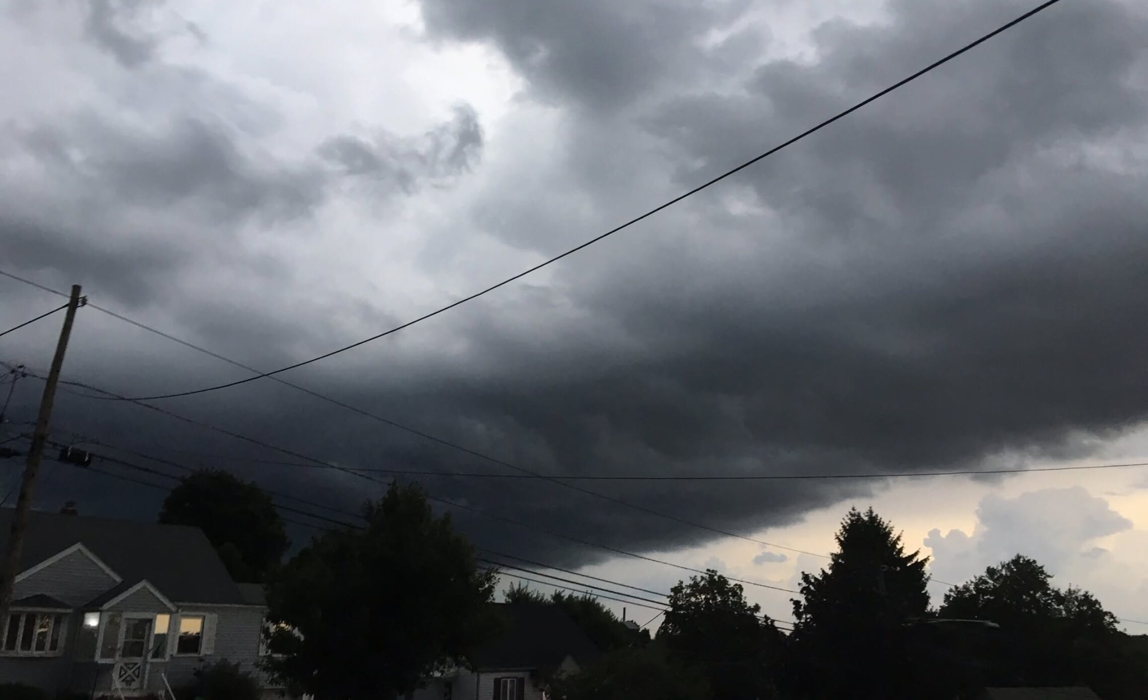
Mostly sunny, quite warm and humid again today with a chance of afternoon and evening showers and thunderstorms! Partly sunny and warm on Wednesday with some showers possible becoming less humid at night!


Good morning!

Skies are mostly clear early on this Tuesday morning and temperatures are quite mild again with readings ranging from the low 70s in Clifton down to the low 60s further inland, the humidity is high and the winds are mainly calm.

CLIFTON’S ALMANAC FOR JUNE 23RD:

AVERAGE HIGH: 82 AVERAGE LOW 62

RECORD HIGH: 92 – 1975 RECORD LOW: 48 – 1992

YESTERDAY’S HIGH: 95 LOW 67 PRECIPITATION: NONE

Another hot and humid day today as high pressure is offshore and a light southerly flow dominates our weather, there is a chance of afternoon and evening showers and thunderstorms. The chance of precipitation is 40% so most places will remain dry, we could use some rain since we have not had any measurable rain since June 11th in Clifton.

A cold front approaching from the west will pass through our area on Wednesday with again some showers and thunderstorms possible, after the front passes it will become less humid by evening.

Generally dry and warm Thursday through the beginning of the weekend but with more comfortable humidity.

Another cold front may cause some showers Saturday night into Sunday.

THE FORECAST:

TODAY – JUNE 23 – Mostly sunny and humid with a chance of showers and thunderstorms mainly after 2 p.m., high near 90.

TONIGHT – Mostly cloudy with a chance of showers and thunderstorms, humid, low in the low 70s.

WEDNESDAY – JUNE 24 – Partly sunny with a chance of showers and thunderstorms, becoming less humid late in the day, high in the upper 80s.

THURSDAY – JUNE 25 – Mostly sunny, high in the mid 80s.

FRIDAY – JUNE 26 – Sunny, high in the upper 80s.

SATURDAY – JUNE 27 – Mostly sunny and hot, high in the low 90s, chance of showers and thunderstorms after midnight.

SUNDAY – JUNE 28 – Partly sunny with a chance of showers and thunderstorms, high near 90.

MONDAY – JUNE 29 – Mostly sunny, high in the upper 80s.

MARINE FORECAST: TODAY – Southerly winds to 15 knots, seas 1-2 feet.

OUTLOOK – No advisories expected Wednesday through Sunday.

Have a nice day and stay safe and healthy!

Mostly sunny, humid and quite warm again today! Warm and humid on Tuesday with a chance of an afternoon shower and thunderstorm! Better chances of thunderstorms on Wednesday!


Good morning!

Skies are mostly clear early on this Monday morning and it is quite mild and muggy with temperatures ranging from near 70 in Clifton down to the upper 50s further inland, winds are mainly calm or light southwesterly.

CLIFTON’S ALMANAC FOR JUNE 22ND:

AVERAGE HIGH: 81 AVERAGE LOW: 62

RECORD HIGH: 100 – 1988 RECORD LOW: 51 – 1992

YESTERDAY’S HIGH: 90 LOW: 66 PRECIPITATION: NONE

High pressure over the area will give us a light southerly flow of very warm to hot air today along with mostly sunny skies, it will remain humid with dew points in the 60s. There is only a slight chance of an afternoon shower mainly to our west and north.

Continued warm to hot and humid on Tuesday with a chance of an afternoon or evening shower and thunderstorm.

A better chance of showers and thunderstorms on Wednesday as a cold front crosses our area.

Dry and less humid Thursday through Saturday but remaining quite warm.

Another front will give us a chance of showers on Sunday with increasing humidity and continued very warm temperatures.

THE FORECAST:

TODAY – JUNE 22 – Mostly sunny, quite warm and humid, high near 90.

TONIGHT – Partly cloudy and muggy, low in the low 70s.

TUESDAY – JUNE 23 – Mostly sunny with a chance of afternoon and evening showers and thunderstorms, humid, high near 90.

WEDNESDAY – JUNE 24 – Partly sunny with a chance of showers and thunderstorms, humid, high near 90.

THURSDAY – JUNE 25 – Mostly sunny and less humid, high in the upper 80s.

FRIDAY – JUNE 26 – Mostly sunny, high in the upper 80s.

SATURDAY – JUNE 27 – Mostly sunny, high near 90, chance of showers and thunderstorms at night.

SUNDAY – JUNE 28 – Partly sunny and more humid with a chance of showers and thunderstorms, high near 90.

MARINE FORECAST: TODAY – Southerly winds to 10 knots, seas 1-2 feet.

OUTLOOK – No advisories expected Tuesday through Friday.

Have a nice day and stay safe and healthy!

Warm and humid today and again on Monday with only a slight chance of a shower both days! Quite warm and humid with chance of showers and thunderstorms Tuesday and Wednesday! Less humid but staying warm at the end of this week!


Good morning!

Skies are partly cloudy early on this Sunday morning and temperatures range from the upper 60s in Clifton down to the upper 50s further inland, winds are mainly calm and the humidity is high.

CLIFTON’S ALMANAC FOR JUNE 21ST:

AVERAGE HIGH: 81 AVERAGE LOW: 62

RECORD HIGH: 97 – 2012 RECORD LOW: 52 – 1985

YESTERDAY’S HIGH: 89 LOW: 66 PRECIPITATION: NONE

High pressure offshore will continue to dominate our weather with a southerly flow of warm and humid air. There is only a slight chance of an afternoon shower with again most of the showers to the west and north of our area. Skies will be partly sunny.

Quite warm and humid weather to continue Monday through Wednesday, only a slight chance of a shower on Monday with better chances Tuesday and Wednesday as a cold front approaches our area.

Still a chance of a shower on Thursday but it will become less humid by late in the day however it will stay warm.

Warm with comfortable temperatures and humidity Friday and Saturday but humidity will start to increase by next Sunday.

Looking further ahead it appears that warmer than normal weather will continue through at least the beginning of July.

THE FORECAST:

TODAY – JUNE 21 – Partly sunny, high in the mid 80s.

TONIGHT – Partly cloudy, low in the upper 60s.

MONDAY – JUNE 22 – Mostly sunny, high in the upper 80s.

TUESDAY – JUNE 23 – Mostly sunny chance of afternoon and evening showers and thunderstorms, high near 90.

WEDNESDAY – JUNE 24 – Partly sunny with a chance of showers and thunderstorms, high near 90.

THURSDAY – JUNE 25 – Partly sunny with a chance of a shower, high in the upper 80s.

FRIDAY – JUNE 26 – Mostly sunny and less humid, high in the upper 80s.

SATURDAY – JUNE 27 – Mostly sunny, high in the upper 80s.

MARINE FORECAST: TODAY – South-southeast winds to 10 knots, seas 1 foot. Point Pleasant Beach’s ocean temperature is 65 degrees.

OUTLOOK – No advisories expected Monday through Thursday.

Have a nice day and stay safe and healthy!

Partly sunny, warm and humid today with a low chance of afternoon and evening showers and thunderstorms as summer begins at 5:44 P.M. Continued warm and humid Sunday with again a low chance of afternoon showers and thunderstorms!


Good morning!

Skies are partly cloudy early on this Saturday morning and temperatures range from the mid 60s in Clifton down to the upper 50s further inland, the winds are mainly calm and the humidity is high.

CLIFTON’S ALMANAC FOR JUNE 20TH:

AVERAGE HIGH: 81 AVERAGE LOW: 61

RECORD HIGH: 97 – 2012 RECORD LOW: 52 – 2004

YESTERDAY’S HIGH: 84 LOW: 64 PRECIPITATION: NONE

High pressure offshore will give our area a southerly flow of warm and humid air with high temperatures similar to yesterday. There is a low chance of showers and thunderstorms this afternoon and evening mainly to the north and west of our area.

Warm and humid air continues on Sunday with again a chance of afternoon and evening showers and thunderstorms.

Mainly warm and humid weather most of next week with the hottest days should be Tuesday and Wednesday with highs near 90. There will be a chance of showers and thunderstorms Monday and Tuesday afternoon with a better chance of storms Wednesday into Thursday as a weak cold front moves into our area.

THE FORECAST:

TODAY – JUNE 20 – Partly sunny and humid with a chance of afternoon showers and thunderstorms, high in the mid 80s.

TONIGHT – Mostly cloudy and muggy with a chance of showers and thunderstorms mainly before 9 p.m., low in the upper 60s.

SUNDAY – JUNE 21 – Partly sunny and humid with a chance of afternoon showers and thunderstorms, high in the low 80s.

MONDAY – JUNE 22 – Mostly sunny and humid with a chance of afternoon showers and thunderstorms, high in the upper 80s.

TUESDAY – JUNE 23 – Mostly sunny, hot and humid with a chance of afternoon showers and thunderstorms, high near 90.

WEDNESDAY – JUNE 24 – Partly sunny, hot and humid with a chance of showers and thunderstorms, high near 90.

THURSDAY – JUNE 25 – Partly sunny and humid with a chance of showers and thunderstorms, high in the upper 80s.

FRIDAY – JUNE 26 – Mostly sunny and less humid, high in the upper 80s.

MARINE FORECAST: TODAY – Southerly winds to 10 knots, seas 1 foot. Point Pleasant Beach ocean temperature is 64 degrees.

OUTLOOK – No advisories expected Sunday through Wednesday.

Enjoy the weekend and continue to stay safe and healthy! Happy Summer!

Partly sunny, warm and humid today with some afternoon and evening showers and thunderstorms! Continued warm and humid on the weekend with some showers and thunderstorms each afternoon!


Good morning!

Skies are mainly cloudy early on this Friday morning and temperatures range from the mid 60s in Clifton down to around 60 further inland, winds are mainly calm and the humidity is high.

CLIFTON’S ALMANAC FOR JUNE 19TH:

AVERAGE HIGH: 81 AVERAGE LOW: 61

RECORD HIGH: 95 – 1994 RECORD LOW: 49 – 1986

YESTERDAY’S HIGH: 80 LOW: 65 PRECIPITATION: NONE

High pressure has moved offshore and a light southerly flow of warm and humid weather will be with us today. There will be a chance of some showers and thunderstorms this afternoon and evening, some of these storms may be accompanied by some heavy downpours, however many areas will remain dry.

The high pressure will remain offshore this weekend with a continued southerly flow of warm and humid air along with chances of mainly afternoon showers and thunderstorms.

Very warm to hot weather most of next week with the best chances of showers and thunderstorms occurring on Monday.

THE FORECAST:

TODAY – JUNE 19 – Partly sunny and humid with a chance of afternoon showers and thunderstorms, some storms may be accompanied by heavy rain, high in the low 80s.

TONIGHT – Mostly cloudy with a chance of showers and thunderstorms before 9 p.m., muggy with lows in the upper 60s.

SATURDAY – JUNE 20 – Partly sunny and humid with a chance of afternoon showers and thunderstorms, high in the mid 80s.

SUNDAY – JUNE 21 – Partly sunny and humid with a chance of afternoon showers and thunderstorms, high in the low 80s.

MONDAY – JUNE 22 – Partly sunny and humid with a chance of showers and thunderstorms, high in the upper 80s.

TUESDAY – JUNE 23 – Mostly sunny, hot and humid, high in the low 90s.

WEDNESDAY – JUNE 24 – Partly sunny, hot and humid, high in the low 90s.

THURSDAY – JUNE 25 – Partly sunny and humid, high in the upper 80s.

MARINE FORECAST: TODAY – South-southeast winds to 10 knots, seas 2 feet.

OUTLOOK – No advisories expected Saturday through Tuesday.

Have a nice day and stay safe and healthy!