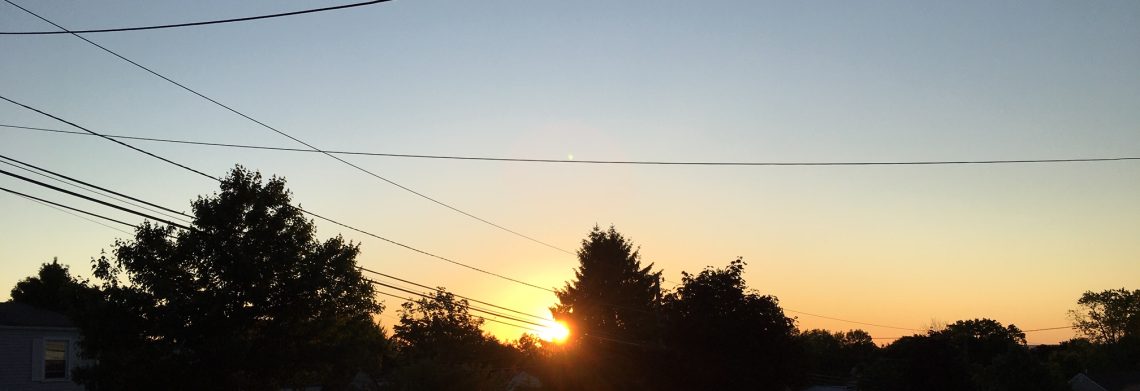
Pleasantly warm Saturday! Chance of showers Sunday morning!


Another clear and cool early morning in the area with temperatures in the upper 50s in the Clifton area to the 40s in some spots of Northwest New Jersey.

Today will be about 5 to 8 degrees higher than yesterday with less clouds, humidity will continued to be on the low side. Not as cool tonight.

On Sunday a weekend cold front will be crossing the area that may touch off a showers mainly before noon followed by clearing late in the day, temperatures will be seasonably warm.

Dry and seasonably warm weather on Monday.

A frontal system to our south may brush us with some showers on Tuesday.

Seasonably warm and mainly dry weather Wednesday through Friday.


THE FORECAST:

TODAY – Sunny, high in the low 80s.

TONIGHT – Mostly cloudy, low in the mid 60s.

SUNDAY – Mostly cloudy with a chance of showers and thunderstorms, high in the low 80s.

MONDAY – Sunny, high in the low 8 0s.

TUESDAY – Mostly cloudy with a chance of showers and thunderstorms, high around 80.

WEDNESDAY – Partly sunny, high in the low 80s.

THURSDAY – Partly sunny, high in the low 80s.

FRIDAY – Partly sunny, high near 80.


MARINE FORECAST:  TODAY – South wind to 12 knots, seas 2 feet.

OUTLOOK –  Sub-advisory level conditions Sunday and Monday with near advisory level conditions Tuesday and Wednesday.


Have a good day!

September like weather to continue today! Warmer on the weekend with only a chance of a shower Sunday morning!


We have clear skies at daybreak this morning and have rather cool temperatures ranging from the upper 50s in the Clifton area to some upper 40s at the cooler spots further inland.

Another very pleasant day today with mainly clear skies this morning with some broken cumulus clouds this afternoon, temperatures will be below normal for the middle of August only reaching the upper 70s, humidity will continue to be quite low with dew points in the very comfortable 40s.

High pressure building in on Saturday will give us another nice day with plenty of sunshine, temperatures will be a few degrees higher but we will still enjoy low humidity.

We will have a chance of a light shower mainly Sunday morning with most of the day will remain dry, it will be seasonably warm with a little higher humidity.

Monday will be a dry day with seasonable temperatures.

A frontal system will give us a chance of rain Tuesday night into Wednesday.


THE FORECAST:

TODAY – Mostly sunny, high in the upper 70s.

TONIGHT – Partly cloudy, low in the upper 50s.

SATURDAY – Mostly sunny, high in the low 80s.

SUNDAY – Cloudy in the morning with a chance of a shower mainly before 9am, gradual clearing in the afternoon, high in the mid 80s.

MONDAY – Mostly sunny, high in the mid 80s.

TUESDAY – Mostly cloudy, high near 80.  Chance of showers at night.

WEDNESDAY – Mostly cloudy with a chance of showers, high near 80.

THURSDAY – Partly sunny, high in the low 80s.


MARINE FORECAST:  TODAY – West wind to 10 knots, seas 2 feet.

OUTLOOK – Sub-advisory level conditions to continue into early next week.


Have a great day!

Pleasantly cool with low humidity through Saturday! Showers possible on Sunday!


We have clear skies at daybreak this morning and temperatures have dipped down to the upper 50s in the Clifton area with the colder suburbs falling to around 50.

Today we will have mostly sunny skies, there is an outside chance of a widely scattered thunderstorm in the afternoon and evening but most areas will see no rain, temperatures will be cooler than normal and the dew points dropping to the 40s which is very comfortable for this time of year.

The dry and comfortable conditions will continue through Saturday as high pressure builds in the area.

Sunday there will be a chance of showers as a disturbance moves through, humidity will be on the rise.

Monday looks dry at this point but another frontal system will again give us a chance of showers on Tuesday and Wednesday, temperatures will be close to normal.


THE FORECAST:

TODAY – Mostly sunny, high near 80.

TONIGHT – Mostly cloudy, low in the upper 50s.

FRIDAY – Mostly sunny, high in the upper 70s.

SATURDAY – Sunny, high in the low 80s.

SUNDAY – Partly sunny with a chance of showers and thunderstorms, high in the low 80s.

MONDAY – Mostly sunny, high in the low 80s.

TUESDAY – Partly sunny, chance of showers and thunderstorms, high in the low 80s.

WEDNESDAY – Partly sunny, chance of showers and thunderstorms, high in the mid 80s.


MARINE FORECAST:  TODAY – Northwest wind to 12 knots, seas 2-3 feet.

OUTLOOK – Sub-advisory level conditions to continue through the weekend.


Have a good day!

Only some showers today as Northern New Jersey is spared from flooding rains!


At daybreak this morning we have very light rain, temperatures are in the upper 60s, the winds are light.

Our area escaped from the drenching and flooding rains as we only  picked up .64″ during the overnight while parts of Central and Southern New Jersey received 6 to 9 inches of rain since last night, this heavy rain now has moved into Long Island causing flooding there this morning.

During the day today we will still have a risk of some showers but we should also have some clearing by this afternoon, temperatures will warm up into the middle 80s.

Much drier and cooler air with plenty of sunshine Thursday and Friday.

At this point we will still have nice weather to start the weekend but a disturbance may give us some showers on Sunday, temperatures will be seasonably warm.

Dry on Monday but another system may give us some showers on Tuesday, temperatures will remain seasonably warm with somewhat higher humidity.


THE FORECAST:

TODAY – Mostly cloudy with a chance of showers, high in the mid 80s.

TONIGHT – Chance of an evening shower then becoming mostly clear, low in the low 60s.

THURSDAY – Sunny, high near 80.

FRIDAY – Mostly sunny, high near 80.

SATURDAY – Sunny, high in the low 80s.

SUNDAY – Partly sunny with a chance of showers, high in the low 80s.

MONDAY – Mostly sunny, high in the low 80s.

TUESDAY – Partly sunny with a chance of showers, high in the mid 80s.


MARINE FORECAST:  Small craft advisory in effect till 11pm tonight for winds becoming west-southwest with gust to 30 knots, seas 4-7 feet.

OUTLOOK – Sub-advisory level conditions expected Thursday through Sunday.


Have a good day!


Heavy rain likely later this afternoon into Wednesday, flash flood watch in effect!


We have cloudy skies this morning with temperatures ranging from the upper 60s in the Clifton area to around 60 further inlands, winds are light, humidity is higher than the last few mornings.  An area of rain is over Eastern and Central Pennsylvania and may affect the western parts of New Jersey this morning.

Today will be cloudy and cooler but with higher humidity, rain should move into Clifton area this afternoon but the heaviest rain will occur tonight into most of Wednesday morning, the rain could be quite heavy at times causing flash flooding, rainfall amounts 2-3 inches can be expected with possibly up to 4″  in some places.

Showers will persist into Wednesday afternoon but we may have some clearing before sunset.

Back to drier and seasonable cool air Thursday and Friday.

Looks like we will have another outstanding weather weekend with warmer temperatures but humidity still rather low along with plenty of sunshine both days.

Long range indications show that this area will have quite warm temperatures through the end of the month with more typical summer high humidity, something we have not seen this pleasant summer of 2014.


THE FORECAST:

TODAY – Showers mainly this afternoon, high in the upper 70s.

TONIGHT – Showers with a thunderstorms possible, heavy rain in storms,  low around 70.

WEDNESDAY – Showers and a thunderstorm possible, heavy rain in storms in the morning, Chance of showers in the afternoon, high in the low 80s.

THURSDAY – Mostly sunny, high near 80.

FRIDAY – Sunny, high near 80.

SATURDAY – Sunny, high in the low 80s.

SUNDAY – Mostly sunny, high in the mid 80s

MONDAY – Mostly sunny, high in the mid 80s.


MARINE FORECAST:  TODAY – Southeast wind to 16 knots, seas 3-4 feet.  Small craft advisory in effect from 4pm today till 6pm on Wednesday for southeast winds gusting to 25 knots, seas 4-7 feet.

OUTLOOK – Sub-advisory level conditions expected Thursday through the weekend.


Have a good day!