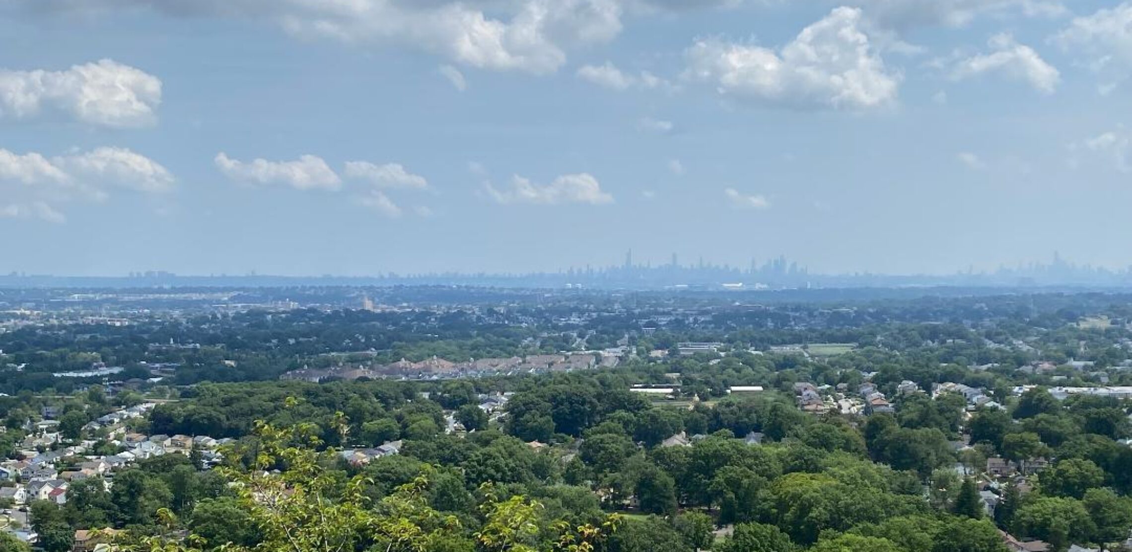
Partly sunny, warm and a little more humid today with a chance of afternoon showers and thunderstorms! Mainly dry, hot and humid Wednesday through Friday! Chance of showers and thunderstorms on Saturday followed by cooler and less humid air on Sunday!


Good morning everyone!

Skies are mostly clear early on this Tuesday morning and there is some patchy fog in some inland valleys. Temperatures range from 69 in Clifton down to 62 at Walpack. Winds are calm or light southerly. The air quality is moderate with an index of 54.

CLIFTON’S ALMANAC FOR JULY 25

AVERAGE HIGH: 86 AVERAGE LOW: 67

RECORD HIGH: 97 – 1987 RECORD LOW – 56 – 1997

YESTERDAY’S HIGH: 87 LOW: 70 PRECIPITATION: NONE

Weak high pressure in our area will give us a partly sunny and warm day today and slightly more humid, there will be a chance of some afternoon showers and thunderstorms as a weak disturbance moves through the area.

Mainly dry Wednesday through Friday along with very hot temperatures and increasing humidity. Highs each day will be well up into the 90s and with dew points near 70 will cause heat indexes to rise to above 100 degrees each day.

A cold front will cross the area on Saturday giving us a chance of showers and thunderstorms, it will still be hot ahead of the front with highs in the 90s.

Dry and cooler weather is expected Sunday into early next week.

THE FORECAST:

TODAY – JULY 25 – Partly sunny with a chance of afternoon showers and thunderstorms, highs in the upper 80s.

TONIGHT – Mostly cloudy in the evening then becoming mostly clear, low in the upper 60s.

WEDNESDAY – JULY 26 – Sunny, highs in the low 90s.

THURSDAY – JULY 27 – Mostly sunny, very hot and humid, highs in the mid 90s.

FRIDAY – JULY 28 – Mostly sunny, very hot and humid highs in the mid 90s.

SATURDAY – JULY 29 – Mostly sunny with a chance of afternoon and evening showers and thunderstorms, hot and humid with highs in the low 90s.

SUNDAY – JULY 30 – Mostly sunny, cooler and becoming less humid, highs in the mid 80s.

MONDAY – JULY 31 – Sunny and pleasant, highs in the low 80s.

MARINE FORECAST: TODAY – South-southeast winds to 10 knots, seas 2 feet. Point Pleasant Beach’s ocean temperature is a warm 77 degrees.

OUTLOOK: No advisories expected for Wednesday; advisories possible Thursday through Saturday.

Have a nice day but please stay safe!

Partly sunny and warm both today and tomorrow with a low chance of afternoon and evening showers and thunderstorms both days! Quite hot and increasingly humid Wednesday through Friday. Chance of showers and thunderstorms Friday night into Saturday! Mostly sunny and less humid on Sunday!


Good morning everyone!

Skies are mostly clear early on this Monday morning and it is a little milder than this time yesterday with temperatures ranging from 71 in Clifton down to 60 at Walpack, Pequest and Hackettstown. Winds are calm or light southwesterly. The air quality is moderate with an index of 51.

CLIFTON’S ALMANAC FOR JULY 24TH.

AVERAGE HIGH: 86 AVERAGE LOW: 67

RECORD HIGH: 99 – 2022 RECORD LOW: 55 – 1992

YESTERDAY’S HIGH: 89 LOW: 64 PRECIPITATION: NONE

Weak high pressure will give us partly sunny skies both today and on Tuesday, temperatures will be a little above normal with an increase in humidity. There will be a chance of showers and thunderstorms mainly during the afternoon and evening.

A heatwave is expected Wednesday through Friday with highs well up into the 90s each day and with dew points around 70 the heat indexes will rise to above 100 degrees. We should remain dry except for a chance of showers and thunderstorms late Friday.

A cold front moving through the area on Saturday will give us a chance of showers and thunderstorms followed by a dry Sunday with lower humidity.

THE FORECAST:

TODAY – JULY 24 – Partly sunny with a chance of afternoon showers and thunderstorms mainly after 2 p.m., highs in the upper 80s.

TONIGHT – Mostly cloudy, low near 70.

TUESDAY – JULY 25 – Partly sunny with a chance of afternoon and evening showers and thunderstorms, highs in the upper 80s.

WEDNESDAY – JULY 26 – Sunny, high in the low 90s.

THURSDAY – JULY 27 – Mostly sunny, hot and humid, highs in the mid 90s.

FRIDAY – JULY 28 – Partly sunny, hot and humid, highs in the mid 90s. Chance of showers and thunderstorms at night.

SATURDAY – JULY 29 – Partly sunny with a chance of showers and thunderstorms, highs in 90.

SUNDAY – JULY 30 – Mostly sunny and becoming less humid, highs in the upper 80s.

MARINE FORECAST: TODAY – Southerly winds to 10 knots, seas 1 foot. Point Pleasant Beach’s ocean temperature is a warm 77 degrees.

OUTLOOK: No advisories expected Tuesday through Friday.

Have a nice day but please stay safe!

Another nice summer day today with plenty of sunshine, seasonably warm temperatures and low humidity! Warm Monday and Tuesday with only a slight chance (20%) of afternoon or evening showers both days! Very hot and more humid Wednesday through Friday!


Good morning everyone!

Skies are mostly clear early on this Sunday morning and temperatures range from 65 in Clifton down to 54 at Walpack. Winds are mainly calm. The air quality is good with an index of 47.

CLIFTON’S ALMANAC FOR JULY 23RD.

AVERAGE HIGH: 86 AVERAGE LOW: 67

RECORD HIGH: 98 2022 RECORD LOW 55 – 1992

YESTERDAY: HIGH: 84 LOW: 65 PRECIPITATION: NONE

High pressure over the area will give us another nice summer day with seasonably warm temperature, low humidity along with plenty of sunshine.

Monday and Tuesday will be warm but there will be a slight chance of afternoon or evening showers both days.

Very hot and increasingly humid Wednesday through Friday with highs in 90s each day. No rain is expected.

A cold front may give us some showers on Saturday followed by cooler and less humid air for next Sunday.

THE FORECAST:

TODAY – JULY 23 – Sunny, highs in the upper 80s.

TONIGHT – Partly cloudy, low near 70.

MONDAY – JULY 24 – Mostly sunny, highs in the upper 80s.

TUESDAY – JULY 25 – Mostly sunny, highs in the upper 80s.

WEDNESDAY – JULY 26 – Sunny, highs in the low 90s.

THURSDAY – JULY 27 – Sunny, highs in the mid 90s.

FRIDAY – JULY 28 – Mostly sunny, highs in the mid 90s.

SATURDAY – JULY 29 – Partly sunny with a chance of showers and thunderstorms, highs near 90.

MARINE FORCAST: TODAY – Variable winds less than 5 knots, seas 1 foot. Point Pleasant Beach’s ocean temperature is 77 degrees.

OUTLOOK: No advisories expected Monday through Thursday.

Again enjoy the nice summer weather today but please stay safe!

Beautiful summer weekend with plenty of sunshine both days, with low humidity and seasonably warm temperatures! Mainly dry next week with a possible heatwave Wednesday through Saturday!


Good morning everyone!

Skies are mostly clear early on this Saturday morning and temperatures are cooler than the last few mornings with readings ranging from 65 in Clifton down to 56 at Walpack. Winds are calm or light northwesterly. The air quality is good with an index of 37.

CLIFTON’S ALMANAC FOR JULY 22ND.

AVERAGE HIGH: 86 AVERAGE LOW 67

RECORD HIGH: 103 -2011 RECORD LOW – 58 – 1974

YESTERDAY’S HIGH: 86 LOW: 68 PRECIPITATION: .29″

High pressure building from the Midwest will give us a mostly sunny day today with seasonably warm temperatures and low humidity with dew points falling into the 50s.

The beautiful weekend weather will continue on Sunday, again with plenty of sunshine and seasonably warm temperatures.

Mainly dry next week with a warming trend, highs Monday and Tuesday should reach the upper 80s. then the 90s are likely Wednesday through Saturday with an increase in humidity.

THE FORECAST:

TODAY – JULY 22 – Sunny, highs in the mid 80s.

TONIGHT – Mostly clear, low in the mid 60s

SUNDAY – JULY 23 – Sunny, highs in the upper 80s.

MONDAY – JULY 24 – Mostly sunny, highs in the upper 80s.

TUESDAY – JULY 25 – Mostly sunny, highs in the upper 80s.

WEDNESDAY – JULY 26 – Mostly sunny, highs in the low 90s.

THURSDAY – JULY 27 – Mostly sunny, highs in the low 90s.

FRIDAY – JULY 28 – Mostly sunny and very hot, highs in the upper 90s.

MARINE FORECAST: TODAY – Northwest winds to 10 knots, seas 1 foot. Point Pleasant Beach’s ocean temperature is 76 degrees.

OUTLOOK: No advisories expected Sunday through Wednesday.

Enjoy this nice summer weather weekend but please stay safe!

Mostly cloudy and humid with showers and thunderstorms mainly this morning! Nicest weekend weather expected so far this summer with sunny skies, low humidity and seasonably warm temperatures both Saturday and Sunday! Warm to hot much of next week!


Good morning everyone!

Skies are cloudy early on this Friday morning and there is a line of thunderstorms moving through the area. Temperatures range from 71 in Clifton down to 61 at High Point. Winds are mainly calm or light southerly. The air quality is moderate with an index of 82.

CLIFTON’S ALMANAC FOR JULY 21ST.

AVERAGE HIGH: 86 AVERAGE LOW: 67

RECORD HIGH: 102 – 1991 RECORD LOW: 54 – 2000

YESTERDAY’S HIGH: 86 LOW: 69 PRECIPITATION: NONE

A frontal system moving through the area will cause showers and thunderstorms mainly this morning although there will still be a chance of afternoon or evening showers. Temperatures will be slightly lower than yesterday, but the humidity will be higher.

High pressure will then build into our area from the west which will likely give us the nicest weekend weather of the summer with plenty of sunshine both days, seasonably warm temperatures and low humidity.

Monday will continue to be pleasantly warm.

A weak frontal system will give us a low chance of showers on Tuesday.

Hotter weather can be expected Wednesday through at least the start of next weekend. We should stay dry but the humidity will rise.

THE FORECAST:

TODAY – JULY 21 – Mostly cloudy with showers and thunderstorms mainly this morning, some storms may be accompanied by heavy rain and gusty winds, humid with highs in the low 80s.

TONIGHT – Partly cloudy with a chance of showers and thunderstorms in the evening, becoming mostly clear after midnight, low in the mid 60s.

SATURDAY – JULY 22 – Sunny, highs in the mid 80s.

SUNDAY – JULY 23 – Sunny, highs in the upper 80s.

MONDAY – JULY 24 – Mostly sunny, highs in the upper 80s.

TUESDAY – JULY 25 – Partly sunny with a chance of afternoon and evening showers and thunderstorms, highs in the upper 80s.

WEDNESDAY – JULY 26 – Mostly sunny, highs near 90.

THURSDAY – JULY 27 – Mostly sunny, highs in the low 90s.

MARINE FORECAST: TODAY – Southerly winds to 10 knots, seas 2 feet. Point Pleasant Beach’s ocean temperature is 76 degrees.

OUTLOOK: No advisories expected Saturday through Wednesday.

Have a nice day but please stay safe!