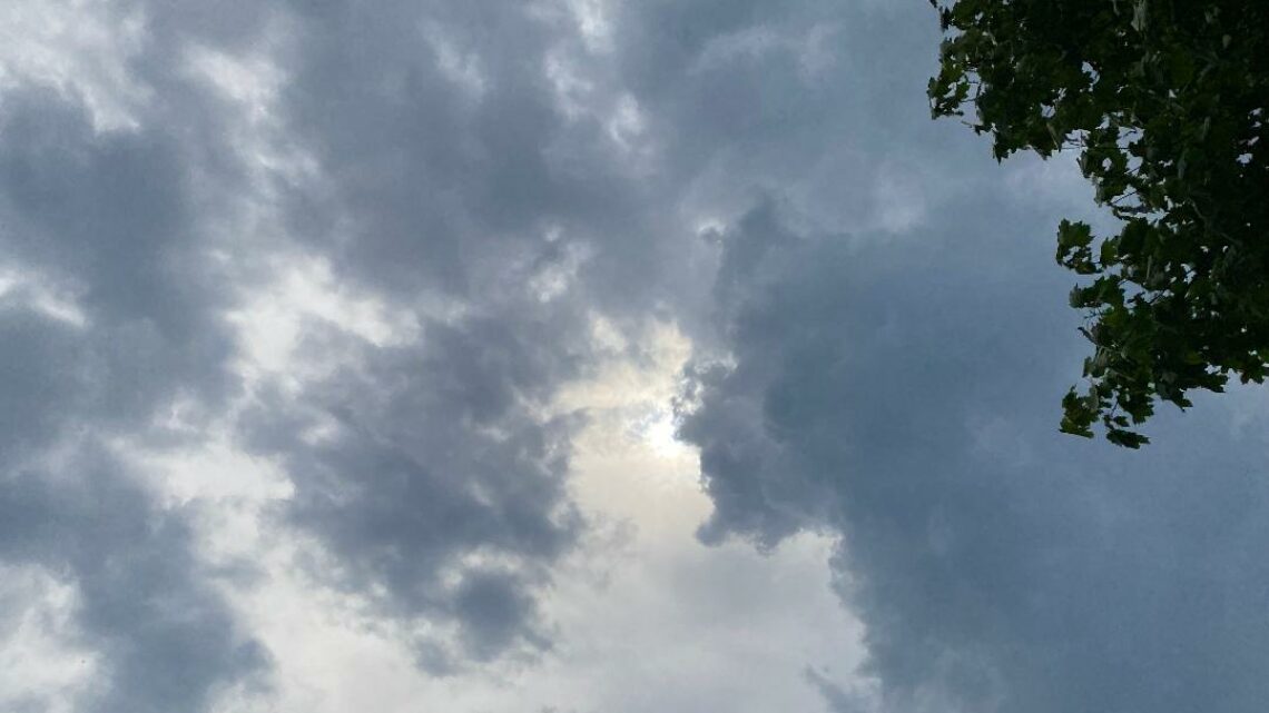
Very humid today with showers from Nate’s remains! Dry and warm on Tuesday but less humid!


MONDAY  OCTOBER 9, 2017  5:45 A.M.

We have another unseasonably warm and humid morning and there are some scattered showers in parts of the area along with patchy fog, temperatures range from the low 70s in the Clifton area down to around 70 further inland, dew points are mainly in the sultry low 70s.

The remains of Nate will cause cloudy skies all day with scattered showers, some showers may be heavy at times, it will continue to be warm and very humid, rainfall amounts are less than what was in the forecast yesterday, look for 1/4 to an inch of rain, less along the coast and more inland.  Winds will become gusty out of the south.

Tuesday we will see sunshine along with warm temperatures but it will become less humid.

A backdoor cold front will cross the area on Tuesday night and the rest of the week will be cooler but still above normal for this time of year.  There is a chance of light rain especially Wednesday night into Thursday.

The upcoming weekend looks to be mainly warm and dry.


THE FORECAST:

TODAY – OCT 9 – Cloudy and humid with occasional showers and possibly a thunderstorm, rain may be heavy at times, becoming breezy, high in the upper 70s.

TONIGHT – Mostly cloudy with a chance of an evening shower, low in the low 60s.

TUESDAY – OCT 10 – Mostly sunny and less humid, high in the low 80s.

WEDNESDAY – OCT  11 – Partly sunny in the morning then becoming cloudy, high in the low 70s.  Chance of light rain at night.

THURSDAY – OCT 12 – Cloudy with a chance of light rain, high in the mid 60s.

FRIDAY – OCT 13 – Cloudy with a chance of light rain, high near 70.

SATURDAY – OCT 14 – Mostly sunny, high in the upper 70s.

SUNDAY – OCT 15 – Mostly sunny, high near 80.


MARINE FORECAST:  A small craft advisory is in effect till 8 a.m. Tuesday morning,  winds southwest gusting to 30 knots, seas 3-6 feet.

OUTLOOK – No advisories expected Tuesday into the day on Wednesday; advisories possible Wednesday night into Thursday; no advisories again expected on Friday.


Have a good Columbus Day!

Warm and very humid today with scattered showers! Remains of Nate to give our area heavy rain on Columbus Day!


SUNDAY  OCTOBER 8, 2017  5:52 A.M.

We have cloudy skies early on this Sunday morning and there are some light showers in parts of the area, temperatures are unseasonably warm with readings ranging from the low 70s in the Clifton area down to the upper 60s further inland, it is also quite humid with dew points near 70 degrees.   Note that the average low temperature in the Clifton area for this time of year is in the mid 40s.

A front just to our west will cause cloudiness today, it will be warm and very humid today with scattered showers.

The remains of Nate will move through the area on Monday, rain heavy at times especially from 2 to 8 p.m., 1-3 inches of well needed rain is expected.

We should clear out on Tuesday, it will become less humid but with more sunshine it will be quite warm.

Cooler Wednesday and Thursday as high pressure builds off the New England coast, there may be some light rain Wednesday night into Thursday morning.

At this point next weekend looks to be dry with above normal temperatures.


THE FORECAST:

TODAY – OCT 8 – Cloudy and humid with a chance of showers and possibly a thunderstorm, high near 80.

TONIGHT – Cloudy and humid with showers likely and possibly a thunderstorm, low in the upper 60s.

COLUMBUS DAY – OCT 9 – Cloudy and humid with showers and possibly some thunderstorms, high in the upper 70s.

TUESDAY – OCT 10 – Mostly sunny, warm but becoming less humid, high in the low to mid 80s.

WEDNESDAY – OCT 11 – Mostly sunny, high in the low 70s, chance of showers at night.

THURSDAY – OCT 12   – Partly sunny with a chance of morning showers, high in the upper 60s.

FRIDAY – OCT 13 – Partly sunny, high near 70.

SATURDAY – OCT 14 – Mostly sunny, high in the upper 70s.


MARINE FORECAST:  A small craft advisory is in effect till 6 p.m. this evening for southwest winds gusting to 25 knots, seas 4-5 feet.

OUTLOOK – Small craft conditions likely on Monday; no advisories expected Tuesday and during the day on Wednesday; small craft conditions likely Wednesday night into Thursday.


TROPICS:  Nate has been downgraded to a tropical storm with top winds of 70 mph, the storm is inland near the Mississippi and Alabama border.  Nate is expected to move northeast and be just to our north by Monday evening giving the area much needed rain.


Have a nice day!

Warm and humid weather to continue this weekend! Possible showers on Sunday! Heavy rain possible on Monday from the remnants of Nate!


SATURDAY  OCTOBER 7, 2017  5:55 A.M.

Another warm and rather muggy morning on this Saturday with temperatures ranging from the mid 60s in the Clifton area down to the mid 50s further inland, skies are mostly cloudy and some areas have patchy fog, winds are mainly calm.

Today will be warm again with increasing humidity, we should have mostly sunny skies after a mostly cloudy morning, highs will be in the 80s.

A weak disturbance will give us a chance of showers on Sunday, precipitation amounts will be generally less than 1/4 of an inch.

The remnants of Hurricane Nate will cause tropical rains on Monday, it will continue to be warm and humid, rainfall amounts may total 1-3 inches.

Generally above normal temperatures Tuesday through Friday, most of the time it will be dry but there is a low chance of showers Tuesday morning and again on Wednesday night.


THE FORECAST:

TODAY – OCT 7 – Becoming mostly sunny after early morning cloudiness, high in the low 80s.

TONIGHT – Increasing cloudiness, low in the upper 60s.

SUNDAY – OCT 8 – Mostly cloudy with a chance of showers and possibly a thunderstorm, high near 80.

COLUMBUS DAY – OCT 9 – Cloudy with showers and possibly a thunderstorm, rain may be heavy at times, high in the upper 70s.

TUESDAY – OCT 10 – Mostly cloudy with a chance of morning showers, high in the low 80s.

WEDNESDAY – OCT 11 – Partly sunny, high in the low 70s, chance of showers at night.

THURSDAY – OCT 12  – Partly sunny, high in the upper 60s.

FRIDAY – OCT 13 – Partly sunny, high in the low 70s.


MARINE FORECAST:  TODAY – Southerly winds to 15 knots, seas 1-2 feet.

OUTLOOK – A small craft advisory is posted effective from 6 a.m. Sunday morning until 6 p.m. Sunday evening.  Advisories likely on Monday; no advisories expected Monday and Tuesday.


TROPICS:  Nate has been upgraded to a hurricane with top winds of 80 mph, the storm is about 325 miles south of the Gulf coast of Mississippi and is expected to come onshore near the Mississippi and Alabama border as a category 1 or 2 hurricane.  The remnants of Nate will then move northeast to near our area on Monday.


Have a nice weekend!

Warm and humid weather to continue through the weekend! Well needed rain likely Sunday night through Tuesday!


FRIDAY  OCTOBER 6, 2017  5:49 A.M.

Another warm night across the area with temperatures ranging from the upper 60s in the Clifton area down to the mid 50s further inland, winds are mainly calm and the skies are partly cloudy.

A weak front will be just north of the area and we will be in a southwest flow of warm air again today, skies should become mostly sunny after early morning cloudiness.

Unseasonably warm and humid over the weekend, Saturday should stay dry but some of the remains of Tropical Storm Nate may give us rain by Sunday afternoon.

Heavy rain is possible Monday into Tuesday, it will continue to be warm and very humid as the remains of Nate crosses the area.

Dry weather with above normal temperatures Wednesday and Thursday.


THE FORECAST:

TODAY – OCT 6 – Mostly cloudy this morning then becoming mostly sunny, high in the low 80s.

TONIGHT – Mostly cloudy, low in the mid 60s.

SATURDAY – OCT 7 – Partly sunny and humid, high in the low 80s.

SUNDAY – OCT 8 – Mostly cloudy with a chance of showers and thunderstorms after 2 p.m., humid, high in the low 80s.

COLUMBUS DAY – OCT 9 – Cloudy with showers, rain may be heavy at times, humid, high in the upper 70s.

TUESDAY – OCT 10 – Mostly cloudy and humid with showers likely and possibly a thunderstorm, high in the low 80s.

WEDNESDAY – OCT 11  – Mostly sunny, high in the mid 70s.

THURSDAY – OCT 12 – Mostly sunny, high near 70.


MARINE FORECAST – TODAY – West wind to 6 knots, seas 1 foot.

OUTLOOK – No advisories expected during the day on Saturday; possible small craft conditions Saturday night into Monday.


TROPICS:   Tropical storm Nate is over the water just north of Honduras, Nate is expected to become a hurricane as it move just east of Cancun and then move north and come ashore just east of New Orleans.  The remnants of Nate is expected to give our area heavy rain early next week.


Have a nice day!

Warmer day today but with more clouds! Chance of showers tonight! Warm and humid weekend with showers possible on Sunday!


THURSDAY  OCTOBER 5, 2017  5:50 A.M.

Skies are partly cloudy early on this Thursday morning and temperatures are much milder than the last few morning with readings ranging from the mid 60s in the Clifton area down to the mid 50s further inland, winds are light.

Today will be a warm day but there will be more clouds but there will be enough breaks in the clouds to help temperatures rise into the 80s.

A weak cold front may touch off some showers late tonight.

Tomorrow will be a little cooler with partly cloudy skies.

Unseasonably warm and humid air is expected for this weekend, Saturday should be dry but there is a chance of showers on Sunday as another front approaches the area.

We may finally see some significant rain Monday into Tuesday as a front will be in the area and some tropical moisture moves up from the Gulf of Mexico, it will continue to be warm and humid.


THE FORECAST:

TODAY – OCT 5 – Mostly cloudy, high in the low 80s.

TONIGHT – Mostly cloudy with a chance of showers, low in the low 60s.

FRIDAY – OCT 6 – Partly sunny, high near 80.

SATURDAY – OCT 7 – Partly sunny and humid, high near 80.

SUNDAY – OCT 8 – Mostly cloudy and humid with a chance of showers, high near 80.

COLUMBUS DAY – OCT 9 – Mostly cloudy and humid with a chance of showers, high in the upper 70s.

TUESDAY – OCT 10 – Partly sunny with a chance of showers, high near 80.

WEDNESDAY – OCT 11 – Mostly sunny, high in the upper 70s.


MARINE FORECAST:  TODAY – Southwest wind to 12 knots, seas 2 feet.

OUTLOOK – No advisories expected Friday and Saturday; possible small craft conditions Sunday and Monday.


Have a good day!