Good morning everyone!
Skies are mostly clear early on this first day of July and temperatures are quite warm with readings ranging from the upper 70s in Clifton down to the low 60s in some areas further inland, winds are mainly calm.
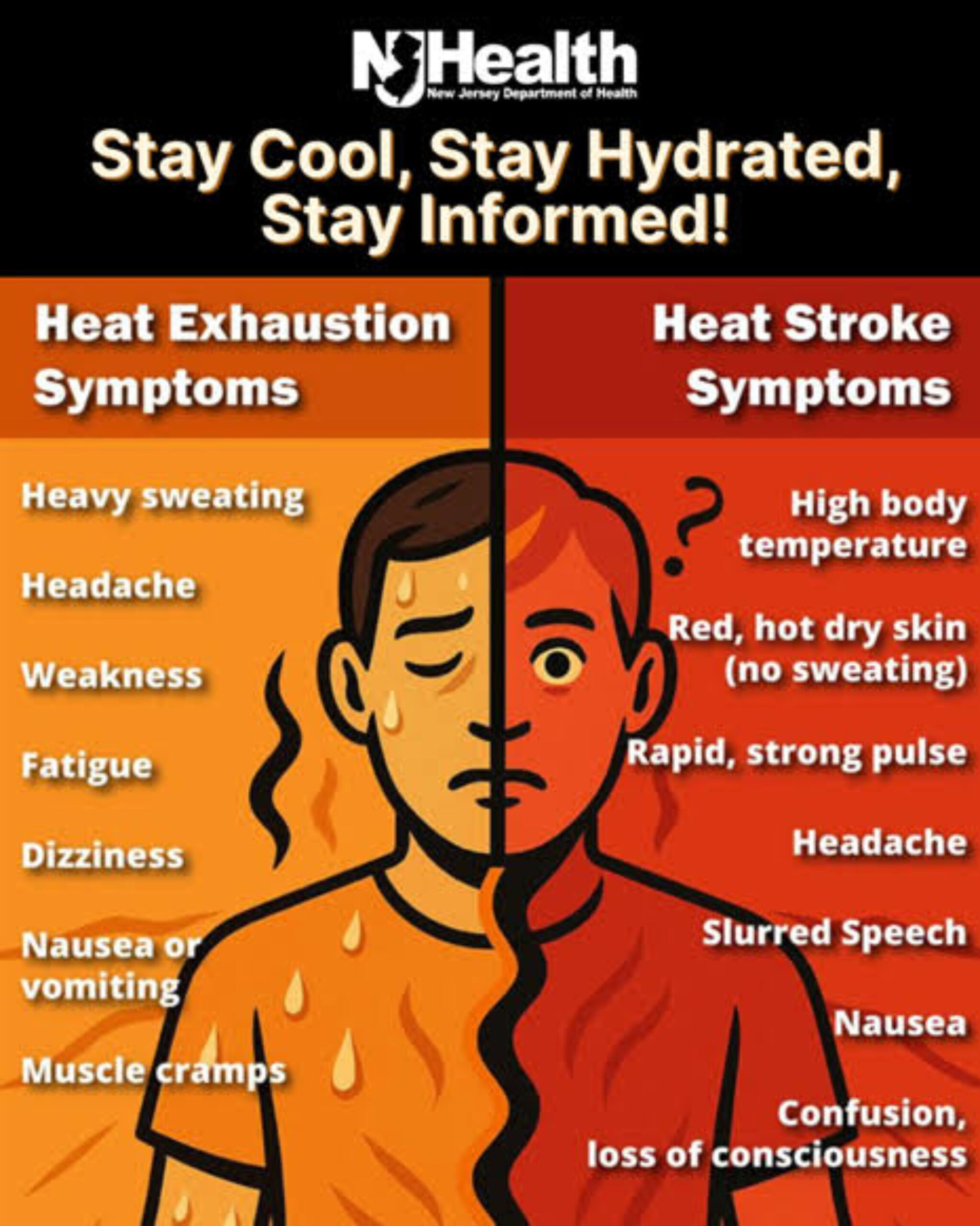
Strong high pressure over the area will give us mostly sunny skies today and temperatures rising to near 100 degrees and with dew points rising to around 70 will cause heat indexes to rise to near 110. A excessive heat warning is in effect.
Very hot again on Monday with continued sunny skies, humidity will continue to be high.
Not quite as hot the rest of the week but it will continue to be humid, highs will still reach the low 90s each day.
A cold front is expected to cross the area on Friday with some showers followed by cooler and drier air for next weekend.
THE FORECAST:
TODAY – JUL 1 – Sunny, very hot and humid, high near 100.
TONIGHT – Mostly clear, low in the upper 70s.
MONDAY – JUL 2 – Sunny, high in the upper 90s.
TUESDAY – JUL 3 – Sunny, high in the low 90s.
INDEPENDENCE DAY – JUL 4 – Mostly sunny, high in the low 90s, chance of and evening shower or thunderstorm.
THURSDAY – JUL 5 – Mostly sunny, high in the low 90s.
FRIDAY – JUL 6 – Partly sunny with a chance of showers and thunderstorms, high near 90.
SATURDAY – JUL 7 – Sunny, high in the mid 80s.
MARINE FORECAST: TODAY – Southerly winds to 9 knots, seas 2 feet. Belmar’s ocean temperature is 68 degrees.
OUTLOOK – No advisories expected Monday through Thursday.
Stay cool!