Good morning everyone!
Skies are mostly clear early this morning and temperatures range from the upper 60s in the Clifton area down to some mid 50s further inland, winds are mainly calm and the humidity is moderate.
Today will be a hot day with plenty of sunshine, the humidity will rise but not be as oppressive as last week as we will have dew points in the upper 60s. There is a low chance of and evening shower or thunderstorm that will be more likely to our north and west.
Pleasant summer weather Wednesday through Friday as high pressure builds into the area, dew points will drop to the 50s so it will be quite comfortable.
Quite warm over the weekend with slowly increasing humidity, most of the area will stay dry with only a slight chance of an afternoon or evening thunderstorm mainly inland.
THE FORECAST:
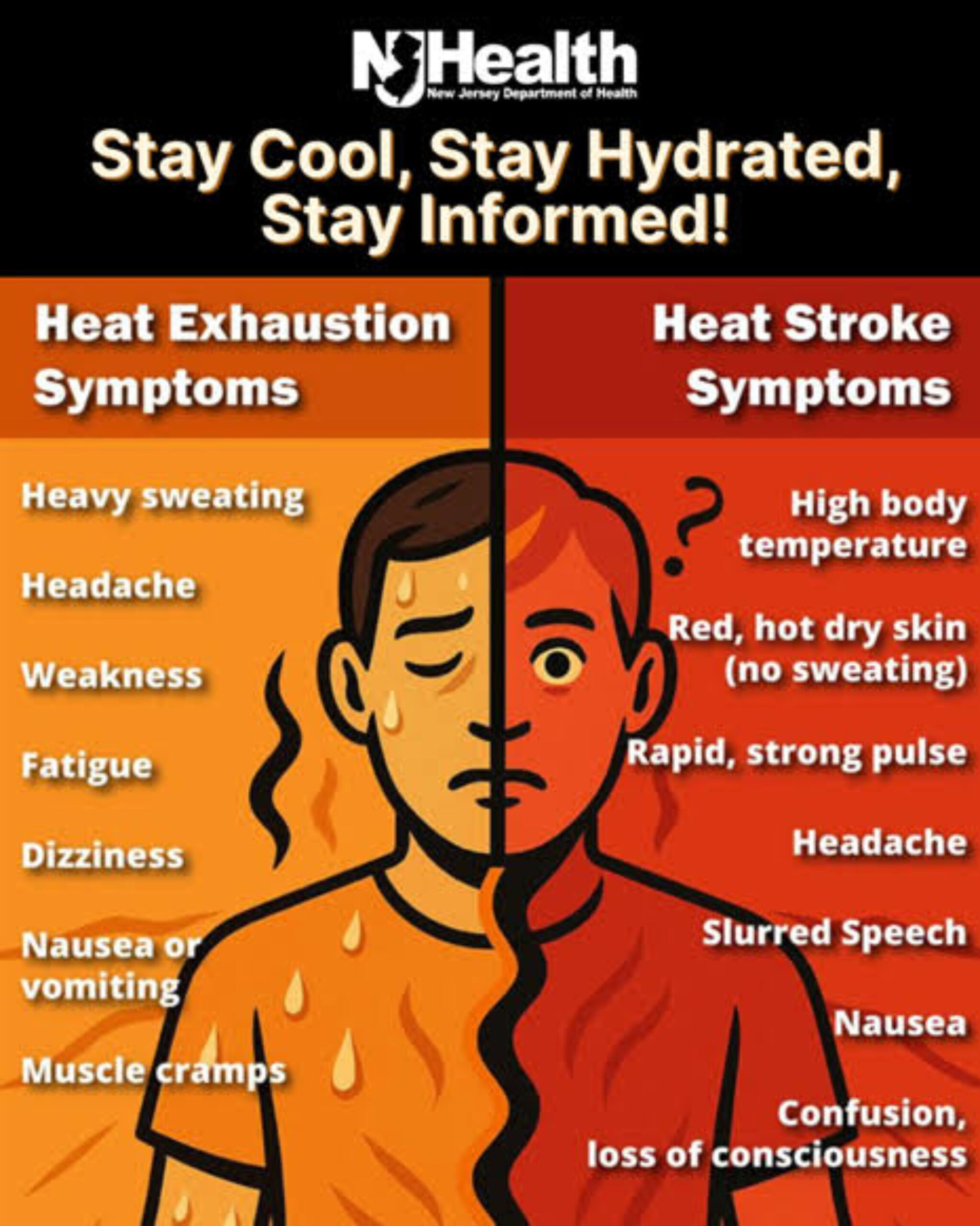
TODAY – JUL 10 – Sunny and hot, high in the mid 90s.
TONIGHT – Partly cloudy, low in the upper 60s.
WEDNESDAY – JUL 11 – Mostly sunny, high in the mid 80s.
THURSDAY – JUL 12 – Sunny, high in the mid 80s.
FRIDAY – JUL 13 – Sunny, high in the mid 80s.
SATURDAY – JUL 14 – Partly sunny, high in the upper 80s.
SUNDAY – JUL 15 – Mostly sunny, high in the upper 80s.
MONDAY – JUL 16 – Mostly sunny, high near 90.
MARINE FORECAST: TODAY – Southerly wind to 12 knots, seas 2 feet. Belmar’s ocean temperature is 71 degrees.
OUTLOOK – Small craft advisories likely on Wednesday for high seas; no advisories expected Thursday through Saturday.
TROPICS: Tropical Storm Chris is located off the Carolina coast and is starting to move slowly northeast. Top winds are 70 mph. Chris is expected to become a hurricane but remain well offshore to affect our weather except to bring higher seas to our coastal areas.
Keep cool today!