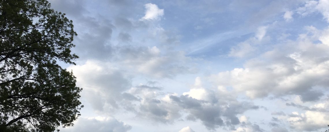
Becoming sunny and very warm and humid today! Hot and humid on Tuesday with showers likely by evening! Sunny and warm on Wednesday but becoming much less humid! Dry weather expected Thursday through the holiday weekend!


Good morning everyone!

Skies are mostly cloudy early on this Monday morning and it is quite warm and muggy with temperatures at 5 a.m. ranging from 73 in Clifton down to 67 at High Point. Winds are calm or light southwesterly. Dew points are in the uncomfortable low 70s and there is some patchy fog across inland areas.

CLIFTON’S ALMANAC FOR AUGUST 29TH:

AVERAGE HIGH: 81 AVERAGE LOW: 62

RECORD HIGH: 96 – 2018 RECORD LOW: 41 – 1986

YESTERDAY’S HIGH: 84 LOW: 73 PRECIPITATION: TRACE (few drops)

Today we will have a mostly sunny day after some early morning cloudiness and it will be quite warm and humid with highs well up into the 80s and dew points in the low 70s.

A cold front will approach our area on Tuesday and move through at night. Quite warm and continued humid air will be with us along with showers becoming likely by evening. Again high temperatures will be well up into the 80s and dew points in the low 70s.

Wednesday will be a sunny day and quite warm but with much less humidity by the afternoon.

A stretch of dry weather Thursday through the holiday weekend. High temperatures will be near normal Thursday and Friday but should rise to above normal levels for the holiday weekend along with pleasant humidity levels.

THE FORECAST:

TODAY – AUG 29 – Becoming mostly sunny after early morning cloudiness, humid, highs in the upper 80s.

TONIGHT – Partly cloudy in the evening becoming mostly cloudy, muggy, lows in the low 70s.

TUESDAY – AUG 30 – Partly sunny with a slight chance of afternoon showers, humid, highs in the upper 80s. Showers likely at night.

WEDNESDAY – AUG 31 – Chance of shower before 8 a.m. then becoming mostly sunny and less humid by the afternoon, highs in the upper 80s.

THURSDAY – SEP 1 – Sunny, high in the mid 80s.

FRIDAY – SEP 2 – Sunny, high in the low 80s.

SATURDAY – SEP 3 – Mostly sunny, high in the upper 80s.

SUNDAY – SEP 4 – Mostly sunny, high near 90.

MARINE FORECAST: TODAY – Southeast winds to 10 knots, seas 1 foot. Belmar’s ocean temperature is 76 degrees.

OUTLOOK – No advisories expected Tuesday through Friday.

Have a nice day and stay safe!

Mostly cloudy and not as warm today but staying rather humid! Very warm and humid Monday through Wednesday with a chance of showers on Tuesday! Seasonably warm and much less humid Thursday through the start of the holiday weekend!


Good morning everyone!

Skies are mostly cloudy early on this Sunday morning and temperatures at 5 a.m. range from 73 in Clifton down to 60 at Walpack. Winds are calm or light easterly and the humidity is high with dew points in the upper 60s.

CLIFTON’S ALMANAC FOR AUGUST 28TH:

AVERAGE HIGH: 81 AVERAGE LOW: 62

RECORD HIGH: 98 – 1973 RECORD LOW: 44 – 1986

YESTERDAY’S HIGH: 92 LOW 72 PRECIPITATION: NONE

Today we will have mostly cloudy skies as a weak back door cold front moved to our west. High temperatures will be lower than the last few days due to the clouds and a light onshore flow of wind. The humidity will be rather high but not oppressive with dew points in the upper 60s.

Very warm and humid Monday through Tuesday and a cold front may cause showers on Tuesday followed by warm but less humid air by Wednesday afternoon.

Seasonably warm but much less humid Thursday through at least the start of the holiday weekend.

THE FORECAST:

TODAY – AUG 28 – Mostly cloudy this morning then becoming partly sunny this afternoon, humid, high in the low 80s.

TONIGHT – Partly cloudy in the evening then becoming mostly cloudy, muggy, low near 70.

MONDAY – AUG 29 – Partly sunny in the morning then becoming mostly sunny in the afternoon, humid, high in the upper 80s.

TUESDAY – AUG 30 – Partly sunny and humid with a chance of showers and thunderstorms in the afternoon, humid, high near 90. Showers likely at night.

WEDNESDAY – AUG 31 – Mostly sunny and becoming less humid by the afternoon, high near 90.

THURSDAY – SEP 1 – Sunny, high in the mid 80s.

FRIDAY – SEP 2 – Sunny, high in the low 80s.

SATURDAY – SEP 3 – Sunny, high in the upper 80s.

MARINE FORECAST: TODAY – Easterly winds to 15 knots, seas 1-2 feet. Belmar’s ocean temperature is 76 degrees.

OUTLOOK – No advisories expected Monday through Thursday.

Have a nice day and stay safe!

Sunny and quite warm again today! Mostly sunny on Sunday and not quite as warm but more humid! Very warm weather Monday through Wednesday with showers possible Tuesday afternoon through the day on Wednesday! Dry, cooler and less humid Thursday and Friday!


Skies are partly cloudy early on this Saturday morning and once again it is unseasonably mild with temperatures at 5 a.m. ranging from 73 in Clifton down to 60 at Walpack. Winds are calm or light westerly and the dew points are in the low-mid 60s.

CLIFTON’S ALMANAC FOR AUGUST 27TH:

AVERAGE HIGH: 81 AVERAGE LOW: 63

RECORD HIGH: 94 – 2021 RECORD LOW: 52 – 1989

YESTERDAY’S HIGH: 92 LOW: 70 PRECIPITATION: NONE

NOTE: On this date 11 years ago Hurricane Irene caused massive flooding in our area with 9.27″ of rain falling on August 27th into the 28th.

High pressure building into our area from the northwest will give us a sunny day today with quite warm temperatures and moderate humidity with dew points in the low to mid 60s.

The high pressure will move offshore on Sunday and we will have more of an onshore flow so temperatures will be slightly lower, but the humidity will rise with dew points averaging in the upper 60s.

Very warm and humid weather to end the month of August. A cold front will slowly approach and come through our area on Wednesday, showers are possible Tuesday afternoon through the day on Wednesday.

Cooler and less humid conditions are expected Thursday and Friday.

THE FORECAST:

TODAY – AUG 27 – Sunny, high in the upper 80s.

TONIGHT – Partly cloudy, low in the upper 60s.

SUNDAY – AUG 28 – Mostly sunny and a little more humid, high in the low 80s.

MONDAY – AUG 29 – Mostly sunny, hot and humid, high near 90.

TUESDAY – AUG 30 – Partly sunny, hot and humid with a chance of showers and thunderstorms mainly after 2 p.m., high in the low 90s.

WEDNESDAY – AUG 31 – Partly sunny, hot and humid with a chance of showers and thunderstorms, high near 90.

THURSDAY – SEP 1 – Sunny and much less humid, high in the mid 80s.

FRIDAY – SEP 2 – Sunny, high in the low 80s.

MARINE FORECAST: TODAY – Northerly winds to 10 knots, seas 2-3 feet. Belmar’s ocean temperature is 76 degrees.

OUTLOOK – No advisories expected Sunday through Wednesday.

Enjoy the nice late summer weather this weekend but please stay safe!

Partly sunny and very warm today with a chance of showers and thunderstorms! Mainly dry and warm weather for the weekend with only a slight chance of a shower on Sunday! Very warm through the middle of next week with showers possible Tuesday and Wednesday!


Good morning everyone!

Skies are partly cloudy early on this Friday morning and temperatures at 5 a.m. range from 70 in Clifton down to 56 at Walpack. Winds are calm or light southwesterly and the humidity is moderate with dew points in the low 60s.

CLIFTON’S ALMANAC FOR AUGUST 26TH:

AVERAGE HIGH: 81 AVERAGE LOW 63

RECORD HIGH: 95 – 2021 RECORD LOW: 49 – 1989

YESTERDAY’S HIGH: 93 LOW: 68 PRECIPITATION: NONE

Today we will have a mix of clouds and sunshine as a weak cold front approaches from the west, showers and some thunderstorms are possible. Temperatures will be warm and the humidity moderate with dew points in the mid 60s.

Mainly dry weather for the weekend as high pressure builds into the area. There is only a slight chance of an afternoon shower on Sunday. Dew points will average in the low 60s on Saturday and then the mid 60s on Sunday.

Very warm to hot weather and humid Monday through Wednesday and a cold front may cause some showers and thunderstorms Tuesday afternoon through Wednesday.

We will begin September with cooler and less humid air for Thursday.

THE FORECAST:

TODAY – AUG 26 – Partly sunny with a chance of showers and thunderstorms, becoming breezy in the afternoon, high near 90.

TONIGHT – Partly cloudy, low near 70.

SATURDAY – AUG 27 – Mostly sunny, high in the upper 80s.

SUNDAY – AUG 28 – Partly sunny, high in the mid 80s.

MONDAY – AUG 29 – Mostly sunny, hot and humid, high near 90.

TUESDAY – AUG 30 – Partly sunny, hot and humid with a chance of afternoon and evening showers and thunderstorms, high in the low 90s.

WEDNESDAY – AUG 31 – Partly sunny and humid with a chance of showers and thunderstorms, high near 90.

THURSDAY – SEP 1 – Sunny, cooler and much less humid, high in the low 80s.

MARINE FORECAST: TODAY – A small craft advisory has been posted effective between 4 p.m. this afternoon through 2 a.m. Saturday morning for southwest winds gusting to 25 knots, seas 4-5 feet. Belmar’s ocean temperature is 76 degrees/

OUTLOOK: No advisories expected Saturday through Tuesday.

Have a nice day and stay safe!

Another sunny and quite warm day today with low humidity! Quite warm and a little more humid on Friday with afternoon and evening showers likely! Mainly dry with warm temperatures and moderate humidity for the weekend! Quite warm again early next week!


Good morning everyone!

Skies are mainly clear early on this Thursday morning and temperatures at 5 a.m. range from 69 in Clifton down to 56 at Walpack. Winds are light from the northwest and the humidity is still rather comfortable with dew points near 60.

CLIFTON’S ALMANAC FOR AUGUST 25TH:

AVERAGE HIGH: 82 AVERAGE LOW: 63

RECORD HIGH: 94 – 2021 RECORD LOW: 48 – 1987

YESTERDAY’S HIGH: 92 LOW: 67 PRECIPITATION: NONE

High pressure moving through the area will give us another sunny and quite warm to hot day today, highs may reach the low 90s but the humidity will still be on the low side with dew points near 60.

Friday will again be quite warm with a slight increase in humidity as a weak cold front moves through the area. Showers are likely in the afternoon and evening.

The weekend looks to be mainly dry and warm with moderate humidity. There is only a slight chance of a shower Saturday afternoon or evening mainly to our north and west.

Quite warm to hot weather early next week with a chance of showers and thunderstorms on Tuesday ahead of another weak cold front.

THE FORECAST:

TODAY – AUG 25 – Sunny, high in the low 90s.

TONIGHT – Partly cloudy, low near 70.

FRIDAY – AUG 26 – Mostly sunny with showers likely in the afternoon and evening with a chance of thunderstorms, high near 90.

SATURDAY – AUG 27 – Mostly sunny, high in the upper 80s.

SUNDAY – AUG 28 – Mostly sunny, high in the mid 80s.

MONDAY – AUG 29 – Mostly sunny, high in the upper 80s.

TUESDAY – AUG 30 – Partly sunny with a chance of showers, high near 90.

WEDNESDAY – AUG 31 – Mostly sunny, high in the upper 80s.

MARINE FORECAST: TODAY – Variable winds less than 5 knots, seas 1 foot. Belmar’s ocean temperature is 76 degrees.

OUTLOOK – No advisories expected Friday through Monday.

Have a nice day and stay cool and safe!